



Temperatures rebound into the 50s Wednesday with potential rain to the north
Plan for some major temperature swings these next few days. While Wednesday will feel like we're shifting from winter, Thursday will feel like we're fully engulfed in summer.
Plan for some major temperature swings these next few days. While Wednesday will feel like we're shifting from winter, Thursday will feel like we're fully engulfed in summer.
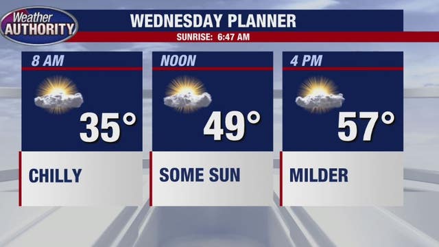

Cold overnight with frost, but the sun - and milder temps are in store for Wednesday
We will likely see high temperatures on Thursday near 80 degrees. Showers then move back in the forecast, Friday and especially Saturday.
We will likely see high temperatures on Thursday near 80 degrees. Showers then move back in the forecast, Friday and especially Saturday.

Getting milder for Wednesday as temps warm up
Rich Luterman has the forecast.
Rich Luterman has the forecast.
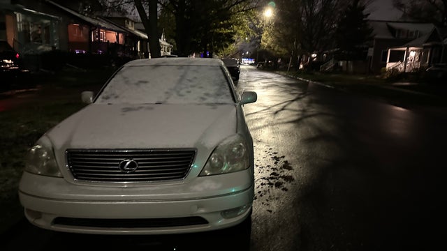

Dusting of snow Tuesday morning gives way to winter feel in Southeast Michigan
Those that woke up early enough Tuesday spied some of the white stuff on their cars and grass after temperatures dropped low enough for snow to fall overnight.
Those that woke up early enough Tuesday spied some of the white stuff on their cars and grass after temperatures dropped low enough for snow to fall overnight.

Snow Showers Tuesday
Chilly start with snow showers today. Milder air with rain by Thursday. Meteorologist Lori Pinson has your forecast.
Chilly start with snow showers today. Milder air with rain by Thursday. Meteorologist Lori Pinson has your forecast.
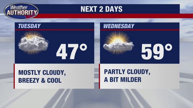

Chilly temps stick around until Thursday - then a dip back down
Our next weather-maker brings milder temperatures to Southeast Michigan Wednesday afternoon and especially Thursday.
Our next weather-maker brings milder temperatures to Southeast Michigan Wednesday afternoon and especially Thursday.

Colder temps stick around until later in the week
Rich Luterman has the forecast.
Rich Luterman has the forecast.


Light rain and snow greet Southeast Michigan as warm stretch breaks this week
The last time we had four 80-degree days in a row was 14 years ago. Don't count on seeing such blessed weather for so long for the next few weeks.
The last time we had four 80-degree days in a row was 14 years ago. Don't count on seeing such blessed weather for so long for the next few weeks.
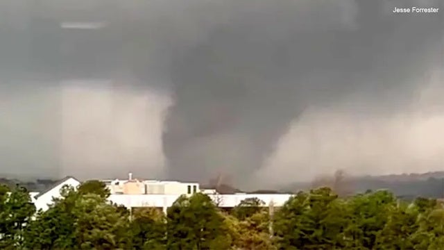

IRS extends tax deadlines for storm victims in these 7 states
Individuals, households and businesses in disaster areas as designated by FEMA qualify for the tax relief.
Individuals, households and businesses in disaster areas as designated by FEMA qualify for the tax relief.

Sunday Storms Possible
An approaching cold front could trigger strong storms Sunday and drop our temperature as we head into the new week. Meteorologist Lori Pinson has your forecast.
An approaching cold front could trigger strong storms Sunday and drop our temperature as we head into the new week. Meteorologist Lori Pinson has your forecast.

A nice Saturday before t'storms arrive on Sunday
Winter like air, and snowflakes, return on Monday
Winter like air, and snowflakes, return on Monday
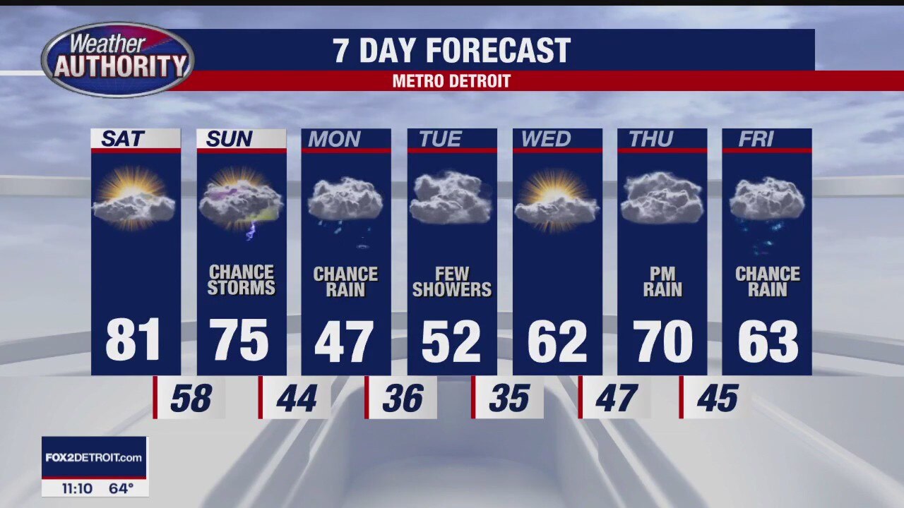
Storms Possible Sunday
At least one more day of 80 degree weather Saturday. A chance for evening showers but a better opportunity for storms Sunday with much colder temperatures Monday. Meteorologist Lori Pinson has your forecast.
At least one more day of 80 degree weather Saturday. A chance for evening showers but a better opportunity for storms Sunday with much colder temperatures Monday. Meteorologist Lori Pinson has your forecast.
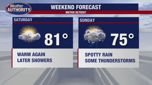

Warm temps come to a close after weekend
The mild temperatures continue into Saturday. Sun and clouds to start the day, then increasing clouds with a chance for evening showers Saturday.
The mild temperatures continue into Saturday. Sun and clouds to start the day, then increasing clouds with a chance for evening showers Saturday.

Warm Saturday
Mild readings overnight give way to another warmer than average day Saturday. An approaching cold front brings the potential for storms and much cooler temperatures. Meteorologist Lori Pinson has your forecast.
Mild readings overnight give way to another warmer than average day Saturday. An approaching cold front brings the potential for storms and much cooler temperatures. Meteorologist Lori Pinson has your forecast.


Warm end to the week before thunderstorms this weekend and possible snowflakes Monday
April can be a crazy weather month with 80 degrees expected Friday, thunderstorms expected Sunday before temperatures plummet on Monday.
April can be a crazy weather month with 80 degrees expected Friday, thunderstorms expected Sunday before temperatures plummet on Monday.

Another great day out there Friday
The weekend will be warm too, with some storms on Sunday
The weekend will be warm too, with some storms on Sunday
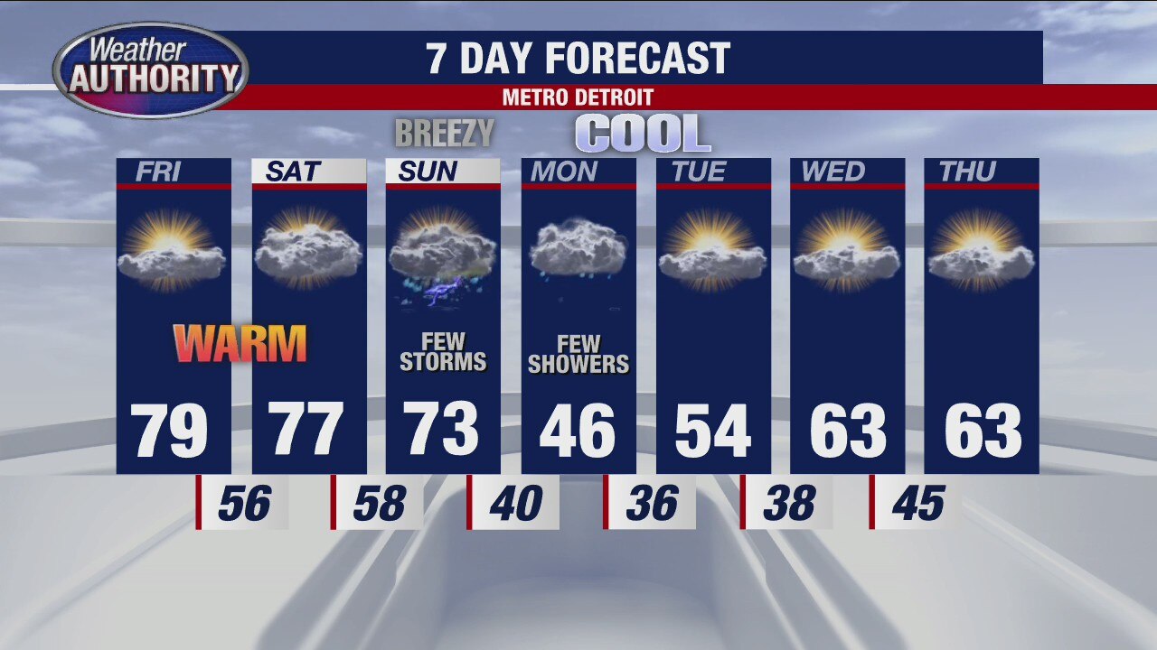
Temps not as warm for Friday, but the pleasant pattern continues
Rich Luterman has the forecast and says next week the temperatures will feel more April-like.
Rich Luterman has the forecast and says next week the temperatures will feel more April-like.
More great weather ahead!
Enjoy the next few days before things change next week!
Enjoy the next few days before things change next week!


Warm week in Southeast Michigan peaks Thursday with 81 degrees expected
Thursday also marks the beginning of a gradual cooldown that will extend into next week.
Thursday also marks the beginning of a gradual cooldown that will extend into next week.


Metro Detroit forecast: Great weather continues with sun, warm temps through Saturday morning
This nice stretch of weather in Metro Detroit continues through the end of the week, but it'll feel more like April after that.
This nice stretch of weather in Metro Detroit continues through the end of the week, but it'll feel more like April after that.