


Milder Tuesday
Milder day ahead as we start a warming trend. Chance for rain by evening. Meteorologist Lori Pinson has your forecast.
Milder day ahead as we start a warming trend. Chance for rain by evening. Meteorologist Lori Pinson has your forecast.

Tuesday night shower chance
Temperatures trend warmer Through the rest of the week with a rain chance Tuesday evening.
Temperatures trend warmer Through the rest of the week with a rain chance Tuesday evening.

A cold start to the new week
Temps jump big time tomorrow
Temps jump big time tomorrow

Little League Forecast
Season openers may be at risk of a cold out
Season openers may be at risk of a cold out


Metro Detroit weather: A cold start to the week before temps return to 60s and 70s
Monday will feature below-average temperatures all day, but the 60s and 70s aren't far.
Monday will feature below-average temperatures all day, but the 60s and 70s aren't far.

Colder Monday
Freeze Warning in effect until 11a. A colder day ahead with temps in the 40s. Warmer air in place tomorrow. Meteorologist Lori Pinson has your forecast.
Freeze Warning in effect until 11a. A colder day ahead with temps in the 40s. Warmer air in place tomorrow. Meteorologist Lori Pinson has your forecast.

What are El Nino and La Nina?
El Niño and La Niña are opposite phases of a natural climate pattern in the Pacific Ocean that heavily influences global weather.
El Niño and La Niña are opposite phases of a natural climate pattern in the Pacific Ocean that heavily influences global weather.

Freeze warning Sunday night, gradual warm up begins Tuesday
FREEZE WARNING – LATE SUNDAY NIGHT INTO MONDAY MORNING…. HARD FROST LIKELY. It will stay CHILLY Monday into Tuesday morning. A gradual warm-up begins Tuesday afternoon for the region. The next best chance for some rain shower activity after early this evening is Friday. Rest of Sunday evening / night…. Spotty early evening showers… then COLDER overnight with lows in the 20’s. Monday: Partly sunny…. still COOL… high 47 Tuesday: Mostly cloudy…. breezy and milder…. High 68 Wednesday: Lots of sunshine… VERY NICE… high near 70 Thursday: Sun and clouds… high 75 Friday: Mostly cloudy…. a few rain showers…. high 75 Saturday: Mostly cloudy…. high 65
FREEZE WARNING – LATE SUNDAY NIGHT INTO MONDAY MORNING…. HARD FROST LIKELY. It will stay CHILLY Monday into Tuesday morning. A gradual warm-up begins Tuesday afternoon for the region. The next best chance for some rain shower activity after early this evening is Friday. Rest of Sunday evening / night…. Spotty early evening showers… then COLDER overnight with lows in the 20’s. Monday: Partly sunny…. still COOL… high 47 Tuesday: Mostly cloudy…. breezy and milder…. High 68 Wednesday: Lots of sunshine… VERY NICE… high near 70 Thursday: Sun and clouds… high 75 Friday: Mostly cloudy…. a few rain showers…. high 75 Saturday: Mostly cloudy…. high 65

Colder Sunday
Frost Advisory this morning, then a Freeze Warning overnight. Temperatures to start Monday will only be in the 20s. Meteorologist Lori Pinson has your forecast.
Frost Advisory this morning, then a Freeze Warning overnight. Temperatures to start Monday will only be in the 20s. Meteorologist Lori Pinson has your forecast.


Coast Guard spots overturned vessel near where ship, 6 crew members went missing
An overturned ship matching the description of the one that went missing along with six crew members earlier this week has been located, the U.S. Coast Guard reported on Saturday.
An overturned ship matching the description of the one that went missing along with six crew members earlier this week has been located, the U.S. Coast Guard reported on Saturday.

Cooler Sunday with a few snowflakes!
Frost Advisory goes into effect overnight through Sunday morning with lows falling to the mid 30s. Chilly Sunday with highs in the lower 50s with a wintry mix during the afternoon, Chilly start to the week with highs rebounding as early as Tuesday!
Frost Advisory goes into effect overnight through Sunday morning with lows falling to the mid 30s. Chilly Sunday with highs in the lower 50s with a wintry mix during the afternoon, Chilly start to the week with highs rebounding as early as Tuesday!

Saturday Morning Showers
Scattered showers and mild temperatures to start. Colder air working in for Sunday. Meteorologist Lori Pinson has your forecast.
Scattered showers and mild temperatures to start. Colder air working in for Sunday. Meteorologist Lori Pinson has your forecast.

Cooler weekend
Few showers Saturday morning then decreasing clouds and rain. Highs will be in the mid 60s. Cooler Sunday with highs in the upper 40s to lower 50s.
Few showers Saturday morning then decreasing clouds and rain. Highs will be in the mid 60s. Cooler Sunday with highs in the upper 40s to lower 50s.


Gov. Gretchen Whitmer declares state of emergency in Ann Arbor amid tornado cleanup
A state of emergency has been declared in Ann Arbor after severe weather slammed into the city overnight Tuesday going into Wednesday.
A state of emergency has been declared in Ann Arbor after severe weather slammed into the city overnight Tuesday going into Wednesday.


Cheboygan dam water level continues to improve with system back online
The Cheboygan dam news has improved - and it is the news everyone has been hoping for. Since the last check at 3:30 p.m. the drop has been .24 inches today.
The Cheboygan dam news has improved - and it is the news everyone has been hoping for. Since the last check at 3:30 p.m. the drop has been .24 inches today.


Ann Arbor officials accessing storm damage door-to-door
Massive trees have been uprooted, some falling on houses and cars. City crews have been working today to clean up.
Massive trees have been uprooted, some falling on houses and cars. City crews have been working today to clean up.

More rain and storms likely tonight
Severe weather looks less widespread for SE MI however
Severe weather looks less widespread for SE MI however


Cheboygan dam water level continues to fluctuate as residents prepare for possible evacuation
Cheboygan dam water levels dropped slightly overnight as water continues to fluctuate. On Thursday afternoon, Michigan Gov. Gretchen Whitmer said officials were in "crisis mode" amid fears that the dam would fail.
Cheboygan dam water levels dropped slightly overnight as water continues to fluctuate. On Thursday afternoon, Michigan Gov. Gretchen Whitmer said officials were in "crisis mode" amid fears that the dam would fail.
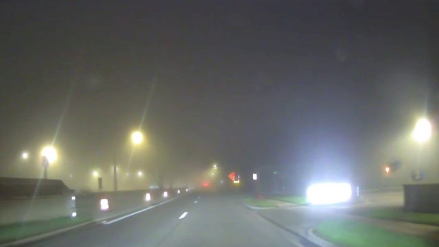

Metro Detroit weather: Dense fog ahead of dropping weekend temps
A Dense Fog Advisory is in effect for Southeast Michigan until 10 a.m.
A Dense Fog Advisory is in effect for Southeast Michigan until 10 a.m.
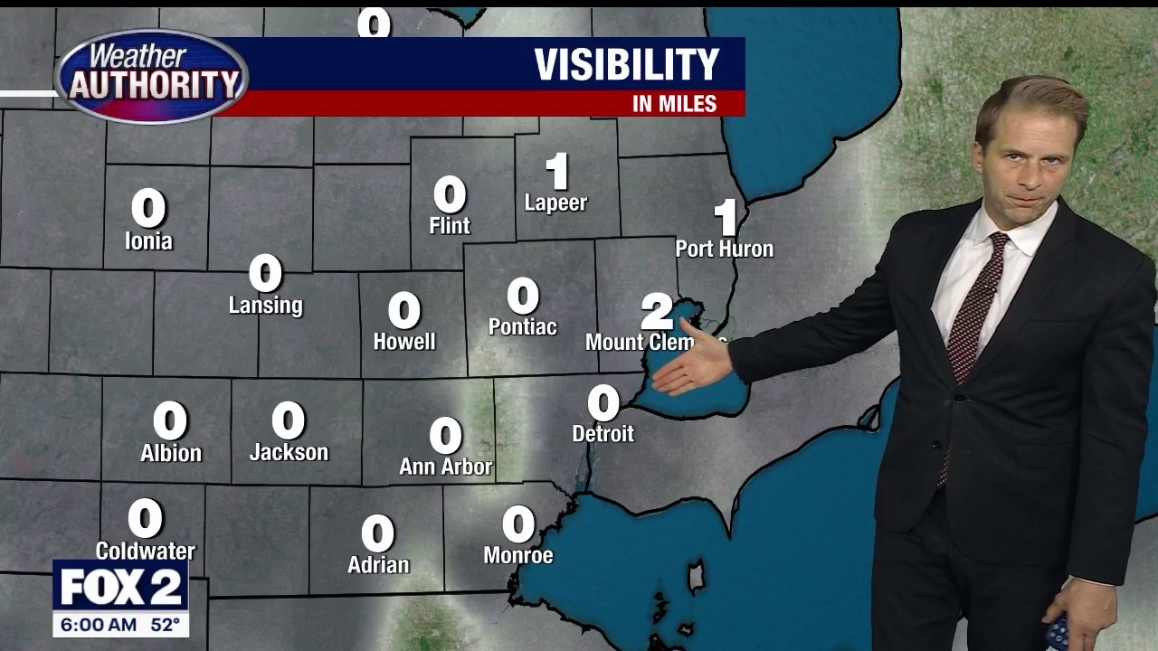
Dense Fog Advisory Friday morning
Southeast Michigan is under a Dense Fog Advisory until 10 a.m. Friday, with very little visibility across much of the area.
Southeast Michigan is under a Dense Fog Advisory until 10 a.m. Friday, with very little visibility across much of the area.