


Inside Detroit's Dossin Great Lakes Museum
FOX 2 News Weekend
FOX 2 News Weekend

Super Bowl Sunday Forecast
After a trace to an inch of new snow overnight, the big weather story today will be the chilly air. In fact, with highs only making it to around 15 degrees, this will be the coldest high temperatures we have experienced in Metro Detroit in the past 2 years. Bundle up.
After a trace to an inch of new snow overnight, the big weather story today will be the chilly air. In fact, with highs only making it to around 15 degrees, this will be the coldest high temperatures we have experienced in Metro Detroit in the past 2 years. Bundle up.
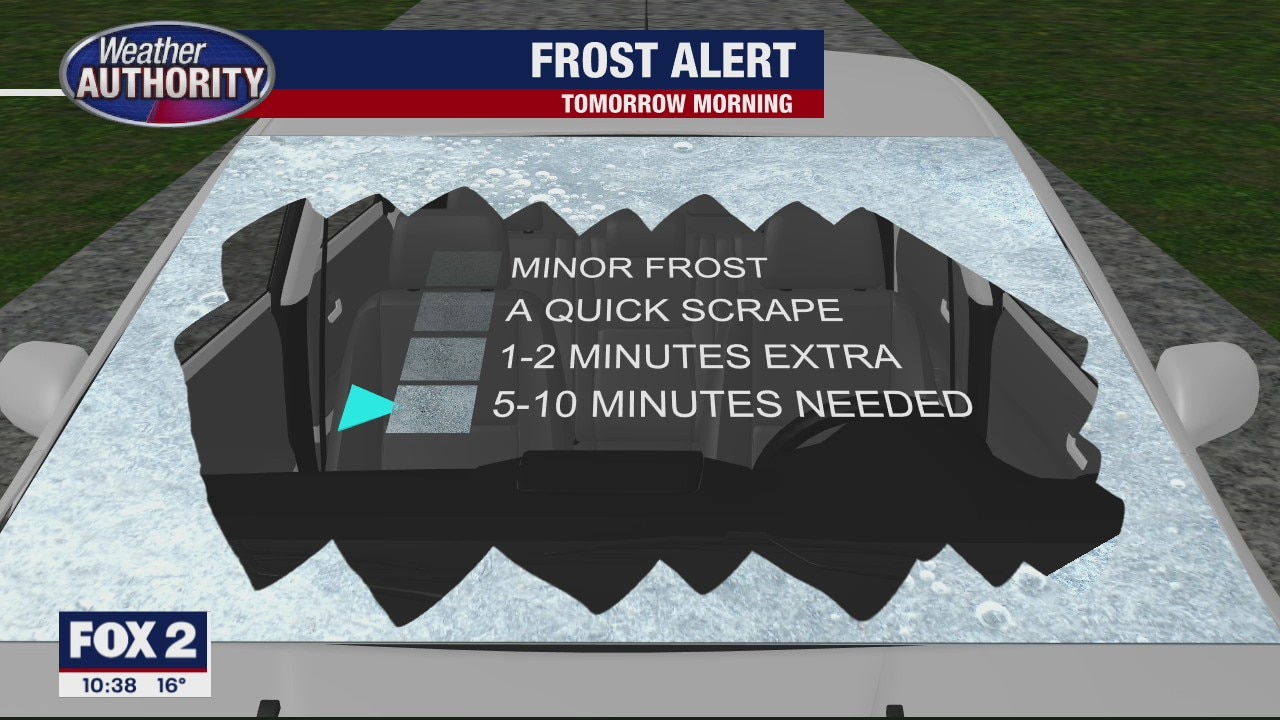
Cold & Snowy Sunday
Another cold start to your day on Sunday with single digit wind chill values with a coating of snow! Meteorologist Lori Pinson has your forecast.
Another cold start to your day on Sunday with single digit wind chill values with a coating of snow! Meteorologist Lori Pinson has your forecast.

Meet Honey!
FOX 2 News Weekend
FOX 2 News Weekend

Coldest "High" Temps in Years on the way
We are off to a very chilly start this morning with wind chills at and below zero at times. Into this afternoon, though actual temps should top out around 20 degrees, our wind chills will only feel like upper single digits. Along with a few morning snow flurries, more snow showers are on the way overnight tonight into early Sunday morning. A trace to 2 inches of light, fluffy snow is expected by Sunday morning. The coldest "high temperature in over 2 years is expected tomorrow with highs around 15 degrees.
We are off to a very chilly start this morning with wind chills at and below zero at times. Into this afternoon, though actual temps should top out around 20 degrees, our wind chills will only feel like upper single digits. Along with a few morning snow flurries, more snow showers are on the way overnight tonight into early Sunday morning. A trace to 2 inches of light, fluffy snow is expected by Sunday morning. The coldest "high temperature in over 2 years is expected tomorrow with highs around 15 degrees.

Sub Zero Wind Chill Overnight
Cold air in place courtesy of Low pressure to our north coupled with a strong wind will bring the potential for sub zero wind chill values overnight into Sunday. Meteorologist Lori Pinson has your forecast.
Cold air in place courtesy of Low pressure to our north coupled with a strong wind will bring the potential for sub zero wind chill values overnight into Sunday. Meteorologist Lori Pinson has your forecast.

Low Wind Chill Overnight
Arctic air in place along with a strong SW wind will bring sub zero wind chills to the area overnight. Meteorologist Lori Pinson has your forecast.
Arctic air in place along with a strong SW wind will bring sub zero wind chills to the area overnight. Meteorologist Lori Pinson has your forecast.


Metro Detroit School Closings for Friday, Feb. 5
A few inches of snow will precede some brutal cold throughout Southeast Michigan on Friday.
A few inches of snow will precede some brutal cold throughout Southeast Michigan on Friday.

Friday Winter Weather Advisory in effect until 10 am
The snow fades but the wind picks up! Get ready for a cold ride.
The snow fades but the wind picks up! Get ready for a cold ride.
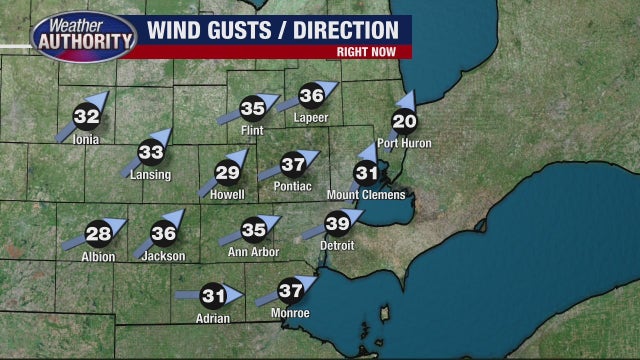

Wind gusts cause temps. to plummet across Southeast Michigan, winter weather advisory extended to 10 a.m.
Snow accumulations are expected between two to four inches leaving slippery roads, narrow visibility and a very likely slow-moving morning commute.
Snow accumulations are expected between two to four inches leaving slippery roads, narrow visibility and a very likely slow-moving morning commute.

Snow tapers off overnight, frigid temps and high winds await Friday
Derek Kevra has the forecast.
Derek Kevra has the forecast.
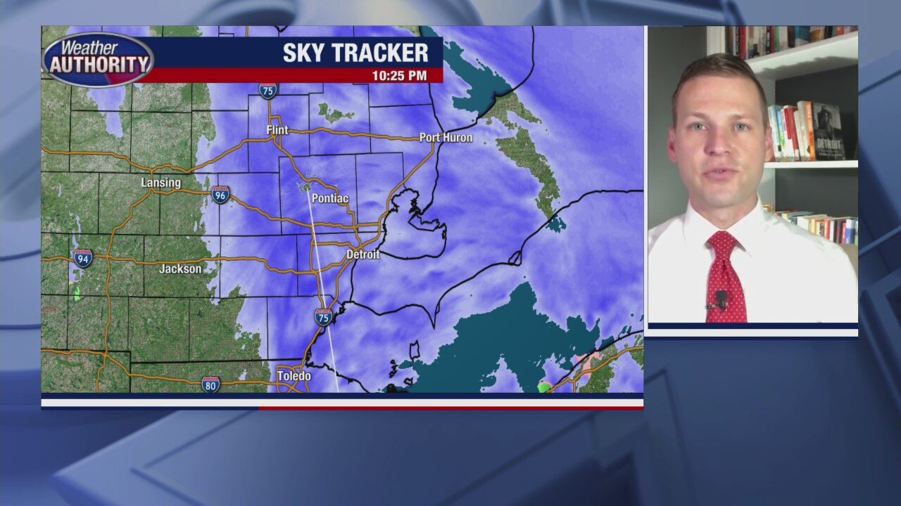
Snow expected to tail off during Winter Weather Advisory overnight
Derek Kevra has the latest on tonight's winter storm and what to expect for Friday.
Derek Kevra has the latest on tonight's winter storm and what to expect for Friday.

Winter Weather Advisory with plenty of wet snow
Derek Kevra has the forecast.
Derek Kevra has the forecast.

Here Comes the Snow
Shower showers are expected for all areas of Metro Detroit this evening through early Friday morning. In total, we should pick up between 1 to 3 inches of a heavy, wet snow. This could lead to big slow downs during Friday morning's commute into work, so plan accordingly. Friday afternoon will be much colder and more windy with wind gusts between 30 to 40 mph.
Shower showers are expected for all areas of Metro Detroit this evening through early Friday morning. In total, we should pick up between 1 to 3 inches of a heavy, wet snow. This could lead to big slow downs during Friday morning's commute into work, so plan accordingly. Friday afternoon will be much colder and more windy with wind gusts between 30 to 40 mph.

Thursday forecast: Winter Weather Advisory goes into effect at 4 pm.
A burst of snow this evening will be followed by a cold and windy Friday.
A burst of snow this evening will be followed by a cold and windy Friday.

Another few inches of snow arriving Thursday evening
Then some Arctic air arrives to put us in a deep freeze
Then some Arctic air arrives to put us in a deep freeze

Sunshine Today. Accumulating Snow Thursday night into Friday
Enjoy the sunshine we see today with temperatures hovering around freezing for highs because accumulating snow showers are on the way Thursday after sunset and into early Friday morning. By the time everything is said and done, most of Metro Detroit could pick up between 1 to 3 inches of snow. The coldest air in years is forecast into early next week with highs topping out in the low teens and single digits overnight. We are trending toward sub zero overnight lows by midweek next week.
Enjoy the sunshine we see today with temperatures hovering around freezing for highs because accumulating snow showers are on the way Thursday after sunset and into early Friday morning. By the time everything is said and done, most of Metro Detroit could pick up between 1 to 3 inches of snow. The coldest air in years is forecast into early next week with highs topping out in the low teens and single digits overnight. We are trending toward sub zero overnight lows by midweek next week.
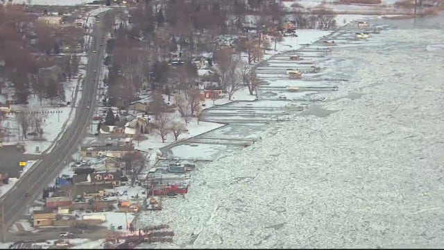

U.S. Coast Guard breaking ice jams on St. Clair River after flood warnings
Several cities in St. Clair County were under flood warnings Wednesday after ice jams threatened the coastline on the St. Clair River.
Several cities in St. Clair County were under flood warnings Wednesday after ice jams threatened the coastline on the St. Clair River.


State officials ask people to use caution on frozen bodies of water
Conservation officers want people to be wary of traveling over frozen lakes after six snowmobiles have fallen through ice in the last two weeks
Conservation officers want people to be wary of traveling over frozen lakes after six snowmobiles have fallen through ice in the last two weeks

Midweek sun with a Thursday night mix on the way!
Plus the coldest air of the season is set to arrive next week.
Plus the coldest air of the season is set to arrive next week.