

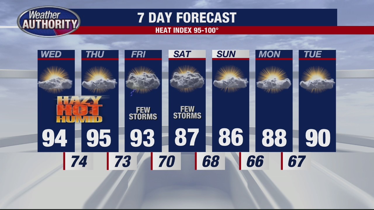
The heat wave continues
Rich Luterman has the forecast.
Rich Luterman has the forecast.

The heat will persist with a heat advisory in effect
Our heat index will near 100? this afternoon with isolated to widely scattered storms set to develop.
Our heat index will near 100? this afternoon with isolated to widely scattered storms set to develop.

The heat continues
Rich Luterman has the forecast.
Rich Luterman has the forecast.
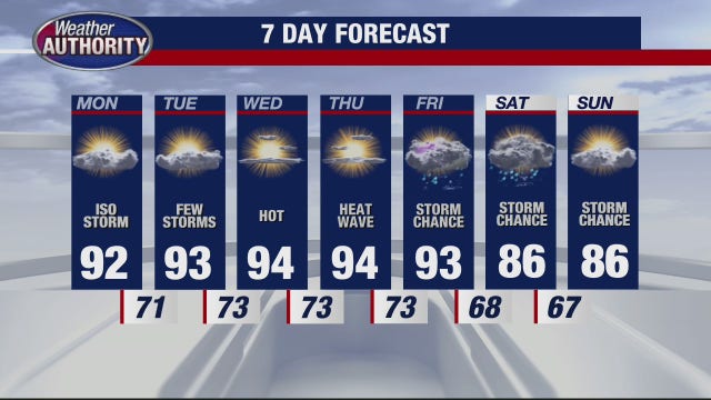

Brutal heatwave continues for Metro Detroit, low-to-mid 90s forecasted for entire week
The end of the holiday weekend, turns out, is only the halfway mark through an exceptional stretch of hot weather that has blanketed Southeast Michigan for the last week.
The end of the holiday weekend, turns out, is only the halfway mark through an exceptional stretch of hot weather that has blanketed Southeast Michigan for the last week.

Our heat wave continues, 90? all week long!
Cooler by the weekend with some storms in between.
Cooler by the weekend with some storms in between.

Boiling Hot Week Ahead
Watch for pockets of dense morning fog first thing Sunday morning. We are in store for another very warm afternoon with highs heading back into the 90s under mostly sunny skies. An Air Quality Alert is in our forecast for today so you may want to think about spending less time outdoors if you have breathing issues. Thankfully our rain chances are slim to none. Enjoy this afternoon because more humidity will be back in play by Monday along with even warmer temperatures.
Watch for pockets of dense morning fog first thing Sunday morning. We are in store for another very warm afternoon with highs heading back into the 90s under mostly sunny skies. An Air Quality Alert is in our forecast for today so you may want to think about spending less time outdoors if you have breathing issues. Thankfully our rain chances are slim to none. Enjoy this afternoon because more humidity will be back in play by Monday along with even warmer temperatures.

Air Quality Alert & Hotter Sunday
Meteorologist Lori Pinson has your forecast
Meteorologist Lori Pinson has your forecast
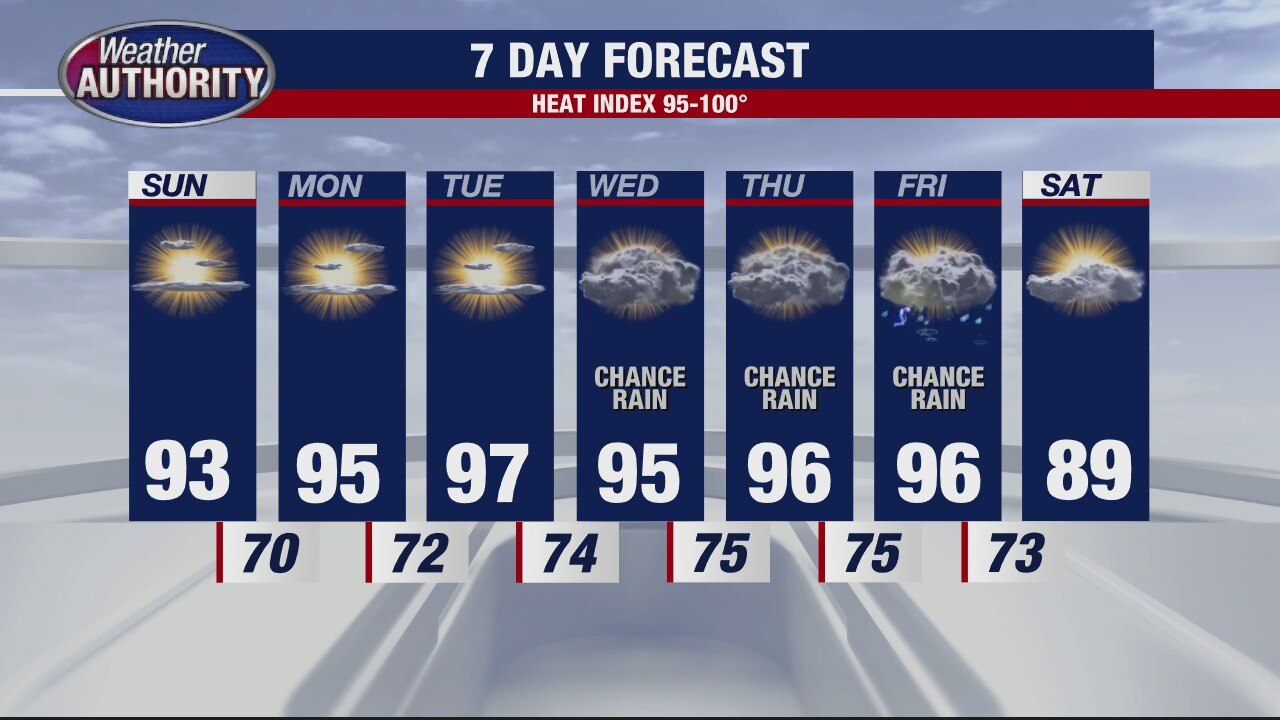
Holiday Weekend Outlook
Meteorologist Lori Pinson has your forecast
Meteorologist Lori Pinson has your forecast
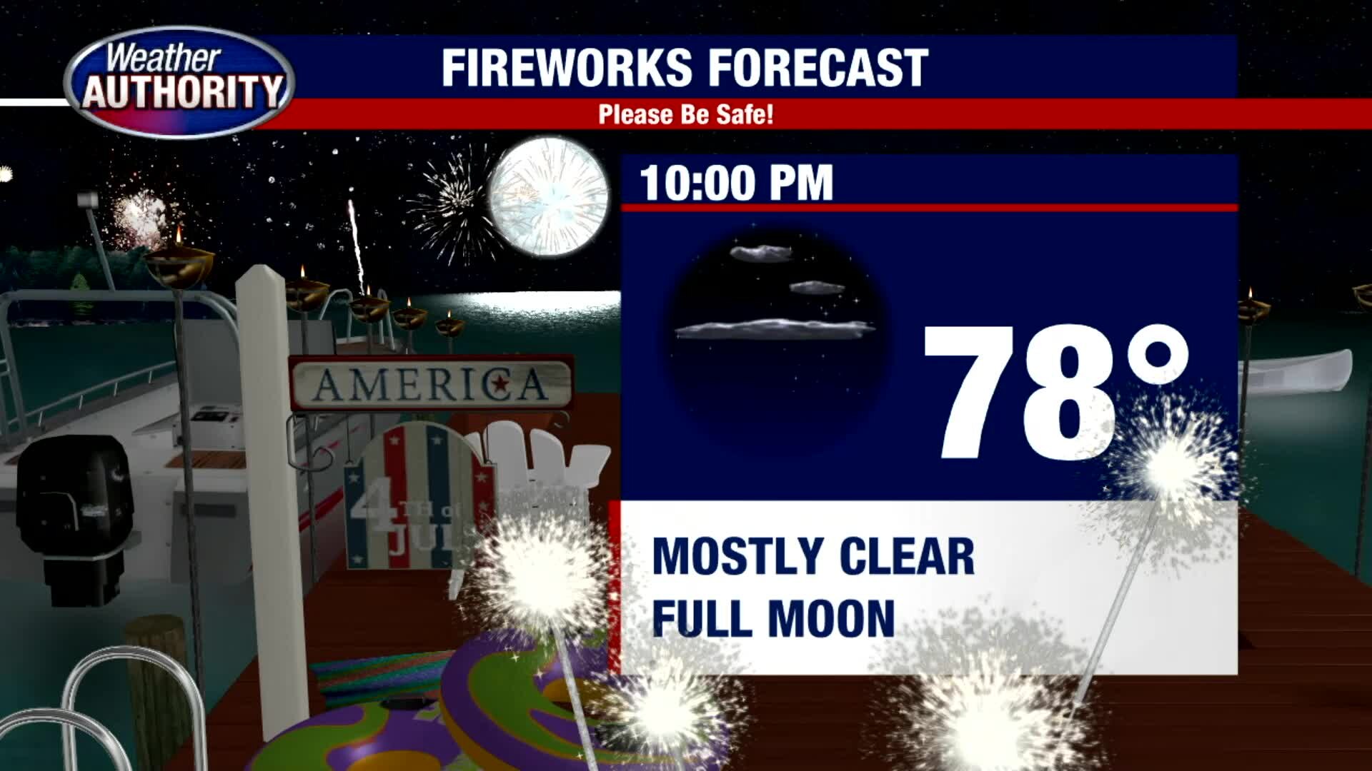
Blazing Hot 4th of July
After a mild morning, we are expecting temperatures to soar like a firework into the low 90s this afternoon under mostly sunny skies. From start to finish, we should keep things dry today with a northeast light breeze between 5 to 10 mph. Sunset tonight is just after 9pm and we are forecasting a mostly clear night with a big, bright full moon. By 10pm, temps should be in the upper 70s. Have a happy and safe Independence Day.
After a mild morning, we are expecting temperatures to soar like a firework into the low 90s this afternoon under mostly sunny skies. From start to finish, we should keep things dry today with a northeast light breeze between 5 to 10 mph. Sunset tonight is just after 9pm and we are forecasting a mostly clear night with a big, bright full moon. By 10pm, temps should be in the upper 70s. Have a happy and safe Independence Day.
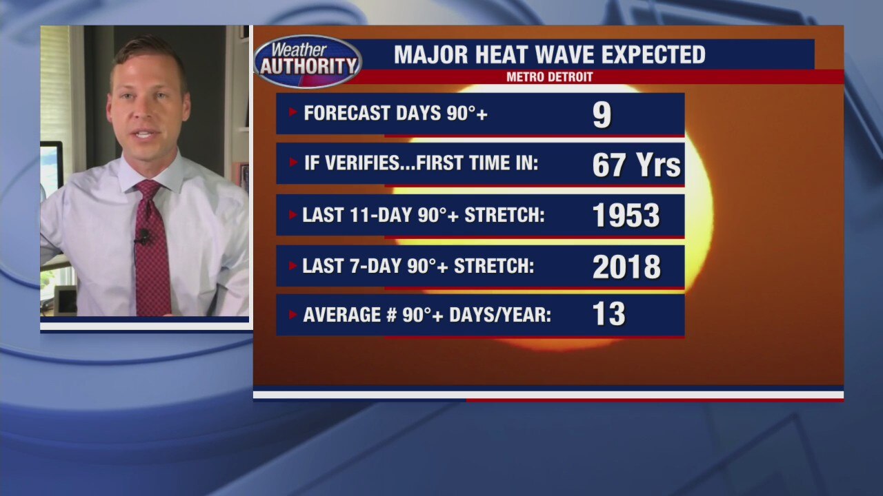
4th of July weekend coming in midst of major heat wave
FOX 2's Derek Kevra looks at the current stretch of 90 degree weather that's happening over the holiday weekend.
FOX 2's Derek Kevra looks at the current stretch of 90 degree weather that's happening over the holiday weekend.

4th of July Weekend Forecast
We are in for a long stretch of hot weather days in Metro Detroit. We made it to 90 degrees on Thursday and we will easily make it into the 90s again today and this weekend. Though an isolated storm is possible Friday afternoon along a surface trough moving through southeast Michigan, most areas will stay dry. You will feel the added humidity this afternoon as well. Overnight lows should fall into the upper 60s. Independence Day looks great with lots of sunshine and highs in the low 90s. Rain does not look to be an issue on Saturday. If you plan on being outside for an extended period of time this weekend, please make sure to drink plenty of water, find shady spots to enjoy, wear light and loose fitted clothes and if you have a pool, make good use of it over the next week.
We are in for a long stretch of hot weather days in Metro Detroit. We made it to 90 degrees on Thursday and we will easily make it into the 90s again today and this weekend. Though an isolated storm is possible Friday afternoon along a surface trough moving through southeast Michigan, most areas will stay dry. You will feel the added humidity this afternoon as well. Overnight lows should fall into the upper 60s. Independence Day looks great with lots of sunshine and highs in the low 90s. Rain does not look to be an issue on Saturday. If you plan on being outside for an extended period of time this weekend, please make sure to drink plenty of water, find shady spots to enjoy, wear light and loose fitted clothes and if you have a pool, make good use of it over the next week.


July 4th heat wave set to hammer US may bring ‘ring of fire’ effect
A Fourth of July weekend heat wave will put the ‘fire’ in ‘fireworks’ for much of the U.S., a report said Thursday — with the potential for a “ring of fire” effect to bring storms to parts of the Midwest.
A Fourth of July weekend heat wave will put the ‘fire’ in ‘fireworks’ for much of the U.S., a report said Thursday — with the potential for a “ring of fire” effect to bring storms to parts of the Midwest.

A mostly dry and all the way hot holiday weekend is on tap!
Other than a stray storm this afternoon we're good to go!
Other than a stray storm this afternoon we're good to go!

Welcome to the 90s as summer sets in
Rich Luterman has the very warm forecast.
Rich Luterman has the very warm forecast.
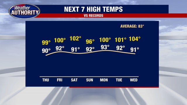

Holiday heatwave will push temperatures over 90 for the next week in Metro Detroit
I don't want to hear anyone complaining about this heatwave that we are in! Back in April when it was unseasonably cool people were begging for some hot weather. Well, now it's here!
I don't want to hear anyone complaining about this heatwave that we are in! Back in April when it was unseasonably cool people were begging for some hot weather. Well, now it's here!
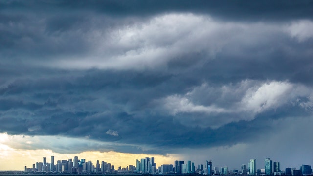

National Weather Service proposes new wireless alerts for most intense thunderstorms
The new product will provide advance notice of damaging wind gusts, large hail and tornadoes that pose a threat to life and property.
The new product will provide advance notice of damaging wind gusts, large hail and tornadoes that pose a threat to life and property.
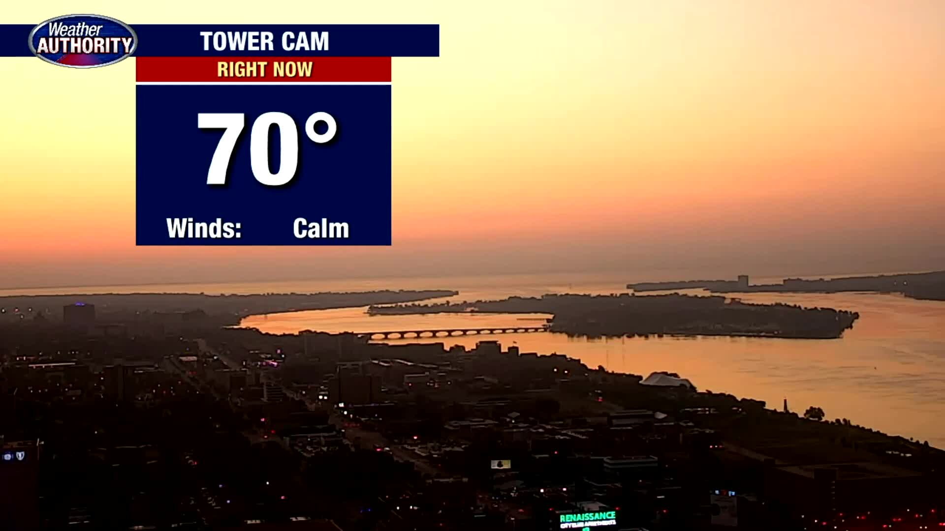
Our heat wave kicks off. Temps should hit 90 today, without much relief in view.
A hot holiday weekend is on the way.
A hot holiday weekend is on the way.
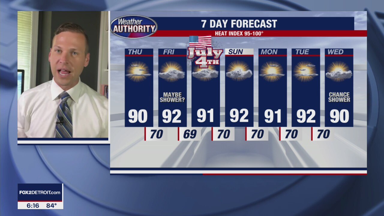
A Hot Stretch Continues
Heat Indices will be between 95-100 degrees for at least a week!
Heat Indices will be between 95-100 degrees for at least a week!
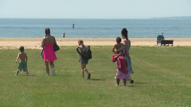

Enhanced cleaning being done to prevent COVID-19 spread at Lake St. Clair Metropark
As temperatures climb to above 90, people are heading to the lake for a cooler place and area beaches like Lake St. Clair Metropark are ready.
As temperatures climb to above 90, people are heading to the lake for a cooler place and area beaches like Lake St. Clair Metropark are ready.

Our pattern remains on repeat another day with a heat wave to come.
Temps should get to 90 tomorrow afternoon and remain there through next week.
Temps should get to 90 tomorrow afternoon and remain there through next week.