

4-day stretch of light snow expected across Michigan starting Sunday

FOX 2 (WJBK) - Hopefully everybody had a wonderful Thanksgiving holiday and enjoyed some time outside, because the weather pattern faces a big shift starting today.
High temperatures will only make it to the middle 30s – unlike the nearly 50 degrees we saw on Thursday. Cold, dry, Arctic air from Canada has arrived and, like an unwanted house guest, is in no hurry to leave. This colder weather pattern will likely stick around for 10 days, so make sure that winter gear is accessible.
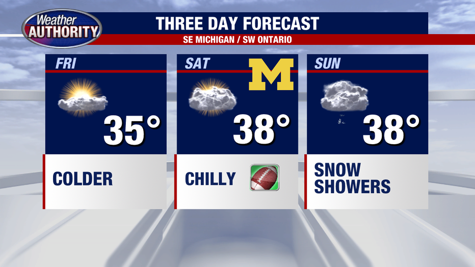
We will climb to 35 degrees with partly cloudy skies on Friday. Overnight will fall to the lower 20s as more clouds begin to push in. Saturday will be dry and cloudy, with temperatures climbing to roughly 38 degrees.
Michigan football fans that are headed down to Ann Arbor early to tailgate should prepare for temperatures to be in the upper 20s and lower 30s. Bundle up and Go Blue!
As we move into Sunday we will see a winter weather system arrive. This means snow is on tap. Overall, we could see around 1 inch of snow.
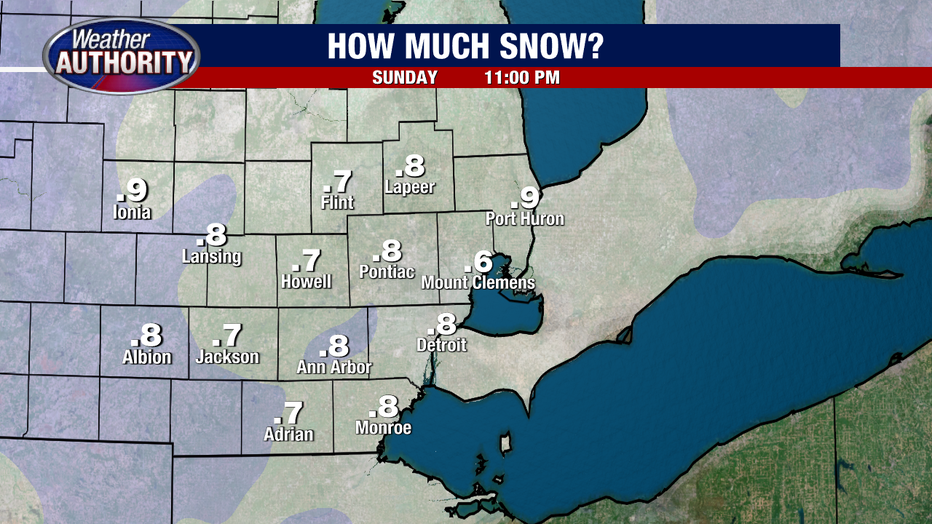
But as always, with the first accumulating system of the year, the question is how much will stick to the slightly milder ground? I think we will see accumulation on grassy surfaces and trees, with slightly less on sidewalks and roadways. However, accumulation on the road is also possible, so please be careful as you drive on these slick surfaces.
Some flurries are expected early next week on Monday and Tuesday and another minor snowmaker arrives on Wednesday. Temps remain in the 35-40 degree range.