

A big warm-up with a stretch of rain Thursday

The big warm-up arrives today. Temperatures top out in the 60s with a little less cold start to the day.
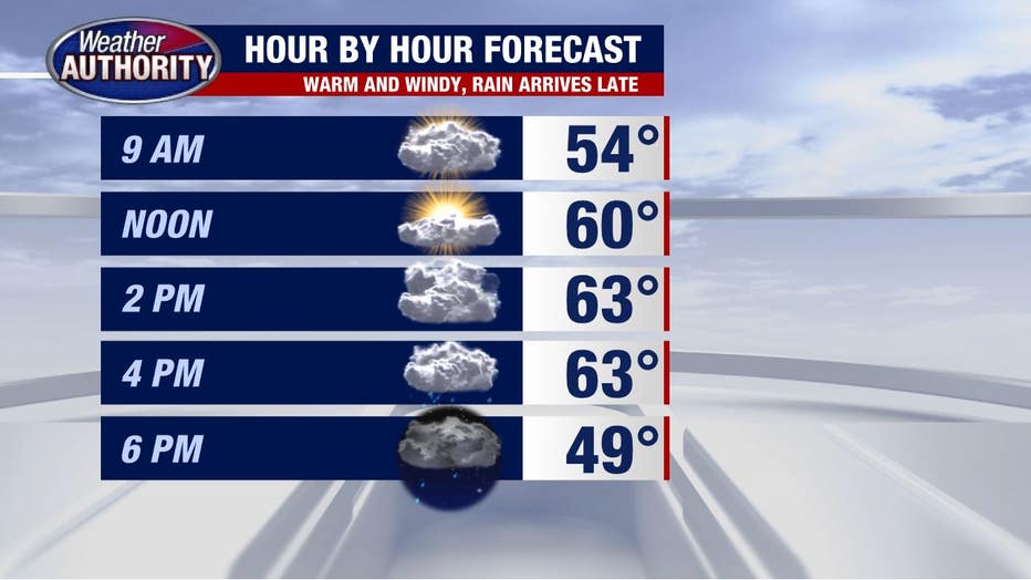
However, all is not pristine, as a strong wind will present itself.
Wind gusts up to 30 or 40 mph this afternoon are likely. And rain will be around to finish the day.
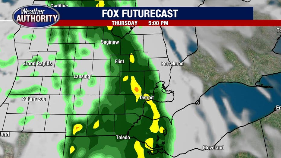
Rain totals will range from .25"-.50 inches and end early in the night.
Friday starts off colder with some sun before clouds increase and we may even end the day with a spotty shower.
The colder weather will keep coming over the weekend. It won't be wet all weekend long, but scattered showers at times will fall with snow mixing in.
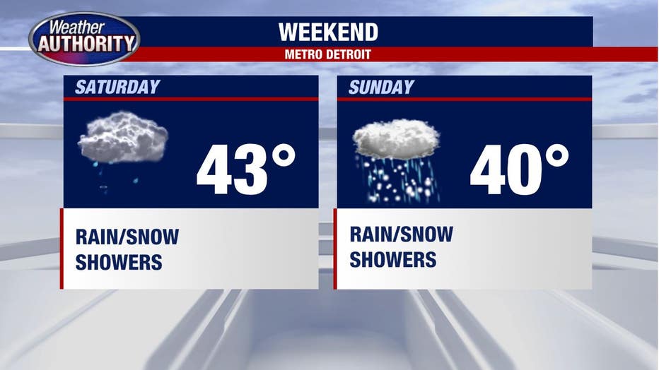
There is increasing potential for our first minor accumulating snow come Sunday as a weak system dives into the Great Lakes. It's still a few days away, so it's probably too early to get too jazzed, but stay tuned!