

A single-digit wind chill in Southeast Michigan will keep Friday freezing with some lake effect snow

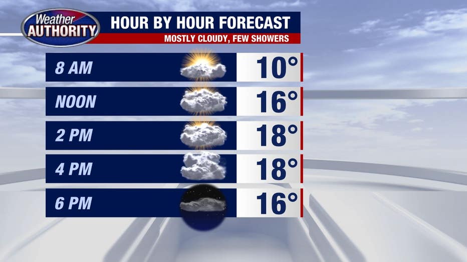
It's cold again. It'll be a single-digit chill basically from start to finish under mostly cloudy skies (some morning sun).
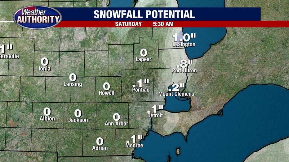
It is possible that some lake effect snow will accumulate along the Lake Huron shoreline.
Minor accumulation is possible for Port Huron and points north, with lower totals further inland.
Another rough start to the weekend with single digit temperatures to begin Saturday.
Plan on temperatures rising into the teens with partly sunny skies by the afternoon while a few snow showers are possible on Sunday.
Our thaw next week is still on, if only briefly, with temperatures hitting 40 degrees Tuesday but coming down after that.
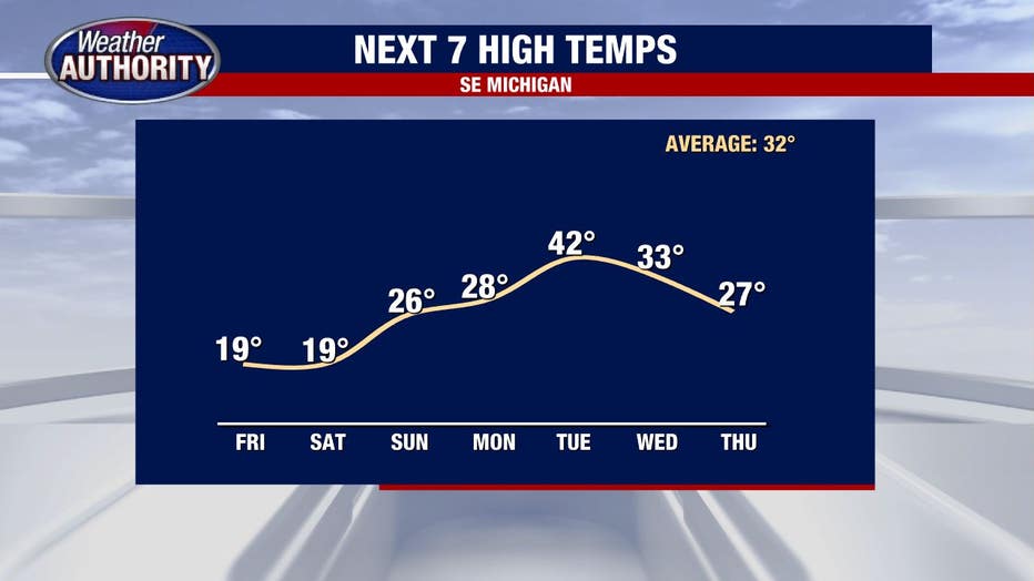
Active weather looks likely as well and although it's far too early to write the weather story, accumulating snow has been looking more and more likely Wednesday and Thursday.
Those will be two days to keep a very close eye on.