

A summer comeback Tuesday with upper 80s, gusty wind, and potential for thunderstorm

Get ready for a summer comeback.
We ONLY hit 72 yesterday and we'll outdo that number by a ton today as highs slide into the mid and upper 80s on a gusty southwest wind.
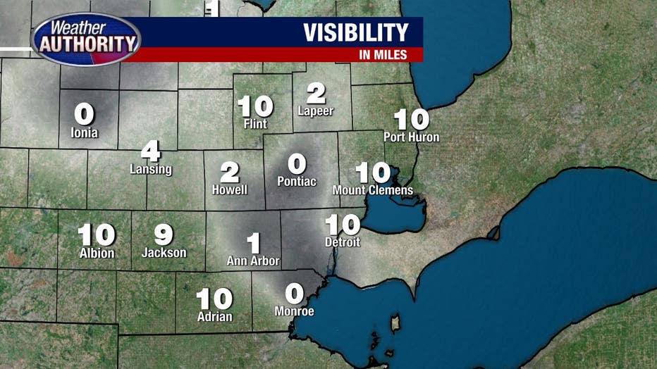
First though, if you're heading out the door early this morning you may run into some fog with visibilities dropping to a quarter mile or less in spots.
We'll wash that away and the skies will turn partly sunny as summer sets in.
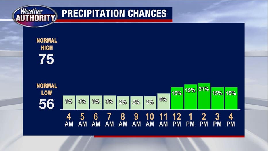
Our storm chances will increase this afternoon slowly at first, check out precipitation chances coming up just a touch early this afternoon.
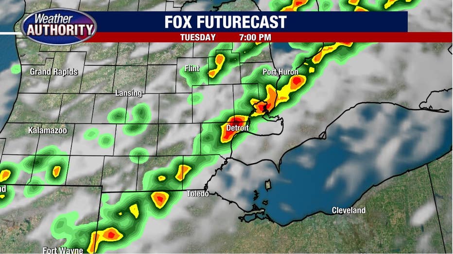
By this evening, storms are likely across Southeast Michigan, check out FOX Futurecast for 7 p.m.
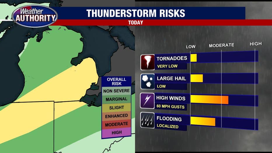
Storms are likely late this afternoon through the evening into the first part of the night.
We have a slight risk for severe weather with damaging winds being the greatest threat.
The risk for flooding rain and large hail coming will be a bit lower and while our concern for tornadoes is not terribly high, it's not at zero either.
The cold front sweeps through tonight and we'll see the storms fade by midnight with cooler weather coming Wednesday and nothing more than a spotty shower.