Chances for rain in Southeast Michigan start Wednesday night as temperatures remain above average

After breaking late yesterday the clouds have filled back in overnight. Sunrise is coming at 7:36 a.m. and will reveal a solid deck of stratus.

Our clouds may break a bit this afternoon (fingers crossed tightly!) but at the same time, high clouds will stream in from the south, tied to our next rainmaker.
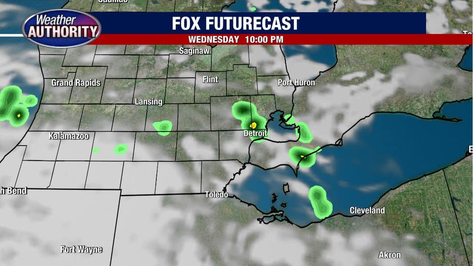
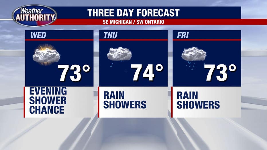
The rain doesn't arrive until this evening at the earliest with rain chances remaining pretty low through the night.
Check out the limited coverage of rain that the Fox futurecast is spitting out tonight.
While showers will be possible Thursday morning, a much greater opportunity exists by the afternoon and evening. This same system will slowly move across the Great Lakes through Friday, keeping rain showers in the forecast to finish the week.
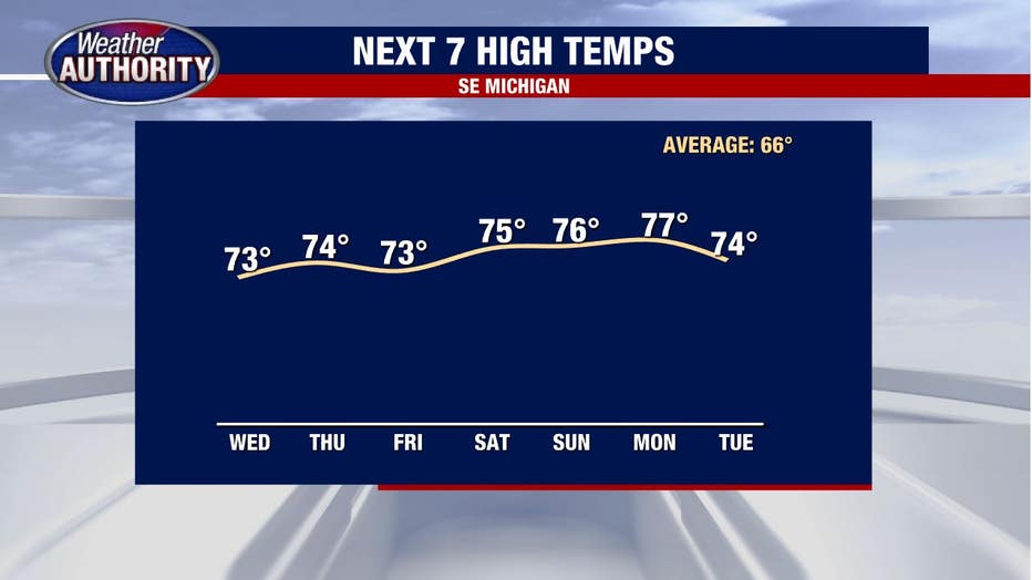
And as we move deeper into October, one might reasonably suspect that a cooldown is coming, but one would be wrong. Check out your high temps through the next seven, which remain steadily above average.
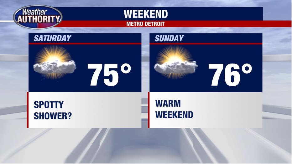
Rain chances for the weekend are still up in the air a bit, but the general picture suggests that while a few showers will remain possible, they will remain more isolated in nature allowing for some decent dry time to enjoy the warmth.