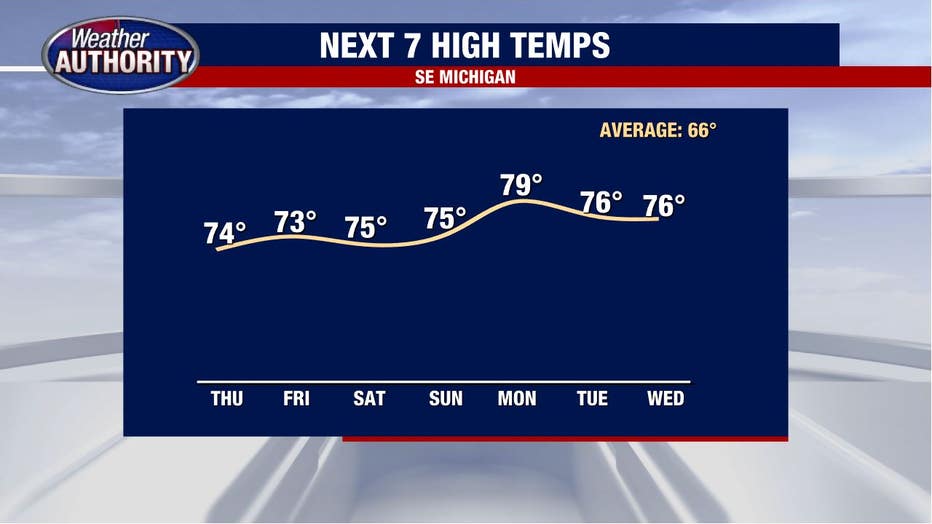
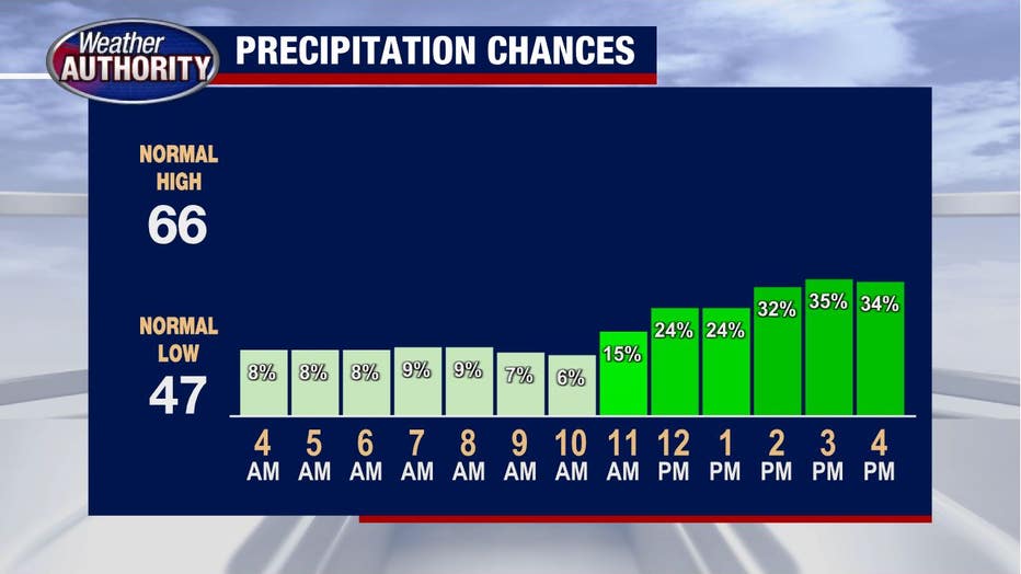
Cloudy and mid-70s Thursday with a growing chance of rain in the afternoon

We're singing a similar song this morning with more clouds, light fog, and a not-too-cold-by-October-standards feel.
Although it's possible a few areas may squeeze out a spotty shower, rain chances will remain quite low this morning before ticking up by afternoon.
Low pressure spinning across southern Illinois will continue to send plenty of moisture our way, keeping our October humidity quite high which is an odd combination of words to say.
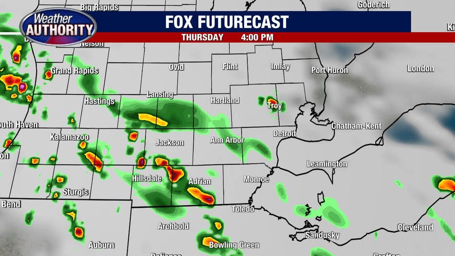
Check out one of our high-resolution models depicting scattered showers with an isolated storm possible come mid or late afternoon.
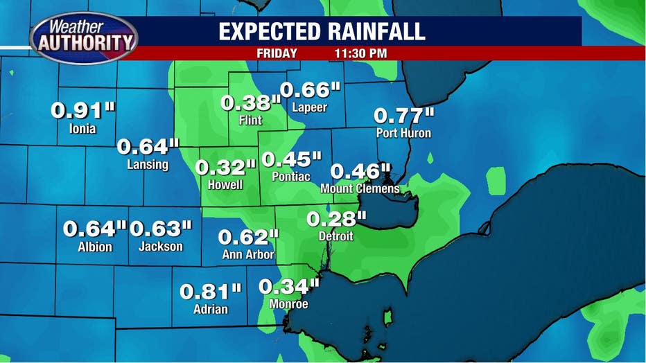
Showers with the potential for a storm here or there will continue off and on through the night and probably increase in coverage a bit on Friday.
Rain totals will range between .25 inches - .50 inches for many of us with some outliers exceeding that.
That system will be moving out this weekend, but may still linger long enough to support at least the *chance* for a shower Saturday, however, I would say most of the weekend looks to remain dry AND WARM.
A warm front will cross the area Sunday and by Monday we'll be in the warm sector of a system bringing a surge of even warmer weather.
High temperatures are near 80 by Monday and if you're looking for a cooldown, look elsewhere.