

Cold eases in Southeast Michigan with potential for snow later in the week
(FOX 2) - The cold eases a bit more this morning.

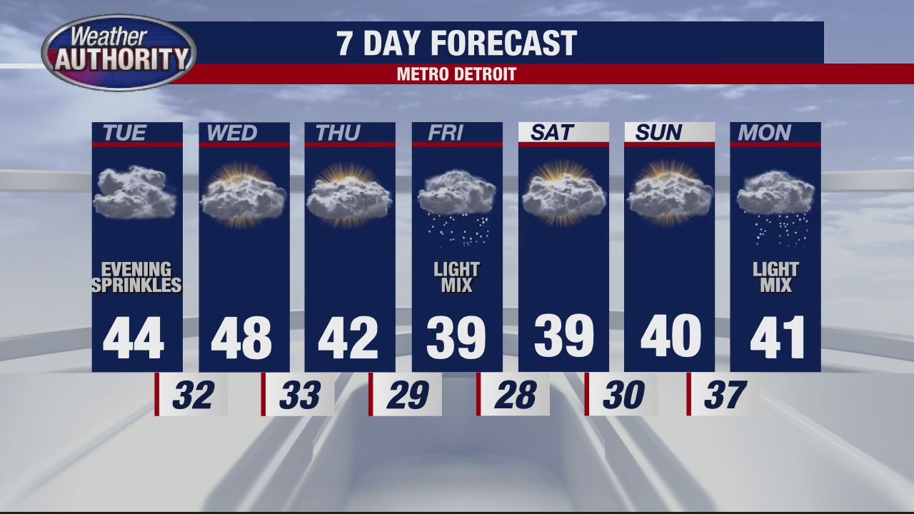
While many of us don't see any rain, light showers remain possible in our northernmost communities with minimal a few flakes possibly mixing in. Rain totals are paltry.

A few rain showers are possible tonight with clouds winning out the next few days.

Our late week system is still the one to watch with accumulating snow possible. You'll see the main piece to the puzzle if we look to the west. A mid-level short wave in the mid-levels of the atmosphere.

That will move onshore, pick up some more energy, swing through the Rockies and eventually make it into the Great Lakes.
Accumulating snow is possible. The system being tracked will bring low pressure and, depending on how it interacts with Canadian high pressure, will determinine the final story.
It's too early to say with certainty, so stay tuned as a clearer picture emerges the next couple of days!