

Humidity and rain chances stick around Southeast Michigan Friday

(FOX 2) - Oh man - this humidity is rough and it's not going anywhere any time soon!
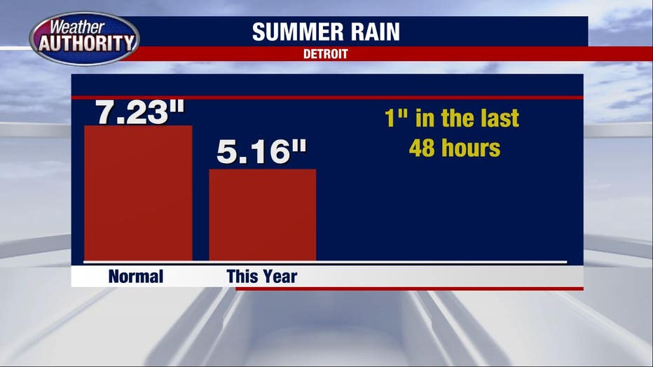
Despite a wet past 48 hours, this summer has been quite dry. Since June 1st, we've received 5.16 inches of rain, which is significantly below our "normal" amount of 7.23 inches. It's even worse when you realize that we've gotten 1 inch of rain in the last 48 hours!
So, before this week it's been very dry around here.
Friday's forecast does come with some showers but not for everyone. We may see some afternoon showers come and go, but they're expected to be smaller cells. Therefore, if you have plans later today I wouldn't cancel them - but I would note that one or two sprinkles is a possibility.
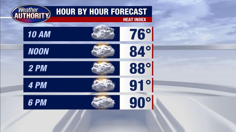
High temperatures climb to 86 degrees but thanks to a real thick humidity it will feel more like 91.
Saturday morning will be foggy, and the afternoon looks dry but still very hot, with a heat index climbing to nearly 95 degrees. The humidity will be something we won't be able to avoid, unfortunately.
The skies will be partly cloudy.
Sunday follows suit with the morning fog, heat, humidity and a chance for some showers or thunderstorms. High temperatures will be near 92, but it will feel closer to 97.
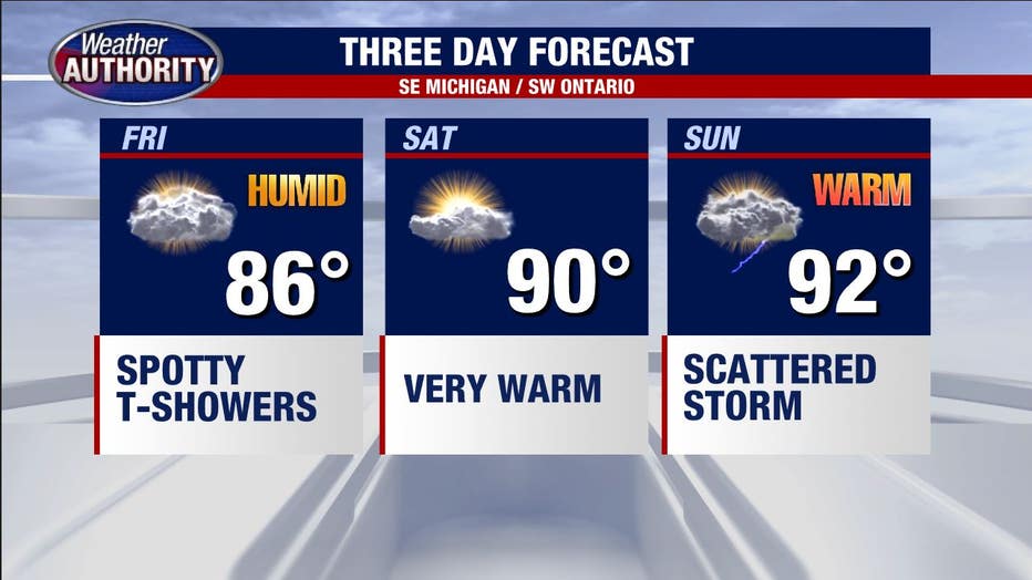
Storm chances build through the afternoon but will again be "hit-or-miss" meaning it will be a tough call on whether to cancel plans (I wouldn't cancel).
Stay cool!