

Metro Detroit severe storms: Strong winds and heavy rain likely, potential for hail and isolated tornado
Metro Detroit severe weather outlook
Strong thunderstorms are possible Tuesday around Southeast Michigan, with strong winds likely, along with the chance for hail and flooding.
DETROIT (FOX 2) - There is a threat for severe weather in metro Detroit today.
Let’s set the stage. Temperatures today will exceed the norm. Readings in the 70s once again on a strong southwest wind. An approaching cold front will attempt to displace the warm air resulting in potentially severe weather.
Timeline:
Rain moving in this morning. Right now, near Livonia, approaching the city with the heaviest rain this morning to our north, toward Saginaw. Around 2 p.m. you’ll notice more redevelopment with the potential for severe weather ramping up as we approach 6 p.m.
This is due to the warmer air in place with a strong cold front working to displace the mild air.
For the latest forecast, live radar, and more, download the FOX 2 Weather app.
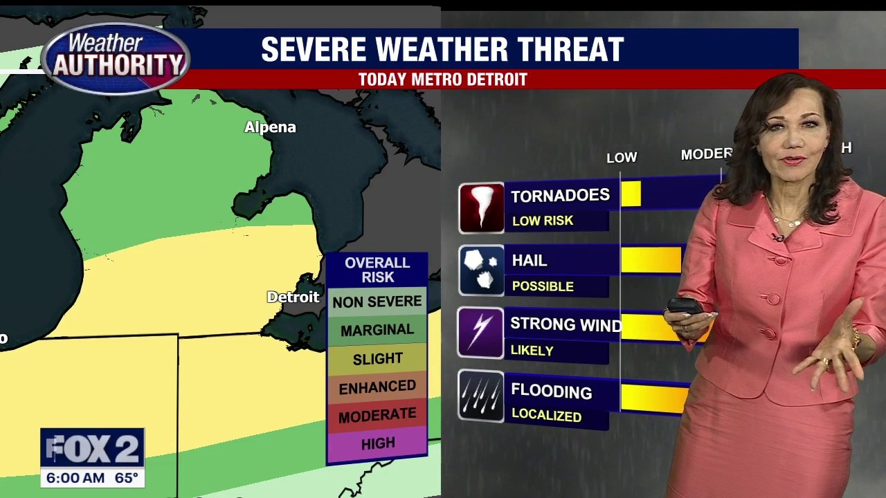
Biggest severe weather threats
We’re under a marginal and slight risk from the Severe Storms Prediction Center for gusty winds near 40 or 50 mph, heavy downpours, not ruling out hail and an isolated tornado.
What's next:
Behind the cold front, much colder air as the wind becomes more of a northerly flow for Wednesday. Highs in the 40s.
Temperatures rebound again Thursday, but another system keeps rain in the forecast. The Tigers Opening Day Friday carries a chance for morning rain with temperatures near 70 degrees.