

Metro Detroit weather: Wind Advisory remains in effect, but threat for severe weather has passed
Another Windy Day
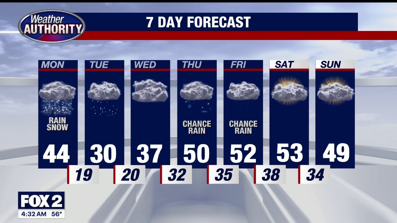
Mild to start with falling temperatures throughout the day resulting in light snow. Wind Advisory remains in place. Meteorologist Lori Pinson has your forecast.
DETROIT (FOX 2) - A windy start to your day. Wind Advisory remains in effect for gusts up to 43 mph, but the threat for severe weather is over.
The wind and falling temperatures dictate the forecast today. Readings begin in the 60s, a holdover from yesterday’s high temperatures, falling to the 30s this afternoon as wind direction shifts behind a cold front and departing Low pressure. What does this do to the line of rain associated with this system?
Light to moderate rain is steadily moving east out of state this morning so wet roads will greet you. As colder air replaces our warmth, don’t be surprised to see light snow this afternoon coming off the lakes. Not much accumulation is anticipated since yesterday’s high was 71. Surface temperatures are too warm to support accumulating snow here, with another warm up expected this week.
Up north snow
Up north is a different scenario. Several locations are reporting double-digit snow totals, in the 20 inch range, with Blizzard Warnings continuing in the UP. 26" in Spalding, 23" in Newberry, 18" in Mackinac. For metro Detroit, colder air tomorrow morning (St. Patrick’s Day) will bring the threat of light morning snow, but it’s temporary. Temperatures reach 50 degrees Thursday bringing rain back to the area.
The Vernal Equinox, or first day of Spring Friday, will bring above seasonal readings, near 52 degrees.