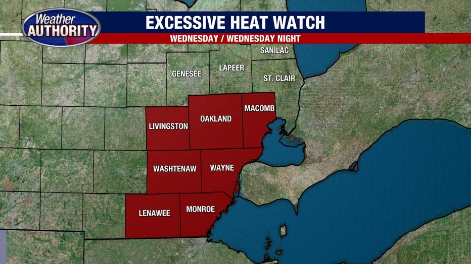
Michigan weather bringing extreme heat, temps that will feel like 105+ on Wednesday
(FOX 2) - What a weather week this is shaping up to be!
Monday's severe storms are in the rearview mirror and now our attention focuses on the extreme heat that is headed our way. A Heat Dome has been building, meaning that under strong high pressure the temperatures rise and the humidity gets pumped in.
Boy will we feel it all starting Wednesday!
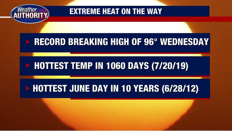
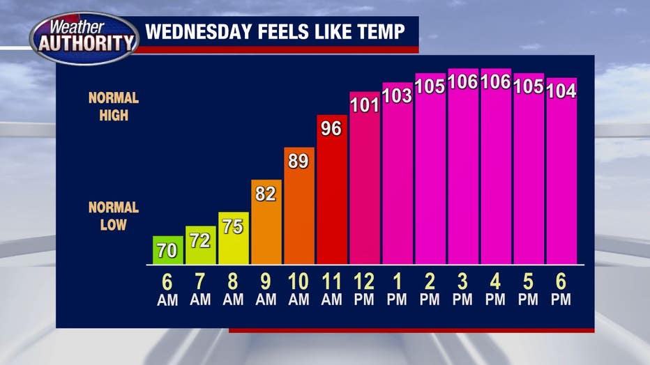
The forecast high for Wednesday right now is 96 degrees. That alone would be a record, breaking the old 95-degree record set back in 1988.
But add into that dew points (which is essentially water in the air) that climb into the low 70s and we are in store for temperatures that "feel like" 105+ degrees! This is the hottest air that we've seen in over a thousand days (since July 20, 2019) and the hottest June day in nearly 10 years (since June 28, 2012).
This type of heat can be extremely dangerous, especially to kids and older folks. If you don't have working A/C in your car it may be uncomfortable to drive around, even with a strong breeze. Make sure you push those fluids on the toddlers (they often forget) and keep the water bowl full for your pets.
Thursday will be hot too, but less muggy.
A cold front will swing through brings showers/storms but drastically changing the temperatures heading into the end of the week. It's a short break though, as we'll be dealing with another round of extreme heat early next week.