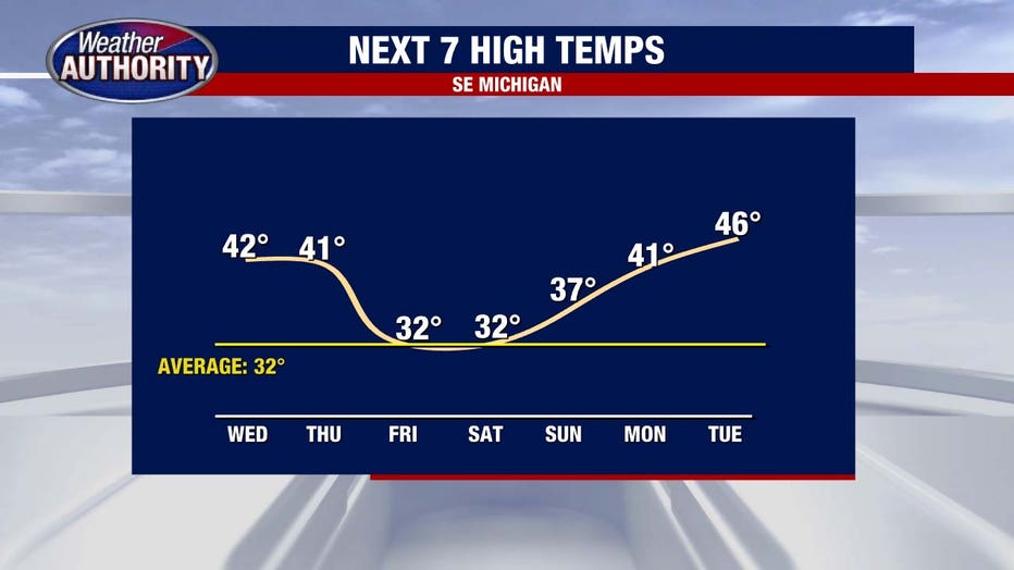
Michigan's warm stretch continues with low 40s Wednesday and spotty showers

(FOX 2) - We'll find our way into the 40s for the 8th time this month as our remarkably warm start to the year continues.
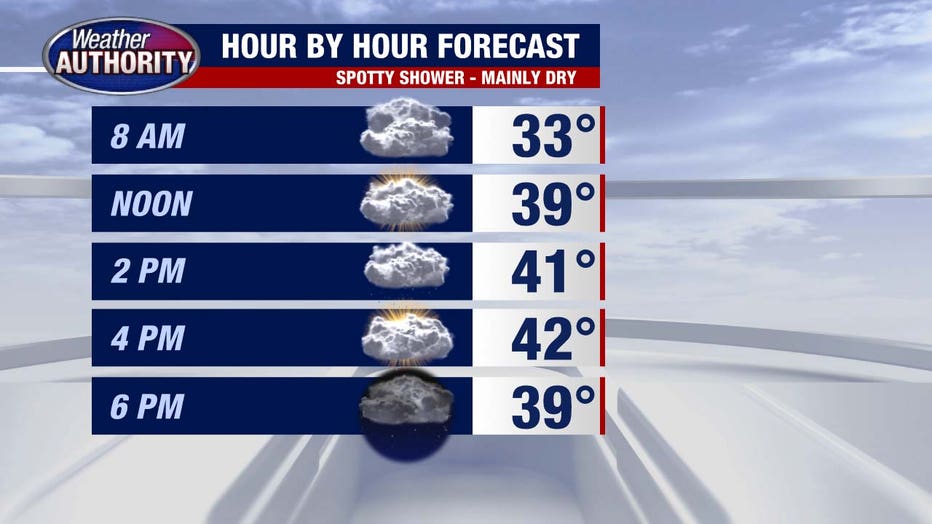
Rain won't be a big issue, but a spotty shower is possible with more rain set for Thursday as low pressure approaches.
Here's a look at the future radar midday tomorrow.
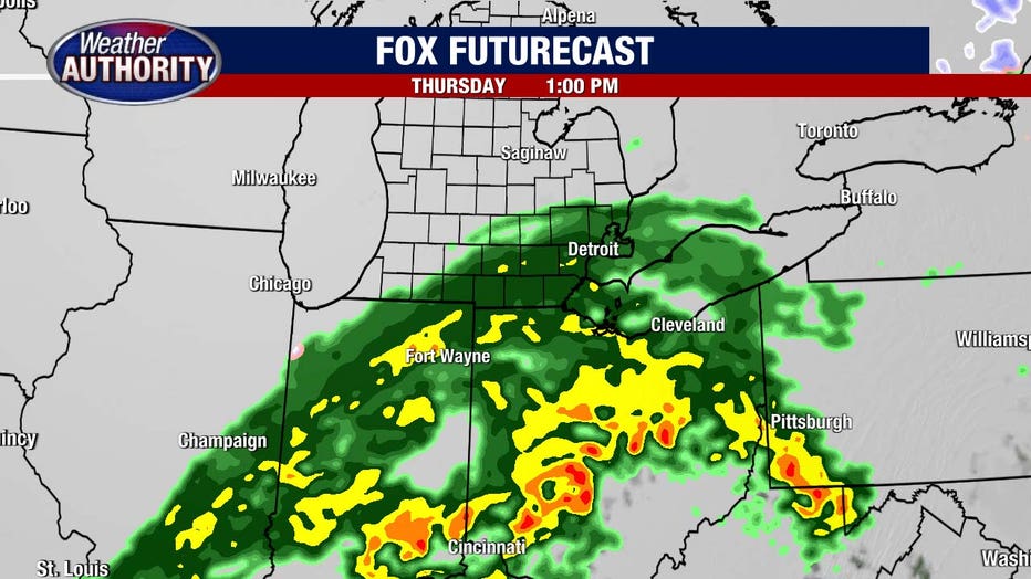
Colder air will turn that to snow Thursday evening and night before turning off early Friday.
I'll say snow totals in the range of an inch or two look like a decent bet. Perhaps higher totals due to lake enhancement off of Lake Huron. Around the Detroit/Ann Arbor area and to the south may even wind up with an inch or less.
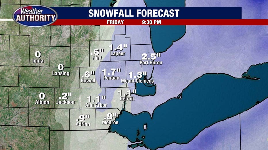
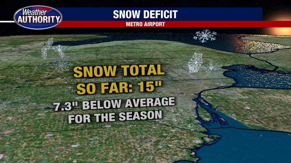
Not a major snow, but considering our yearly deficit, we'll take it.
Temperatures come down Friday and Saturday, but jump back up next week and by that time we're almost to February. It's too early to throw in the towel yet if you're looking for snow as we have plenty of time for a pattern change.
February averages about a foot of snow.