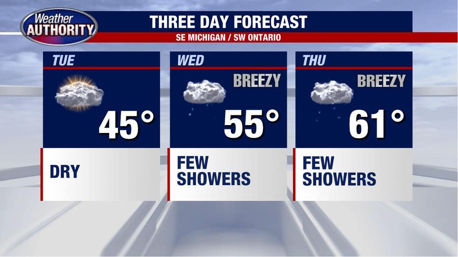
Mid-40s and cloud cover expected Tuesday with rain showers set to move in at night

A frosty Tuesday morning, but moving closer to warmer and wetter weather!
50's & 60's midweek come with clouds, rain and wind.
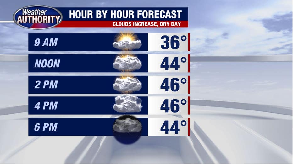
The big warm-up is still on, but today is the small step back.
A frosty start with clear skies in place, clouds will increase and temperatures top out in the 40s.
Temperatures tonight stay just "warm" enough to support rain showers that will linger into Wednesday before we eventually top out in the mid-50s by afternoon with off-and-on showers.
We warm further Thursday morning ahead of the cold front that's set to cross Southeast Michigan by midday.
Plan for wind gusts up to 40 or 50 mph during that time - not quite as strong as the big wind we had this past Saturday, but they may still be strong enough for a wind advisory.
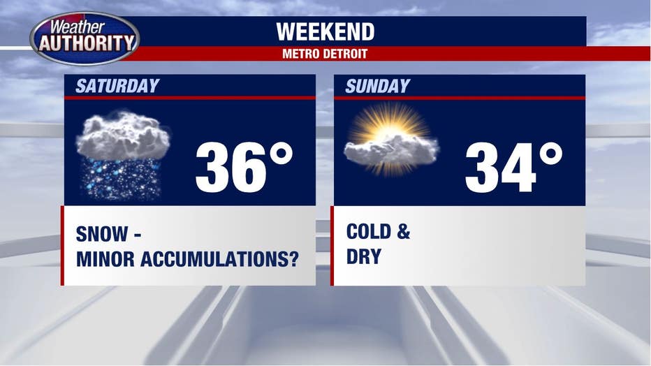
A winter feel returns with highs in the 30s over the weekend and an increasing chance for snow Saturday.
It's too early to get too specific, but minor accumulations are certainly possible.