On and off showers expected Monday as temperatures climb to low 70s

The weekend ended wet and stormy (with a Tornado Warning issued late Sunday night in northern Oakland County!) and that's exactly how Monday begins.
The pesky low pressure that gave us warm and wet weather late in the weekend is sticking around Monday, keeping the "on and off showers" verbiage for another day.
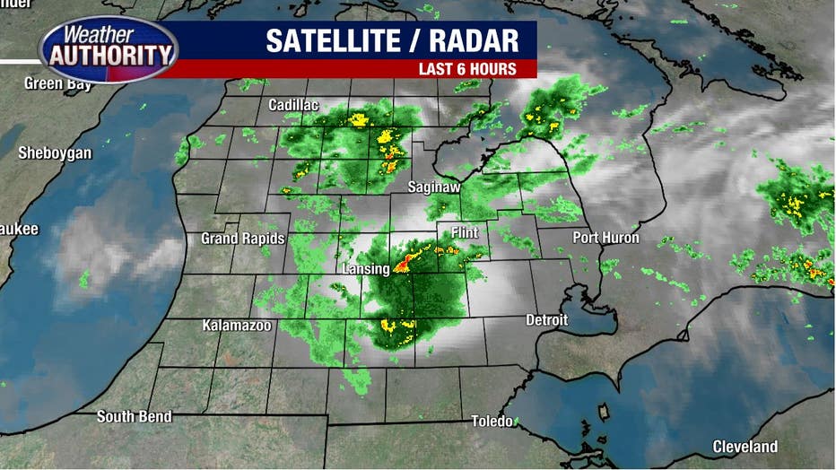
Some pockets of heavy persistent rain are around - especially for Livingston and Washtenaw Counties - while the majority of people will see light drizzly haze through the morning commute. Temperatures begin near 65 degrees.
Through the afternoon, the showers become spotty, but they'll be around as they start and stop through lunchtime. Temperatures climb into the low 70s with a little humidity adding to the mix.
It's strange to feel this level of "sticky-ness" in early October but hey, with the weird year we've had, I've come to expect anything!
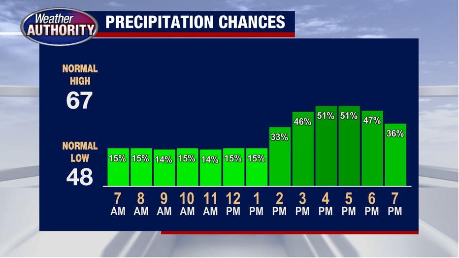
Showers gradually dwindle later tonight as temps fall to about 60. The rest of the week will be warm with highs near 75 degrees.
Rain will leave the forecast as a well-deserved break in the rain enters for Tuesday and Wednesday. It'll return later in the workweek.