

Snowiest part of the day coming later this afternoon, 3-6" total by midnight

Wednesday Winter Weather Advisory; The Snow’s Coming Down!
Some light snow should fall this morning will pick up a bit by afternoon.
(FOX 2) - This winter storm has been a tricky one to nail down, as the "bullseye" has been moving all over the state. However, models are beginning to come to an agreement so let's share the information.
The timeframe for the snowfall lasts more than 24 hours - from around 8 p.m. Tuesday through 10-11 p.m. Wednesday. By midnight tonight expect to see 3-6" area-wide.
All of southeast Michigan is under a Winter Weather Advisory right now all well, through midnight.
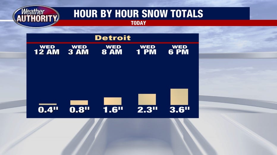
(A timeline for Wednesday when the snow will fall )
The commute into work or school Wedneday will be slower - and expect your commute home to be impacted as well.
Check the traffic before you leave the house 24/7 at fox2detroit.com/traffic.
Hundreds of schools are also closed Wednesday for the snowstorm. Get the school closings today and every day at fox2detroit.com/closings.
The snowiest part of the day is still to come. The snowfall rates pick up by lunchtime and stay heavier through the evening. Evening rush hour will be slower still, with nearly 4" on the ground at this point.
The entire system will end around 11 p.m. Wednesday and most of us will fall in the 3-6" range.
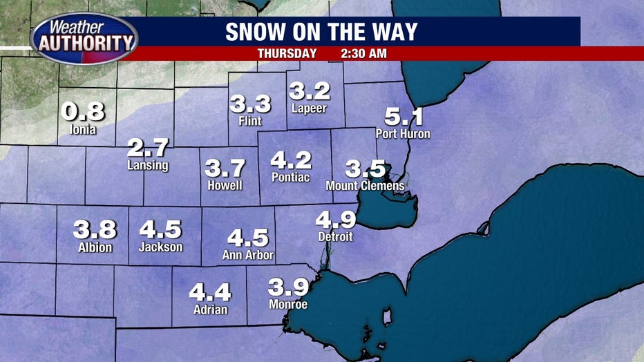
(Projected snow totals for metro Detroit as of Tuesday afternoon)
Thursday will be colder and windier with blowing snow. A true return to winter!
Keep an eye on the forecast and the weather radar with your FOX 2 Weather App.
FOX 2 News is live every morning between 4 a.m. and noon, then again between 5 p.m. and 7 p.m., the 10 p.m. News and the Edge at 11, all at fox2detroit.com/live to get the latest on the storm's path.