

Southeast Michigan under heat advisory as potential for severe weather rises this afternoon

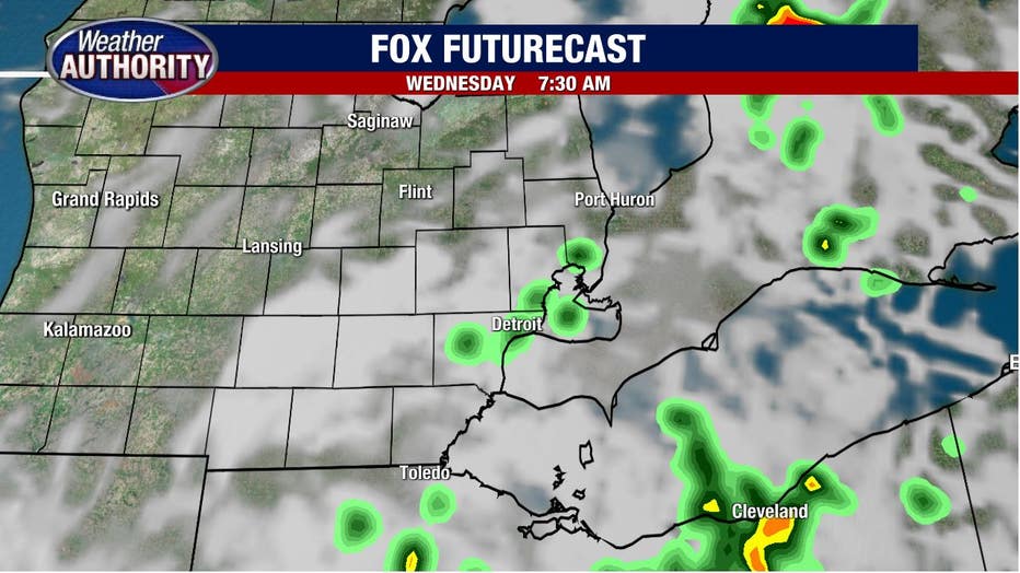
Some wet weather is coming down across Southeast Michigan, but the rain showers won't be around too long this morning.
They should come to a close during the morning commute, leading to drier weather later this morning. Here's a snapshot of the 7 a.m. picture.
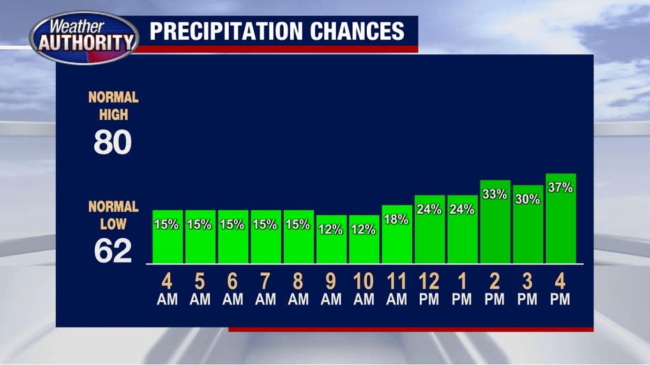
The clouds will clear and temperatures will rise, leading to the opportunity for afternoon storms. Coverage doesn't look to be all that great, so we may wind up with a good chunk of the afternoon on the dry side.
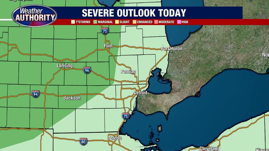
While we're not anticipating widespread severe weather (60 mph wind gusts), any storms that manage to develop may contain 45-55 mph winds which could lead to additional power outages.
Download the FOX 2 Detroit app for iPhone and Android.
Here is the severe outlook produced by Storm Prediction Center which actually keeps most of Southeast Michigan outside of the severe risk, but this may shift a bit as storms develop and evolve upstream.
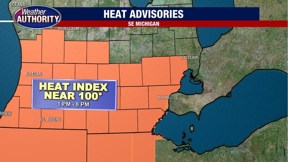
The heat will continue as well. A heat advisory is in effect for most of Southeast Michigan.
The opportunity for more storms will exist daily through the rest of the week and into the weekend. With that said, there will likely be plenty of dry time around the storms.
Cooler weather is still set to arrive early next week with high temps fading in the mid/low 80's. The question is how long will the cooldown stick around as some models build the heat back in before long.