

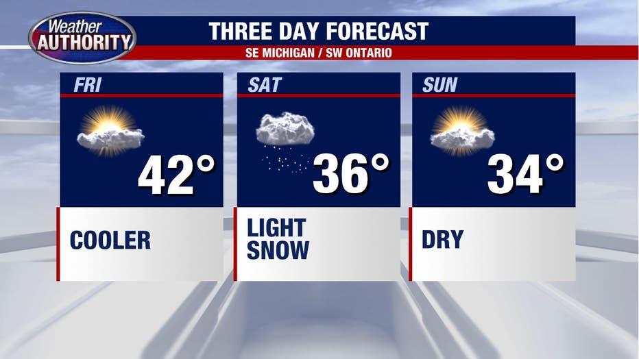
Temperatures tumble Friday before 1-2 inches of snow fall Saturday

Goodbye wind, hello snow!
Yep, that's right. Snow is in the weekend forecast as cold air has moved in thanks to the passage of a strong cold front yesterday.
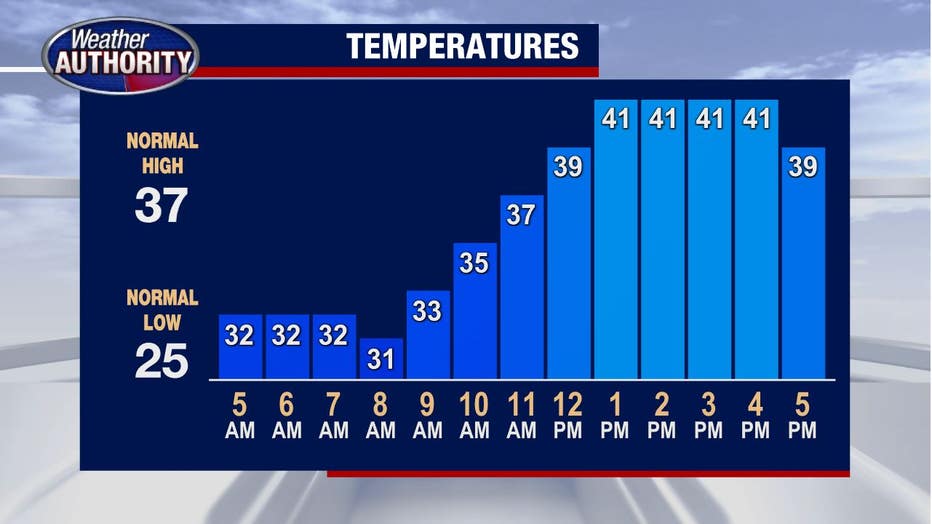
After peaking in the low 60s Thursday we are beginning Friday in the low 30s and won't get much higher than 40 later today.
Skies will be sunny for most of the day, while clouds will push up from the south by tonight.
A wintry mix will start to enter southern Michigan by Midnight, into Lenawee and Monroe Counties. Eventually the moisture will encounter enough cold air that by 6 a.m. it will switch over into snowflakes.
Snow will then travel north and stick around until about 2 p.m. for many Southeast Michigan spots.
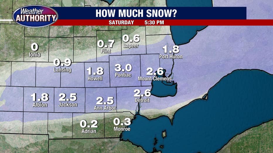
Snow totals for Saturday will be in the 1-2 inch range, however it will not stick entirely to all surfaces.
While you should plan on most of it sticking to the grassy and mulchy areas, some will end up sticking to the roads and sidewalks too.
It will be slippery and cold by Saturday afternoon thanks to the winter precipitation.
Sunday will be dry and chilly with a high near 34.