

Between 2 and 4 inches of snow coming to SE Michigan Wednesday into Thursday

SOUTHFIELD, Mich. (FOX 2) - Sunday and Monday we had temps in the 50s - not bad for February in Michigan. But let's remember we're in the middle of winter and, in 48 hours, we'll be reminded of that with several inches of snow as the third big snowmaker this season heads our way.
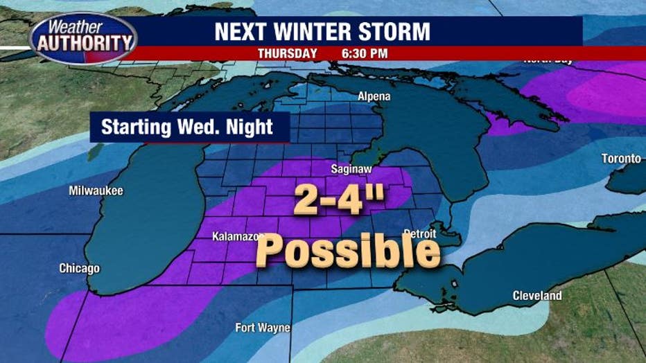
- When: Wednesday night - Thursday
- What: Some freezing rain, accumulating snow
- How Much: 2-4" (as of Monday)
To get the latest forecast between now and Wednesday, watch FOX 2 News Live every morning between 4 a.m. and noon, then again between 5 p.m. and 7 p.m., the 10 p.m. News and the Edge at 11, all at fox2detroit.com/live.
Here's how all that's going to play out.
Beginning Wednesday night we will see a system to our south gain strength and move our way. While there is still some uncertainty to the forecast (more than normal, in fact) it looks likely enough that we are calling for 2 to 4 inches of snow to fall late Wednesday into Thursday afternoon.
Keep an eye on the radar and stay up-to-date with the latest forecast with the FOX 2 Weather app.
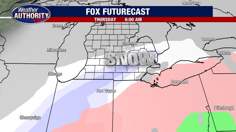
Thanks to a "kink" in the jet stream, much colder air will be present at every layer of the atmosphere. With cold air present, and moisture moving in... it doesn't take a certified meteorologist to tell you that these things combine to create snow (although, hey, that's what I'm here for).
This will of course time out with the morning commute and possibly affect school scheduling for Thursday.
To track the latest closings today and every day, check out fox2detroit.com/closings.
The one question mark that remains is how north the system tracks. If it moves farther north, a chunk of the precip may be rain, meaning snowfall totals would be lower. It's possible that could happen, but it's also possible that the system could gain strength and dump more... meaning totals could inch up.
I'll say it simply: Thursday is going to have snow, and yes, you'll have to shovel it.
More details to come.