


Nice end to the weekend
Highs return to the upper 50s Sunday with mostly cloudy skies. Trending even warmer through Tuesday with highs in the 60s and 70s with rain chances increasing! Seasonal and wet second half of te week.
Highs return to the upper 50s Sunday with mostly cloudy skies. Trending even warmer through Tuesday with highs in the 60s and 70s with rain chances increasing! Seasonal and wet second half of te week.
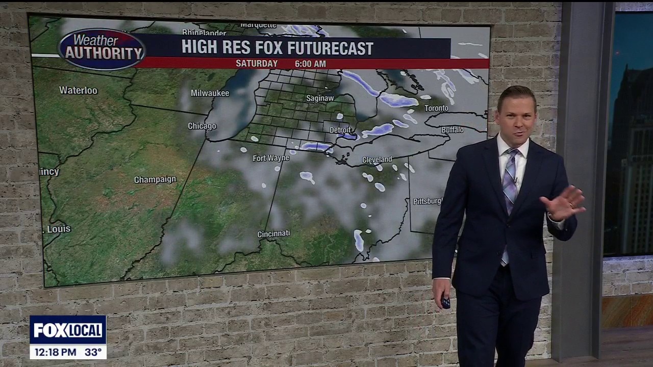
Cool, Cloudy Saturday
Starting with sun on a cold morning, ending with clouds on a chilly day. Meteorologist Lori Pinson has your forecast.
Starting with sun on a cold morning, ending with clouds on a chilly day. Meteorologist Lori Pinson has your forecast.
Colder temps settle in for the end of the work week
The weekend starts to warm up, especially Sunday
The weekend starts to warm up, especially Sunday

Metro Detroit weather: Cold start to the weekend, but warmer temps are on the horizon
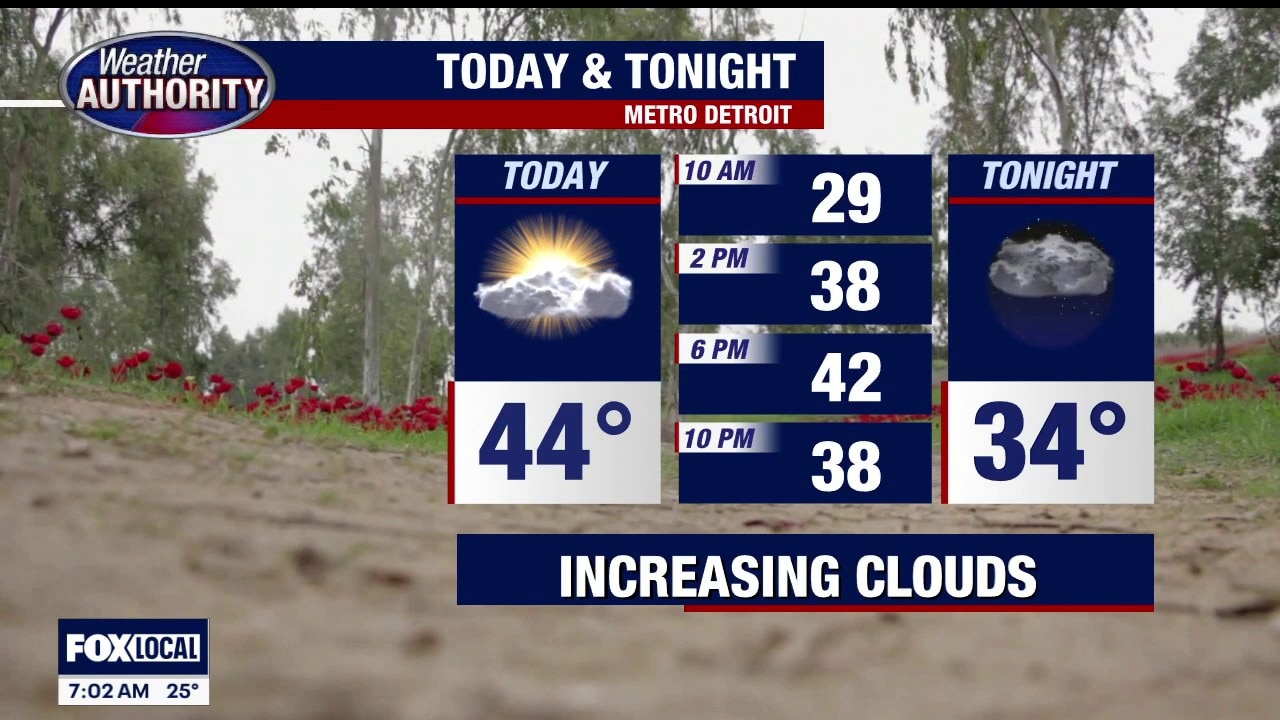
Today is cold from start to finish, but we should at least squeeze out a little sun this afternoon in Metro Detroit.
Today is cold from start to finish, but we should at least squeeze out a little sun this afternoon in Metro Detroit.
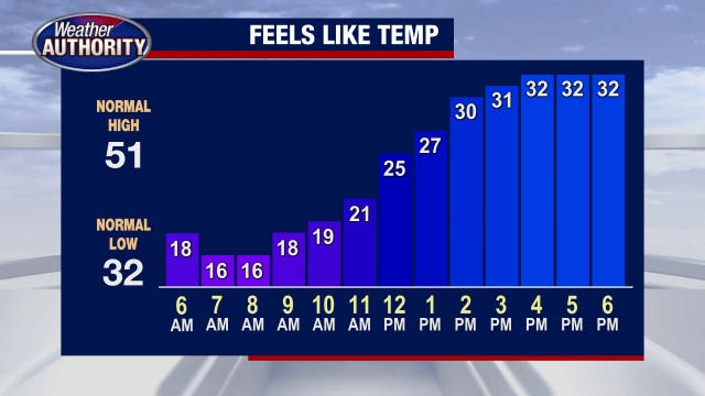
Cold day from start to finish
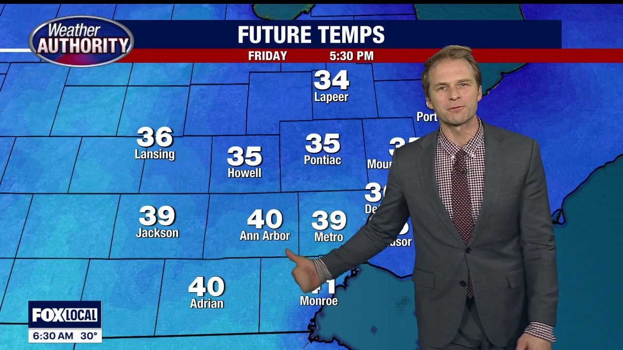
Temps are shifting down Friday in Detroit. Alan Longstreet has your full weekend forecast.
Temps are shifting down Friday in Detroit. Alan Longstreet has your full weekend forecast.
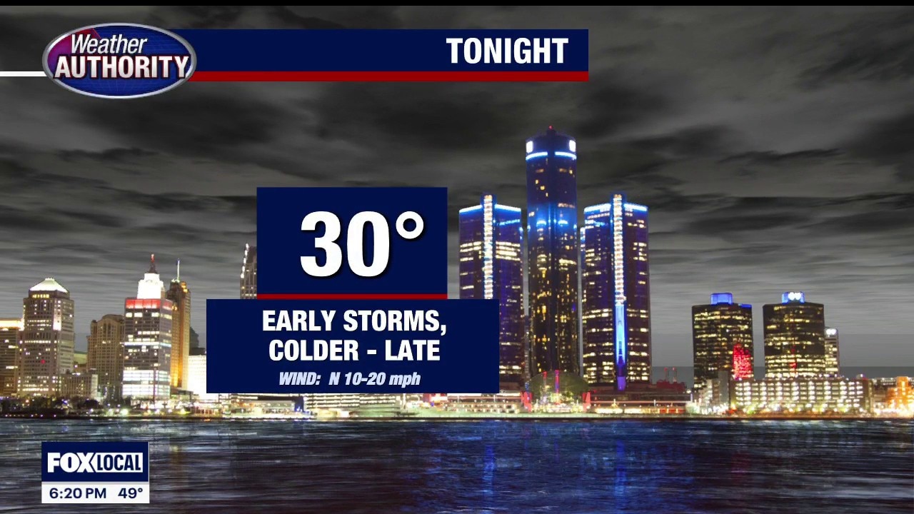
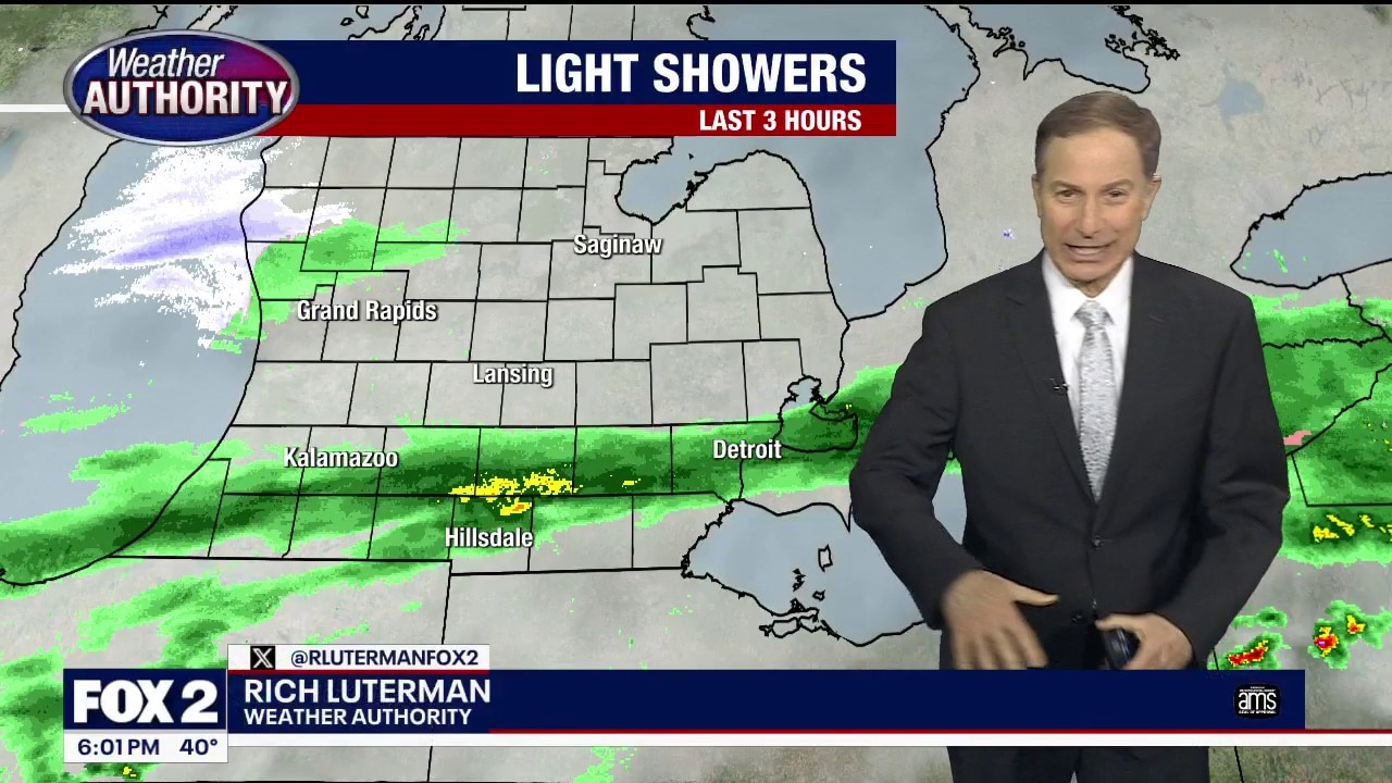
Storm chances tonight, colder temps for Friday
Rich Luterman has the forecast.
Rich Luterman has the forecast.


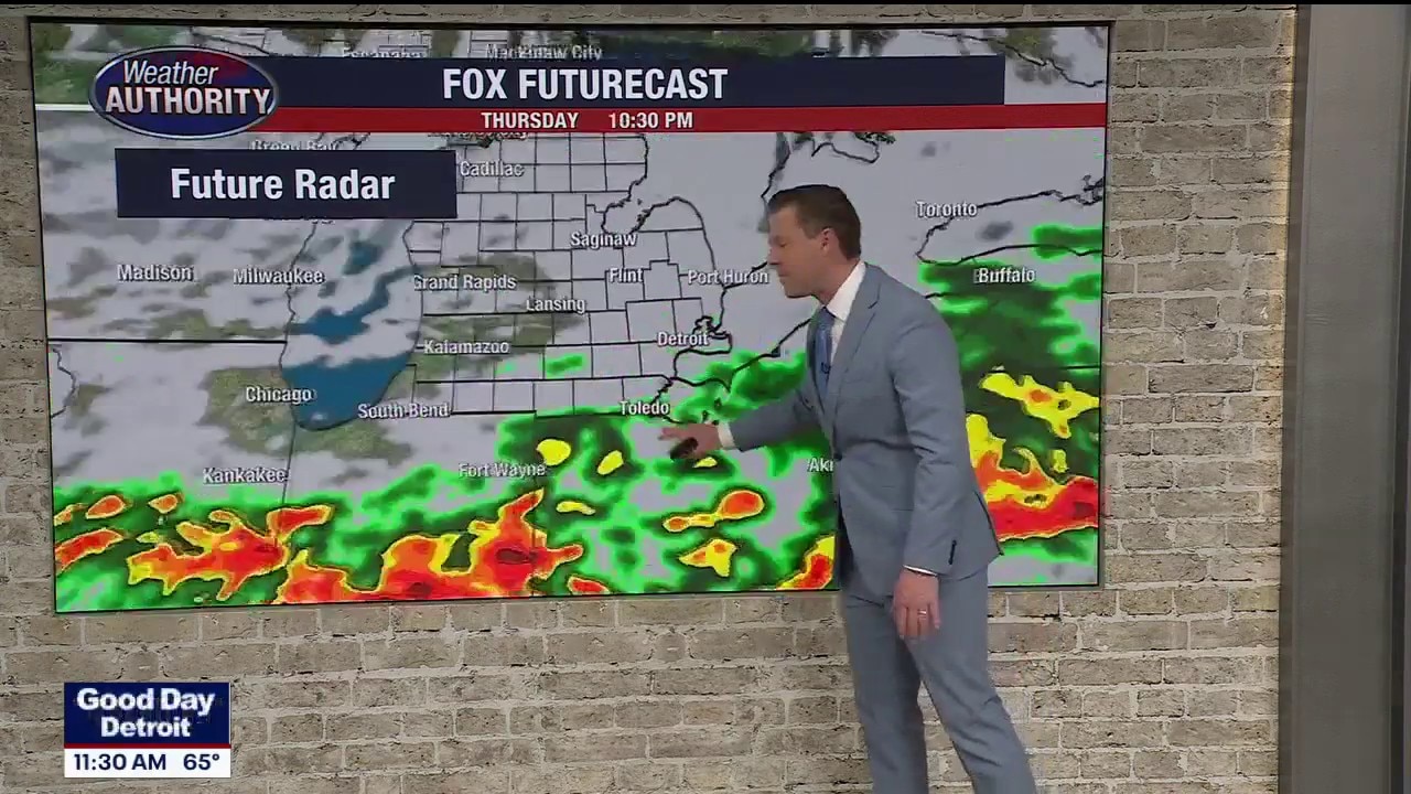
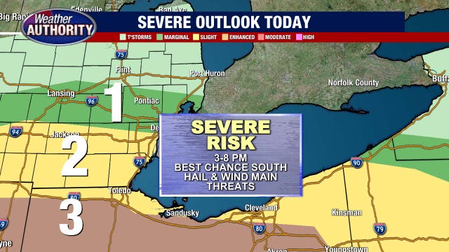
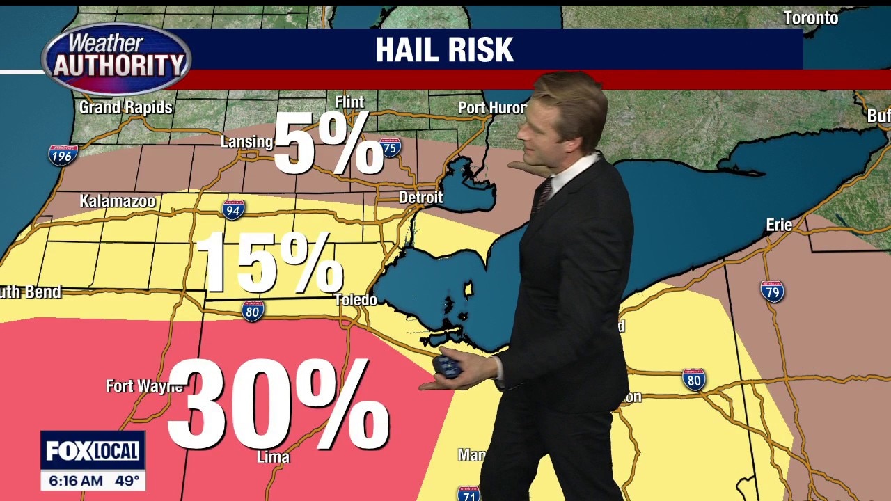
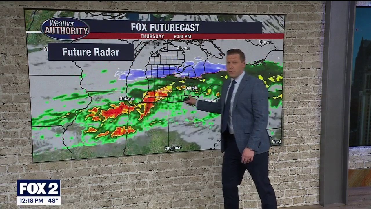
Southeast Michigan severe weather: Strong winds, hail, isolated tornado risks Thursday
Despite some rain earlier in the day, which can sometimes take the edge off severe weather potential later, severe weather risks still remain for later Thursday in Southeast Michigan.
Despite some rain earlier in the day, which can sometimes take the edge off severe weather potential later, severe weather risks still remain for later Thursday in Southeast Michigan.
Storms building today in Southern Michigan
Some severe weather is possible: Dangerous winds, hail and isolated tornadoes
Some severe weather is possible: Dangerous winds, hail and isolated tornadoes

Southeast Michigan storms: Severe weather possible later Thursday
Severe thunderstorms are possible Thursday in Southeast Michigan. Damaging wind and hail are the primary threats, but not everyone has the same chance of getting severe weather.
Severe thunderstorms are possible Thursday in Southeast Michigan. Damaging wind and hail are the primary threats, but not everyone has the same chance of getting severe weather.
Severe weather possible Thursday in Southeast Michigan
Wet weather Thursday in Michigan brings the chance for severe storms in Metro Detroit. Alan Longstreet breaks down the likelihood of strong storms.
Wet weather Thursday in Michigan brings the chance for severe storms in Metro Detroit. Alan Longstreet breaks down the likelihood of strong storms.
A warmer Wednesday as we watch more active Thursday weather
Gusty winds, hail and an isolated tornado are possible Thursday
Gusty winds, hail and an isolated tornado are possible Thursday


Metro Detroit weather: Mild day ahead after a chilly start
It’s a chilly start for Metro Detroit, but temps climb into the 50s by afternoon.
It’s a chilly start for Metro Detroit, but temps climb into the 50s by afternoon.
Chilly start but temps are headed up to 50s
A milder day is ahead as temps move up in Metro Detroit.
A milder day is ahead as temps move up in Metro Detroit.
Trending milder!
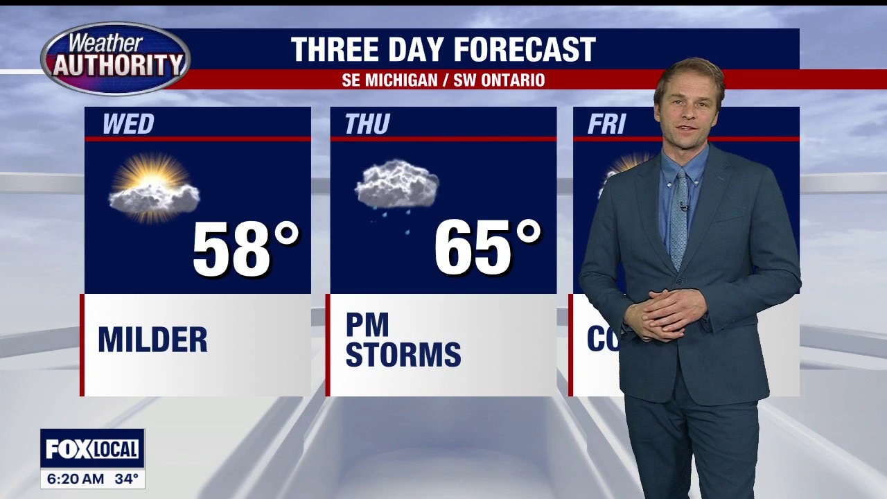
Nice next day and a half with waming temperatures! Highs will reach the mid 50s Wednesday then mid 60s Thursday with a chance of storms returning Thursday evening! We then see temperatures take a dive Friday with most spots in the lower 40s!
Nice next day and a half with waming temperatures! Highs will reach the mid 50s Wednesday then mid 60s Thursday with a chance of storms returning Thursday evening! We then see temperatures take a dive Friday with most spots in the lower 40s!


Metro Detroit weather: Chilly start to Tuesday with a milder finish ahead
The day starts cold but will finish slightly milder, with temps headed up in Metro Detroit.
The day starts cold but will finish slightly milder, with temps headed up in Metro Detroit.
Cold Start, Milder Finish
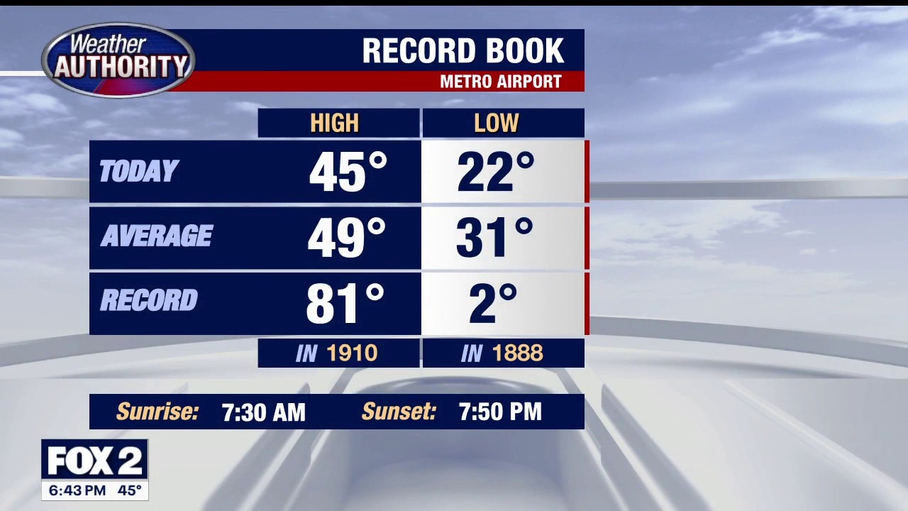
A colder start to your day when compared to yesterday, but temperatures should exceed yesterday's high reading of 39 degrees. Milder Wednesday and Thursday. Meteorologist Lori Pinson has your forecast.
A colder start to your day when compared to yesterday, but temperatures should exceed yesterday's high reading of 39 degrees. Milder Wednesday and Thursday. Meteorologist Lori Pinson has your forecast.
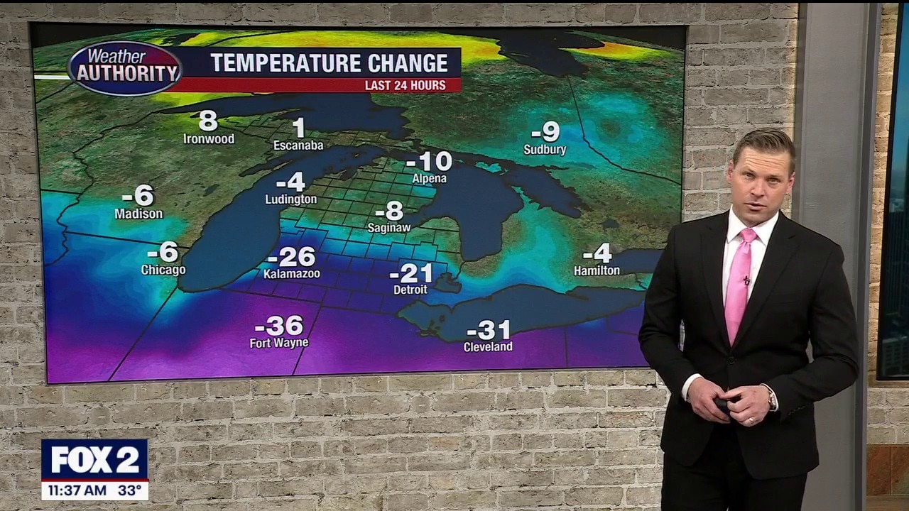
A colder day continues today
Some light snow will move in as well
Some light snow will move in as well


Metro Detroit weather: Noticeably colder start to the week with light snow flurries possible
Monday starts with temperatures about 10 degrees below average in Metro Detroit, but temps head back up after today.
Monday starts with temperatures about 10 degrees below average in Metro Detroit, but temps head back up after today.
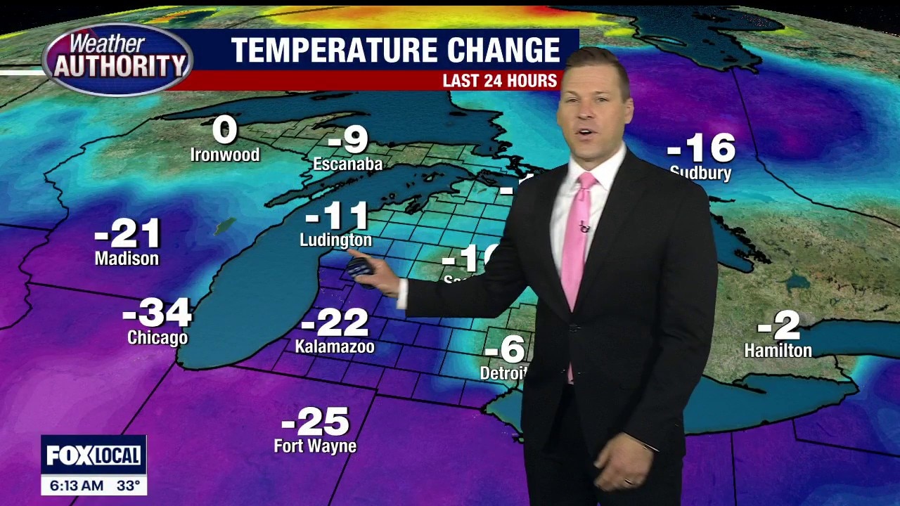
A colder start to the new work week
Some light snow flakes are also possible but no accumulation
Some light snow flakes are also possible but no accumulation
Chilly week ahead with rain expected later in the week
Our weather will be quiet Monday – Tuesday – Wednesday. Our next good chance for some showers comes Thursday with cooler air to follow once again. Rest of Sunday evening / night… Mostly cloudy…. scattered evening showers…. breezy and cooler overnight….. low near 30 Monday: Decreasing clouds… some breaks of afternoon sun…. breezy and cool….. high 42 Tuesday: Mostly cloudy…. high 49 Wednesday: Mostly cloudy… not as cool…. High 56 Thursday: Cloudy and milder with some rain showers…. high 64 Friday: Mostly cloudy… cooler…. high 42 Saturday: Sun and clouds… high 48 Sunday: Partly sunny…. high 54
Our weather will be quiet Monday – Tuesday – Wednesday. Our next good chance for some showers comes Thursday with cooler air to follow once again. Rest of Sunday evening / night… Mostly cloudy…. scattered evening showers…. breezy and cooler overnight….. low near 30 Monday: Decreasing clouds… some breaks of afternoon sun…. breezy and cool….. high 42 Tuesday: Mostly cloudy…. high 49 Wednesday: Mostly cloudy… not as cool…. High 56 Thursday: Cloudy and milder with some rain showers…. high 64 Friday: Mostly cloudy… cooler…. high 42 Saturday: Sun and clouds… high 48 Sunday: Partly sunny…. high 54