Metro Detroit weather: Potential for severe storms Monday; record-setting heat coming this week

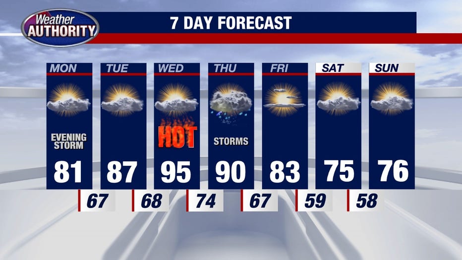
High heat, but first severe storms are possible!
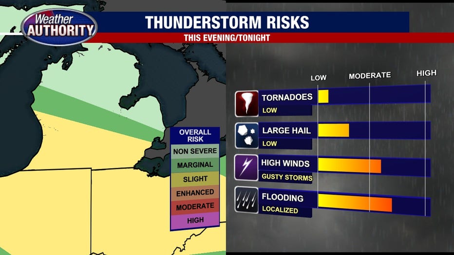
Strong winds and flooding rains are the greatest threats this evening and tonight.
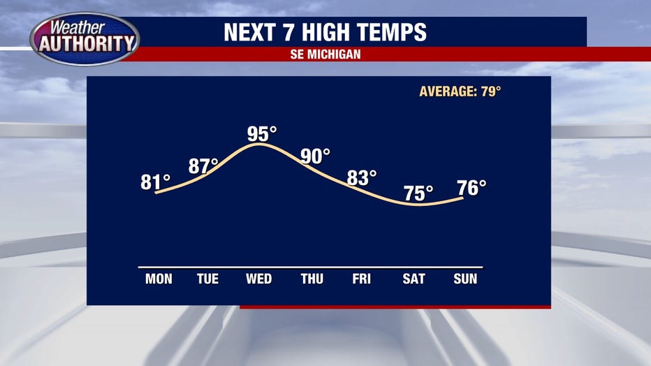
DETROIT (FOX 2) - The heat is coming! Near record or record heat sets on Wednesday.
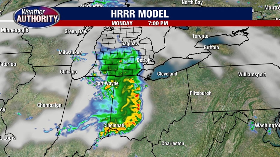
The warm front that opens the door to the hot stuff lies to our south today and creeps north. Storms will develop upstream and race along the boundary into SE Michigan this evening and tonight. Check out one of our high resolution models at 7 pm.
Notice the strongest line of the storms will be favored to our south, however that is just one potential scenario of many, and the opportunity for severe storms does exist in SE Michigan. A slight risk covers the heart of SE Michigan tapering to a marginal risk in our northern areas. Slight = scattered severe storms possible, marginal = isolated severe storms possible.
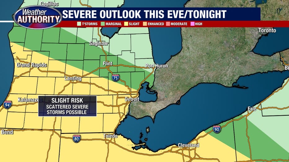
So two rounds of storms are possible. One this evening and another overnight. Strong winds and flooding rains are our greatest threat, with hail and tornado prospects coming in much lower.
Then we turn hotter Tuesday and by Wednesday our Heat Index (the combined effect of the heat and humidity) cranks up over 100°. This will be the hottest we've felt this season by far. It will be short-lived with the cold front and storms Thursday followed by a cooler weekend.