Monday will near 80 degrees with chances of rain this afternoon. But a major shift in weather is on the way

Monday morning forecast: big changes are coming!
Much cooler weather and flooding concerns return midweek
A major shift is on the way for Southeast Michigan, with significantly cooler and wetter weather on the way.
High temperatures today will still make it near 80 with a dry start to the day and increasing rain chances for the afternoon, although I would say most of the day will remain dry and the rain that we see won't amount to a whole lot.
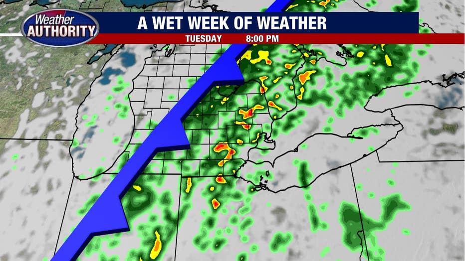
Check out a glimpse of the hit-and-miss showers this afternoon.

Much of the night looks to remain dry with at least the chance for a shower existing tomorrow morning, but the main event doesn't kick off until late Tuesday.
A cold front will approach and bring with it a solid line of rain and storms.
Low pressure will develop to our south and ride north along the front which will lead to rain that will continue through Tuesday night and Wednesday. Occasional showers will stick around Thursday.
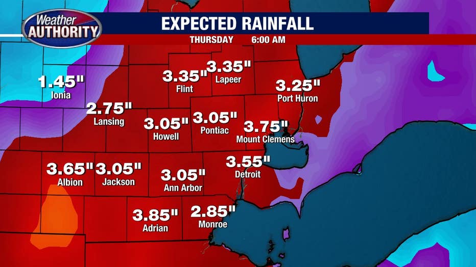
Rain totals will likely be sufficient to warrant a flood watch or flash flood watch later this week with the concern centered on Tuesday night through Wednesday.
Look at rain totals from late Tuesday through Thursday morning, models are spitting out three inches or more and this will be areawide as opposed to in a few different spots.
Needless to say, flooding will be a concern.
Temperatures will come crashing down midweek as well, by Wednesday and Thursday we'll have a difficult time hitting 60 degrees.
Looking toward next weekend, calmer weather will return.