Near-record warmth in Southeast Michigan on the way this week

Monday sun with near record warmth by midweek
40's with sun today, 50's & 60 w/clouds later this week.
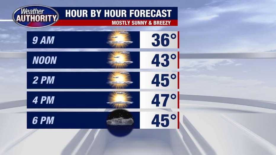
A week of near record warmth is on the way! And while today we're not breaking any records, we'll take the sun as we inch closer to Christmas.
Tuesday temperatures are steady but then we soar.
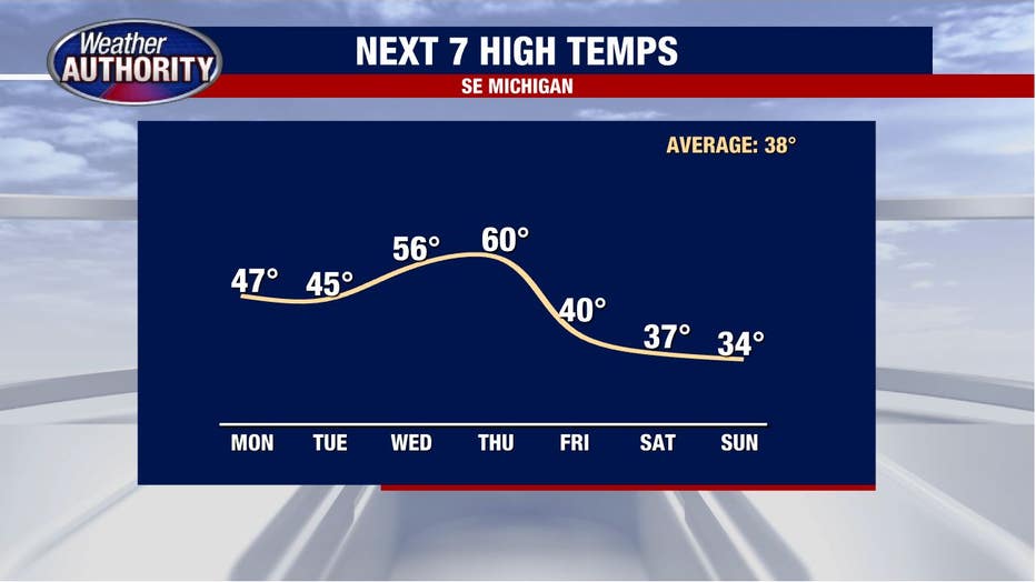
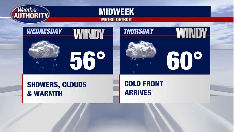
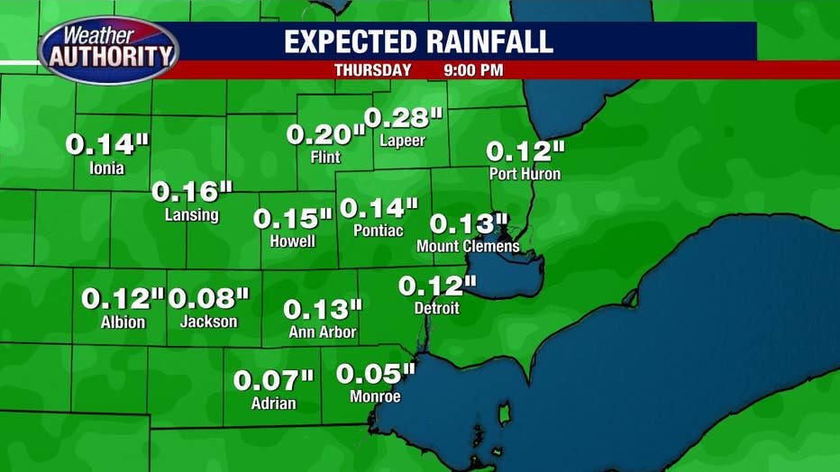
Record highs Wednesday and Thursday are 61 degrees and 65 degrees respectively, so we're close, but not quite there the way things look at the moment. The clouds will be around with a wind that you'll notice (but not as strong as Saturday's high wind warning) while rain showers are expected both days as well.
Rain totals look to be quite limited.
It's back to reality Friday and the weekend with high temperatures failing to make it out of the 30s.
No big snow makers are apparent, but at least a chance for snow showers exists on Saturday.