Storms to arrive in Michigan Thursday evening, will bring torrential rain and winds of 50 mph

SOUTHFIELD, Mich. (FOX 2) - Michigan has been warm and muggy all week long and especially so on Thursday. While it's been dry and pretty quiet here in southeast Michigan, that's going to change quickly Thursday afternoon.
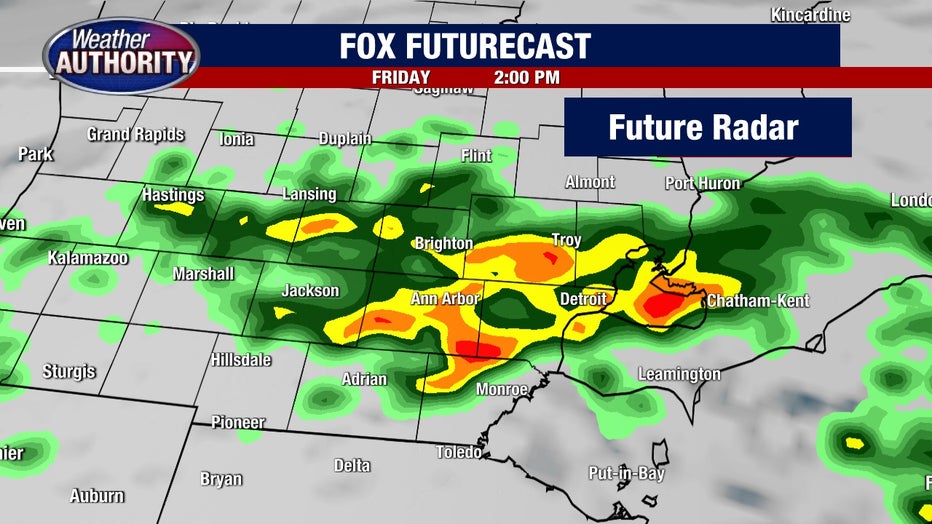
I've been studying Skytracker Radar all morning until now and it looks fairly unimpressive...that is until around 1:30 p.m. when I started noticing building clouds and storms in Northern Indiana. Those storms will likely travel northeast over the next 2-3 hours and arrive in parts of Michigan by the commute home.
Hopefully, you have the FOX 2 Weather Authority App. It's 100% free and will alert you off possible severe weather. Current conditions, interactive radar map, and daily/hourly forecasts are just a click away. The radar is fully integrated with GPS functionality, meaning you can personalize and track weather all over the world. Just set what weather conditions you want to see on the radar and you're done!
The FOX 2 Weather app is available for free to all iPhone, iPad and Android users.
What is the timeline of these storms?
These are the storms that we've always been concerned about for Thursday; the ones that could pack a punch with winds nearly 50 mph and torrential rain, on top of an already totally saturated ground (which would mean some flooding in spots).
Thankfully, rivers and creeks have had a chance to drop in height and are not in flood stages. Hopefully, they stay that way.
Want breaking news straight to your phone? Curious about events happening this weekend? Download the FOX 2 News app and the FOX 2 Weather app for iOS and Android today
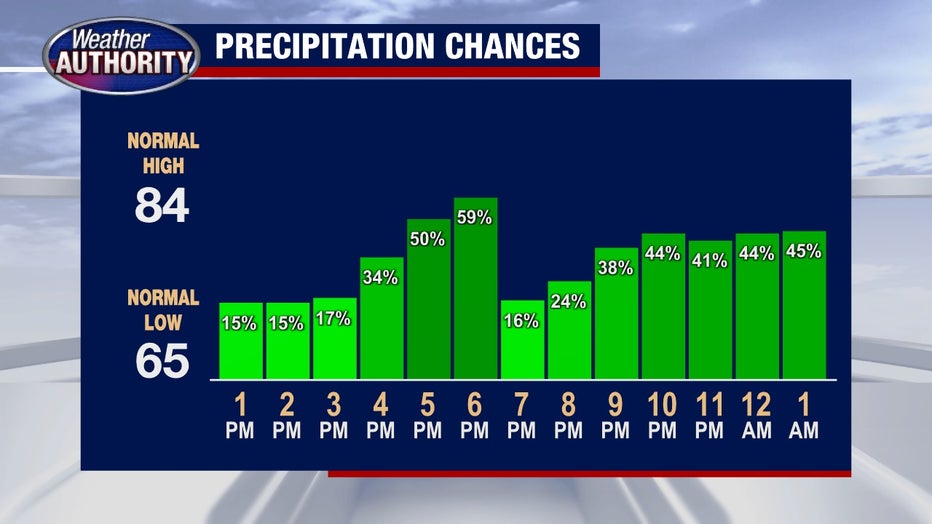
New model data is coming in every few hours or so and they continue to tell a wet/rainy story from Thursday through Saturday morning. The question remains WHERE exactly the heaviest rain will set up, and while we don't yet have the bullseye pinpointed we know for sure we'll get storms until Saturday lunchtime.
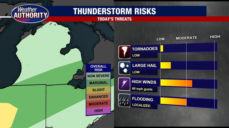
What are the severe weather threats?
When these storms push into the area over the next few days, the largest threat will be high winds - which is in the moderate to high range, in terms of risk. We could see winds of 50 or even 60 mph so be sure anything that could be blown over is anchored down.
You should also look out for localized flooding, which we touched on earlier, which is a moderate chance of happening.
Hail is possible but it's a low risk and tornadoes are the lowest of all.
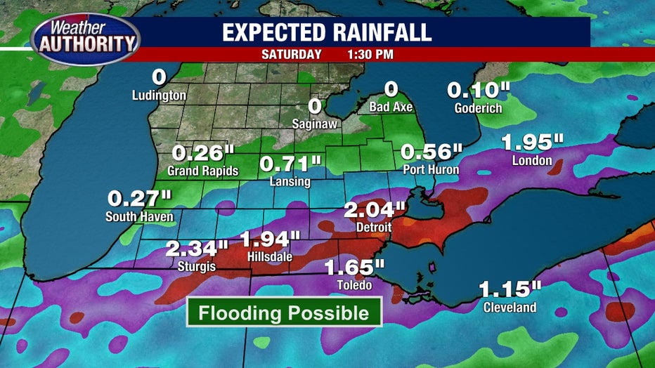
How much rain will we get?
A trusted FOX Futurecast model has some very heavy downpours on Friday afternoon right over Metro Detroit. If that lines up - and there is plenty of evidence that it might - Rainfall Totals from Thursday - Saturday would be in the 1-3 inch range.
This continues to be a situation to monitor closely over the next 48 hours. The two biggest threats remain gusty winds as storms develop and the likelihood of flooding as the rain gets stronger Friday.