Storms to finish the week with 90 degree temperatures ahead for the weekend

Friday forecast: storms to finish the week with a hot weekend ahead
Cooler weather's coming next week.
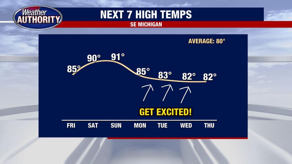
Hot weather wins out through the weekend just as it has all week, but Friday's temperatures do move down just a touch.
We'll be topping out in the mid-80s compared to 91 yesterday. We'll be back up to 90 again both Saturday and Sunday, so I'll take solace in that very small silver lining.
Humidity levels will still be sky high and storms will be a bit more prevalent today compared to yesterday.
Any scattered storms that develop will have the greatest chance of arriving by afternoon.
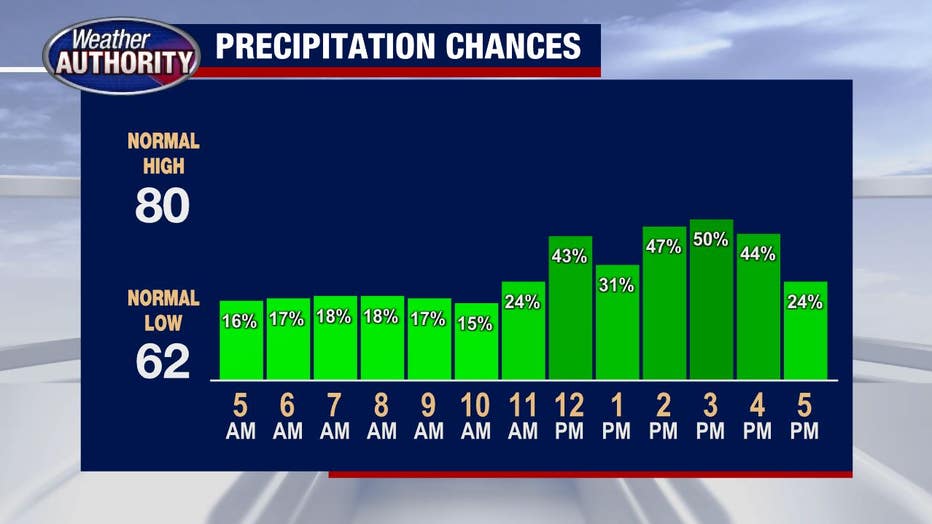
Severe weather is not anticipated but an isolated stronger wind gust will be possible. Any storms will be slow-moving and contain heavy rain, thus an isolated flooding threat can't be ruled out.
Tonight's weather will be warm, muggy, and mainly dry.
Both Saturday and Sunday will feature the chance for storms. Here's Saturday:
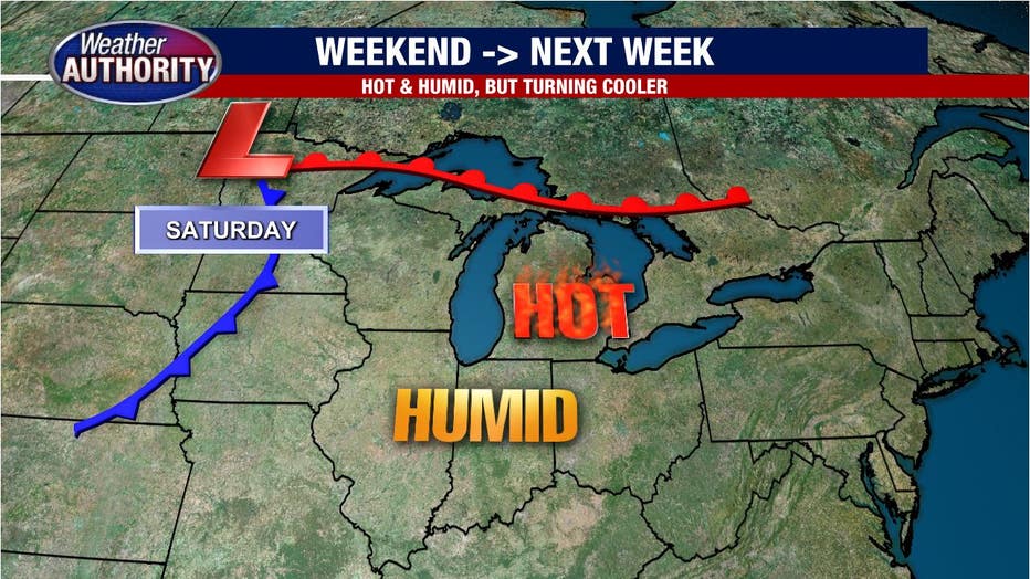
Notice the warm front to our north and the approaching cold front well to the west, leaving us squarely in the warm sector.
So it will be hot and humid and most of the day, it will also be dry. There's a chance for a late-day storm which will likely be isolated or widely scattered if they do in fact form.
Download the FOX 2 Detroit app for iPhone and Android.
A better bet for storms is late Saturday or Sunday night as the cold front arrives and brings a completely different feel next week.