Strong winds, a flood watch, and 4-8 inches of snow; here's the weather on the way for Southeast Michigan

Metro Detroit weather: Wednesday temps could reach 50
Rich Luterman has the full Metro Detroit forecast.
Much to discuss! We'll start here.

The strong wind may lead to localized power outages, and it will also draw in much warmer air.
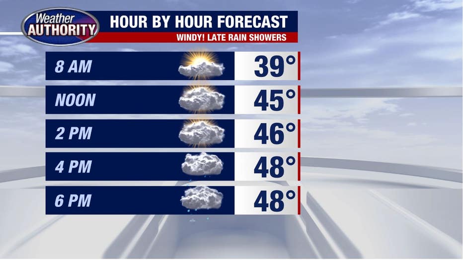
A few rain showers will be around late afternoon/evening and by tonight rain will be widespread and continue into tomorrow morning.
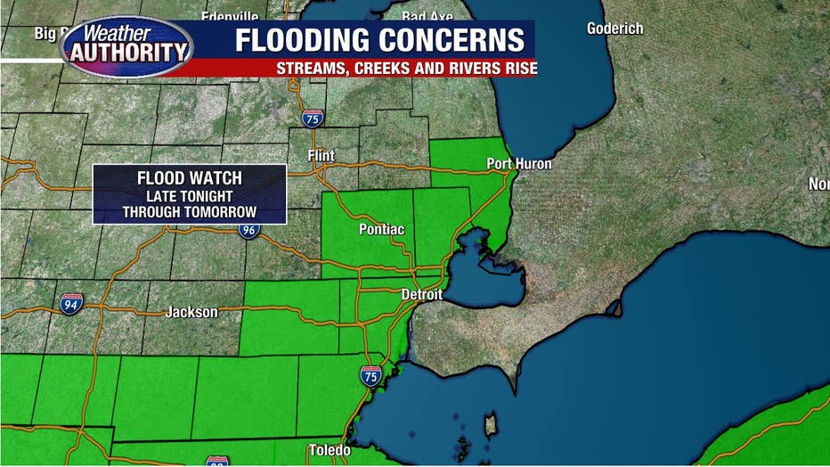
Combine an inch or more of rain with melting snow and a frozen ground which won't soak all the rain in, and you'll get a flood watch.
MORE: What to have on hand if the power goes out during a winter storm
Rises on streams, creeks and rivers are likely.
Want to get the latest news and weather updates from your phone instantly? Download the FOX 2 app today on Android and iPhone today. You can also sign up for our FOX 2 newsletters to have breaking news delivered to your email. Sign up here to have them sent to you.
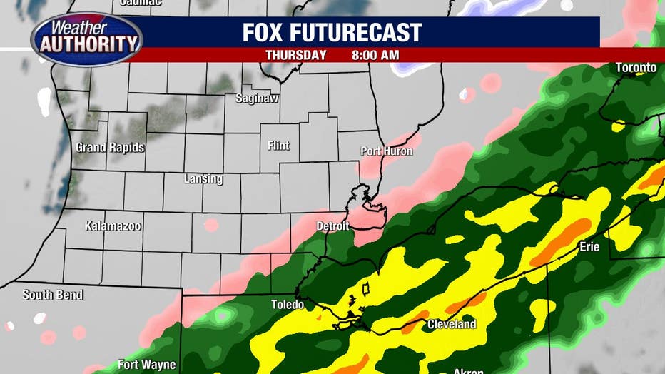
The rain will change to sleet or freezing rain Thursday morning, but the freezing rain and sleet don't look like too much (but some!) and we might even see a lull in the precipitation over a good chunk of the region.
Check out FOX Futurecast tomorrow morning.
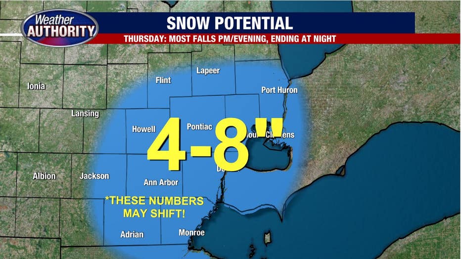
Snow will surge back in during the afternoon with the bulk of the snow falling in the evening and ending overnight.
The picture is becoming clearer, but there is still a range of possible outcomes with regard to snow totals. I will say 4-8 inches, but a nudge upward isn't totally out of the question.