

Temperatures dip Tuesday with Southeast Michigan highs in the low 70s
Bright and comfortable day
Great Tuesday with showers moving out! Falling humidity and more sunshine this afternoon with highs in the lower 70s.
(FOX 2) - Monday provided a taste of our incoming summer and now temperatures will pull back marginally as we say goodbye to rain - at least until Friday.
Ponding, reduced visibility, and even some minor flooding were some of the impacts of showers that fell overnight into Tuesday. About half an inch was reported at Coleman A Young Airport, where the National Weather Service tracks water levels.
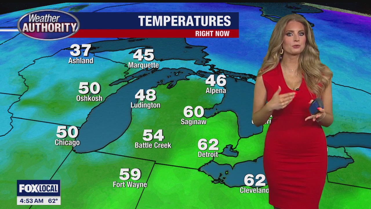
Tuesday will be a bit cooler with the low 70s expected by mid-afternoon on April 30. Clouds are expected to decrease over the day, allowing more sun to poke through. The falling humidity will give way to a beautiful afternoon.
Detroit, Ann Arbor, and Pontiac can all expect 70-72 degrees, while areas in greater Southeast Michigan will land in the high 60s. Temperatures will rebound back into the high 70s Wednesday.
"A low pressure system tracks across western Great Lakes offering a locally warmer air mass. High pressure builds in by Wednesday evening ensuring dry conditions until the next low approaches late Thursday and into Friday," NWS wrote on social media Tuesday.
There are also some wind gusts reaching as strong as 30 mph expected on Wednesday.
The next chance for showers and storms is Thursday evening.