

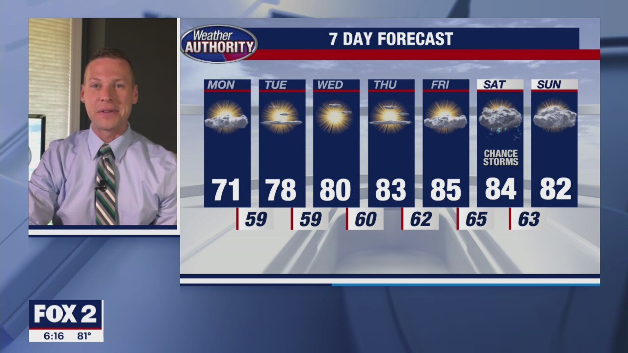
Dry, quiet and nice stretch ahead
Temperatures return to the low 80s and the humidity is gone.
Temperatures return to the low 80s and the humidity is gone.
Sunday Showers and Storms
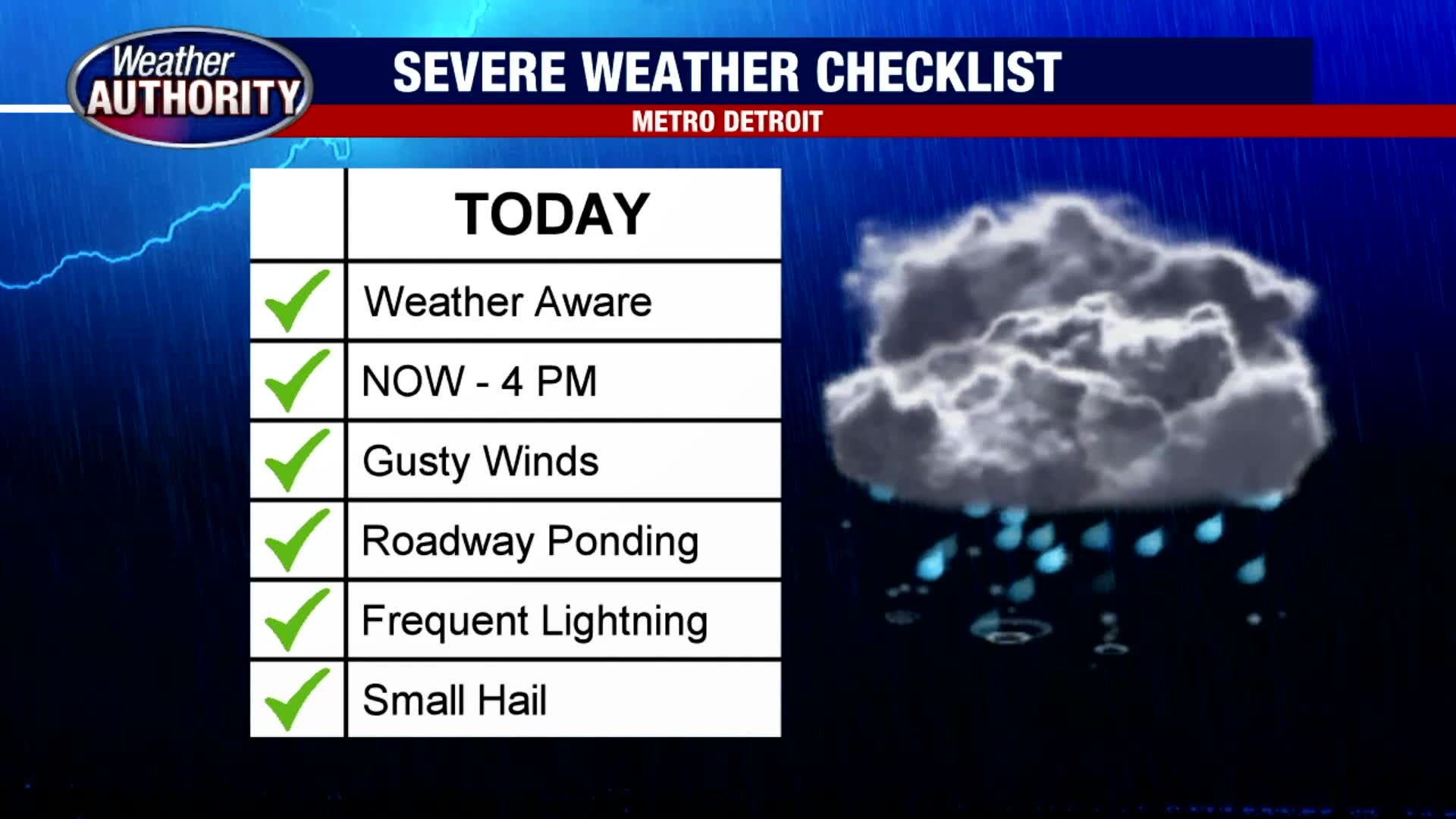
Scattered rain and thunderstorms are expected on Sunday. Heavy rain, frequent lightning, gusty winds and localized flooding is possible in the strongest of the storms. Have your umbrella ready to go if you plan on being out and about. Most of the storms should pass by this evening with skies becoming partly cloudy late. Highs should top out in the low 80s. Cooler air is on the way by midweek.
Scattered rain and thunderstorms are expected on Sunday. Heavy rain, frequent lightning, gusty winds and localized flooding is possible in the strongest of the storms. Have your umbrella ready to go if you plan on being out and about. Most of the storms should pass by this evening with skies becoming partly cloudy late. Highs should top out in the low 80s. Cooler air is on the way by midweek.

Storms For Sunday
Meteorologist Lori Pinson has your forecast
Meteorologist Lori Pinson has your forecast

Stray Storms Saturday
Hang on to an umbrella just to be on the safe side today. A few morning showers may lead to a few after storms as highs jump into the upper 80s. A cold front moving through may trigger additional showers and storms Sunday morning with cooler air behind the front. Highs on Sunday are forecast in the low 80s. 70s are back by next week.
Hang on to an umbrella just to be on the safe side today. A few morning showers may lead to a few after storms as highs jump into the upper 80s. A cold front moving through may trigger additional showers and storms Sunday morning with cooler air behind the front. Highs on Sunday are forecast in the low 80s. 70s are back by next week.
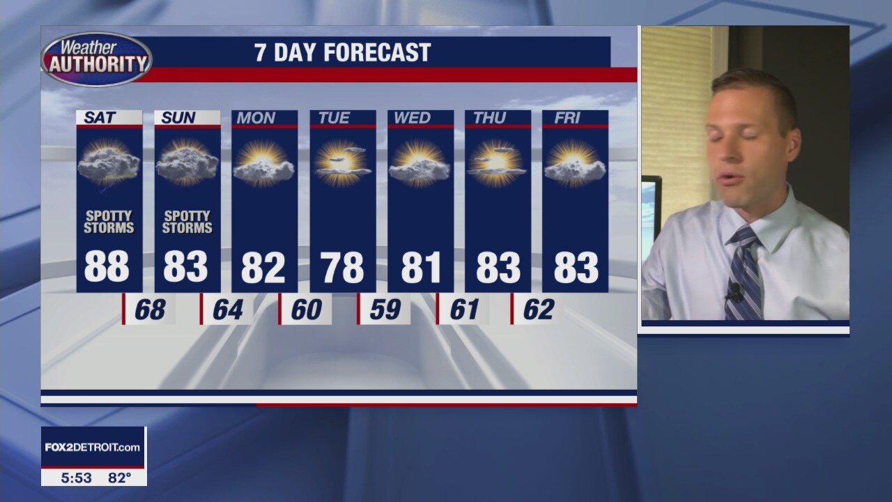
More spotty storms this weekend
After some action on Friday afternoon and evening we are likely to see more this weekend
After some action on Friday afternoon and evening we are likely to see more this weekend

Warm and Muggy Friday
The warm and more muggy air is back with us today as temperatures soar into the mid and upper 80s this afternoon. Given the additional humidity today along with a surface trough moving in from the southeast, a spotty shower is possible this afternoon. With the approach of a cold front on Saturday, better chances exist for rain and a few rumbles late Saturday and especially on Sunday.
The warm and more muggy air is back with us today as temperatures soar into the mid and upper 80s this afternoon. Given the additional humidity today along with a surface trough moving in from the southeast, a spotty shower is possible this afternoon. With the approach of a cold front on Saturday, better chances exist for rain and a few rumbles late Saturday and especially on Sunday.

Partly cloudy and warm again on Friday
Rich Luterman has the forecast.
Rich Luterman has the forecast.

Hot couple of days ahead
Then a slight cool down as we move into the weekend
Then a slight cool down as we move into the weekend

Mostly Sunny and Warm Thursday
Enjoy the warmth and sunshine today because the start of fall is only 40 days away. We are warm and dry on your Thursday with highs in the upper 80s nearing 90 degrees. Though we are warm through Saturday, Sunday will feature our best shot for showers and thunderstorms with cooler air moving in next week.
Enjoy the warmth and sunshine today because the start of fall is only 40 days away. We are warm and dry on your Thursday with highs in the upper 80s nearing 90 degrees. Though we are warm through Saturday, Sunday will feature our best shot for showers and thunderstorms with cooler air moving in next week.

The Heat is ON this Week
If you enjoy the heat, you are going to love everything about today and the rest of this week. Expect temperatures to jump into the mid and upper 80s today under partly to mostly sunny skies. We should keep things rain-free today, tonight and through the week. Our next best shot for showers is on Sunday and into early Monday.
If you enjoy the heat, you are going to love everything about today and the rest of this week. Expect temperatures to jump into the mid and upper 80s today under partly to mostly sunny skies. We should keep things rain-free today, tonight and through the week. Our next best shot for showers is on Sunday and into early Monday.

A cool start, warm finish to your Wednesday. Weekend rain chances return.
We're dry through the week and we'll likely stay that way through Saturday.
We're dry through the week and we'll likely stay that way through Saturday.

A hot week continues
But humidity levels remain lower
But humidity levels remain lower

Temps take a step back as our rain free week marches on.
High will only reach the mid/low 80's today.
High will only reach the mid/low 80's today.

Big storms fizzle out before reaching southeastern Michigan, humidity breaks soon
A big stretch of storms that hit the Chicago and Milwaukee areas, with wind gusts of up to 100 mph, fizzled out before reaching metro Detroit.
A big stretch of storms that hit the Chicago and Milwaukee areas, with wind gusts of up to 100 mph, fizzled out before reaching metro Detroit.
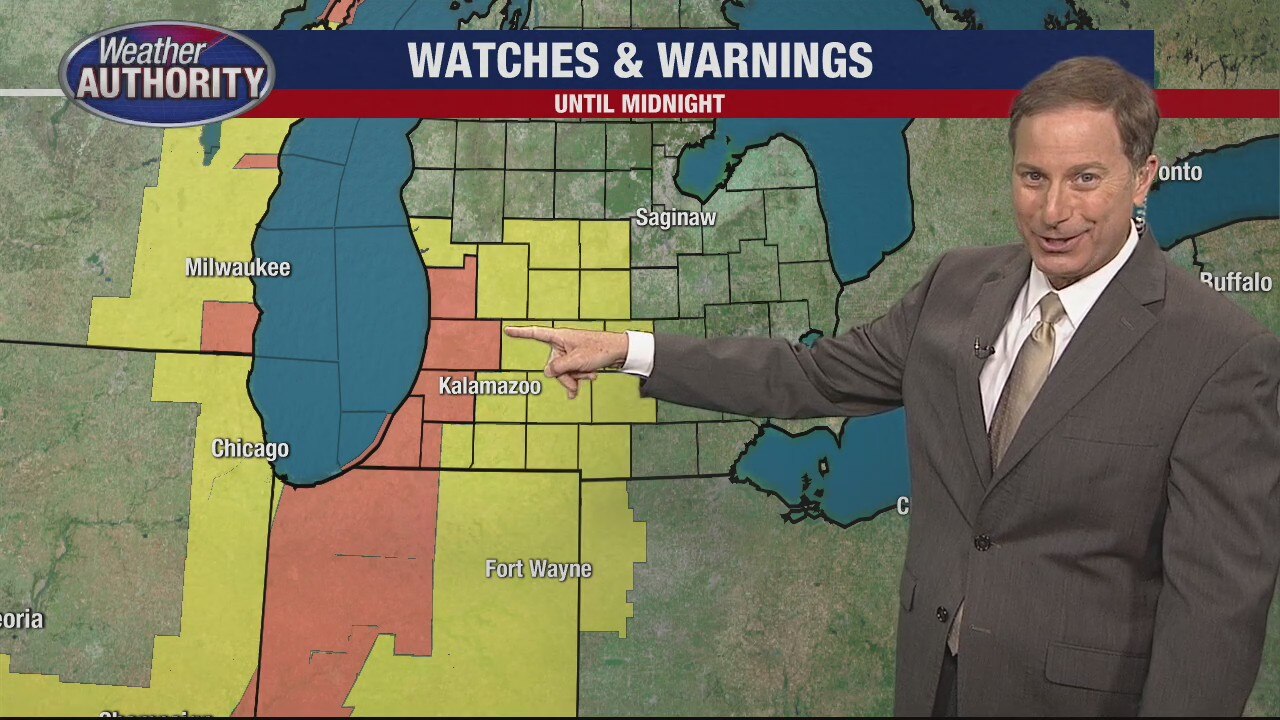
Humidity fueling big storms crossing Chicago into Michigan
Southwestern Michigan is under thunderstorm watches and warnings as storms are rolling in from the Chicago area.
Southwestern Michigan is under thunderstorm watches and warnings as storms are rolling in from the Chicago area.

The heat is on! Near 90° again this afternoon. A few storms are possible this afternoon.
Less muggy air moves in behind tonight's cold front.
Less muggy air moves in behind tonight's cold front.

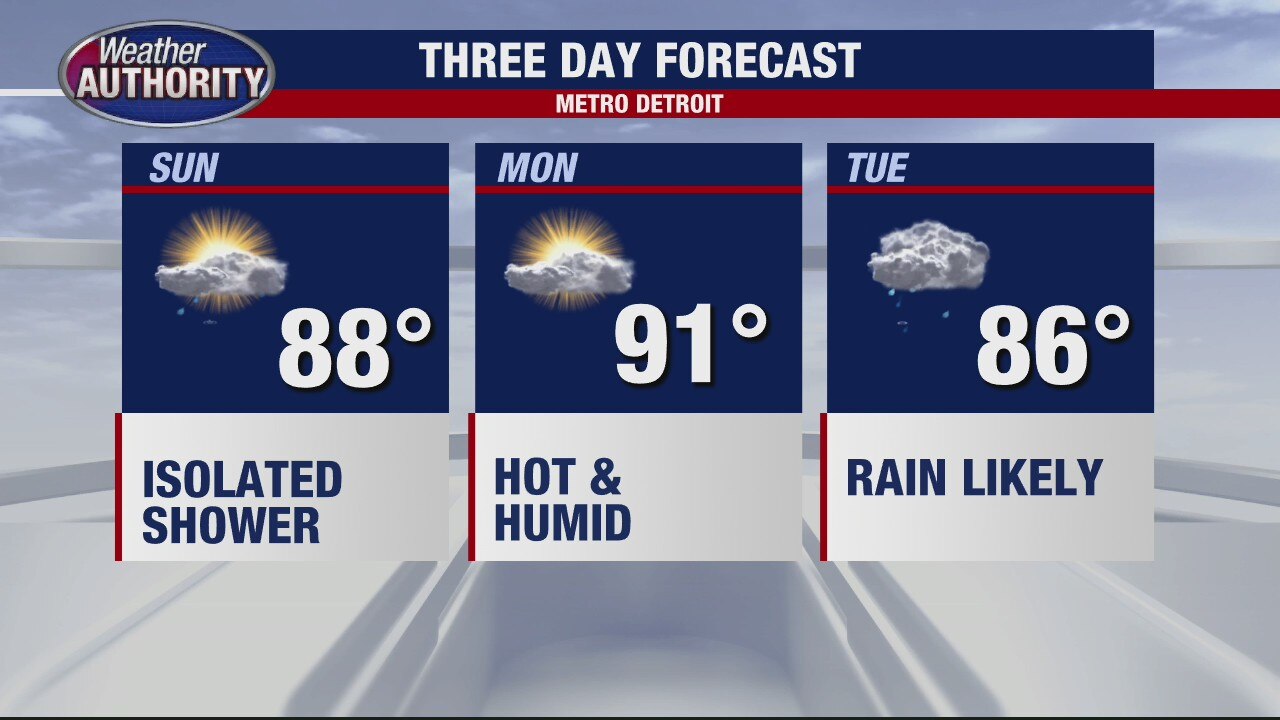
Warm and Humid Sunday
We are off to a mild and somewhat muggy start this morning with temperatures in the 60s and low 70s to get things going. With a surface trough crossing Michigan, we will have to be on the lookout for a spotty shower or two. Most areas in southeast Michigan will stay dry. Heat and humidity will be our weather headlines today. Our heat index is forecast in the mid 90s this afternoon under partly sunny skies. Make sure you are drinking plenty of water and finding cool, shady spots if you plan on being outside for an extended period of time. More rain and isolated storm chances are on the way Monday and Tuesday.
We are off to a mild and somewhat muggy start this morning with temperatures in the 60s and low 70s to get things going. With a surface trough crossing Michigan, we will have to be on the lookout for a spotty shower or two. Most areas in southeast Michigan will stay dry. Heat and humidity will be our weather headlines today. Our heat index is forecast in the mid 90s this afternoon under partly sunny skies. Make sure you are drinking plenty of water and finding cool, shady spots if you plan on being outside for an extended period of time. More rain and isolated storm chances are on the way Monday and Tuesday.
Warmer Weather On The Way
Meteorologist Lori Pinson has your forecast
Meteorologist Lori Pinson has your forecast

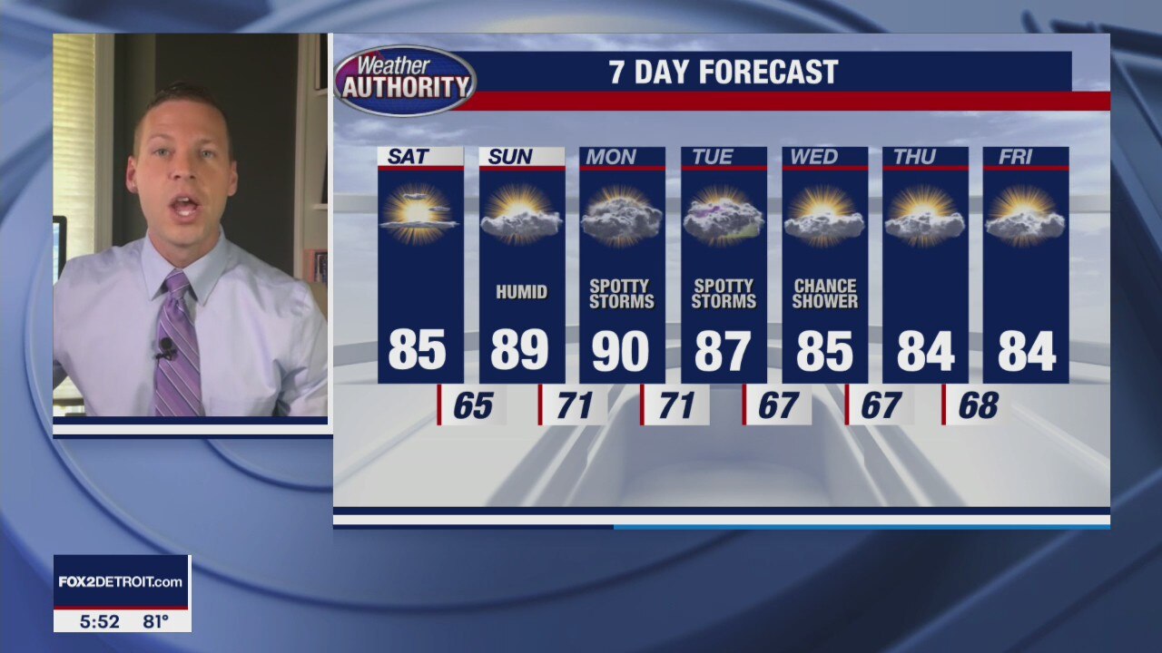
Warm and More Humid Weekend
Be on the lookout for some patchy morning fog to start your Saturday. As that fog burns off, sunshine and warm air will be the name of the weather game today with highs making it into the mid 80s. Should be a beautiful day in Metro Detroit. We should fall into the mid 60s overnight under mostly clear skies. More humidity is on the way on Sunday with highs in the upper 80s nearing 90. When you factor in the humidity tomorrow afternoon, it could feel closer to the mid 90s, so make sure you are drinking plenty of water and finding shady spots if you plan on being outside. Rain and storm chances return by Monday and Tuesday.
Be on the lookout for some patchy morning fog to start your Saturday. As that fog burns off, sunshine and warm air will be the name of the weather game today with highs making it into the mid 80s. Should be a beautiful day in Metro Detroit. We should fall into the mid 60s overnight under mostly clear skies. More humidity is on the way on Sunday with highs in the upper 80s nearing 90. When you factor in the humidity tomorrow afternoon, it could feel closer to the mid 90s, so make sure you are drinking plenty of water and finding shady spots if you plan on being outside. Rain and storm chances return by Monday and Tuesday.
A hotter weekend ahead
Sunday will be humid as well.
Sunday will be humid as well.