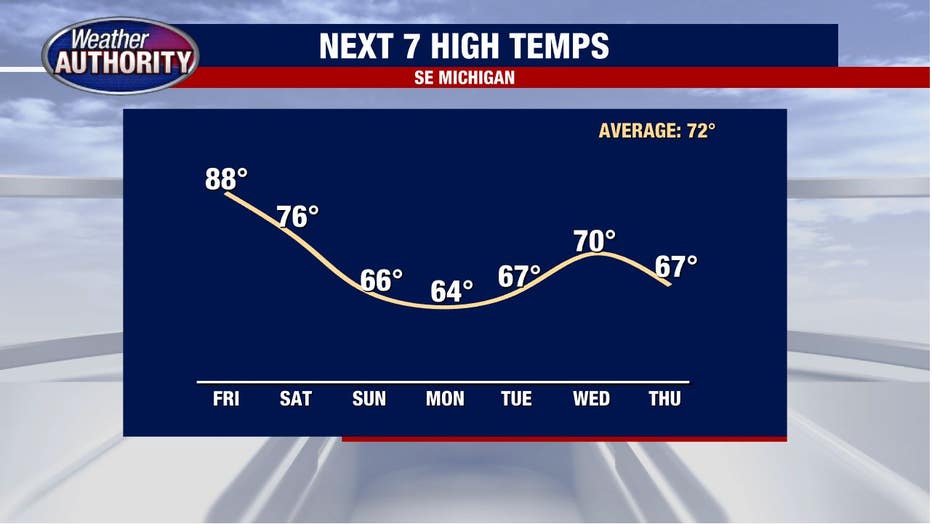
Friday temperatures spike into the high 80s with morning showers possible

(FOX 2) - Summer's back!
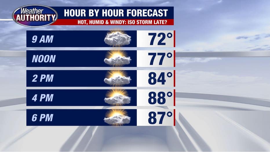
It'll be hot, humid, windy, and mostly dry.
A few showers or storms are possible early this morning, otherwise dry through midday into the afternoon and probably even into the evening.
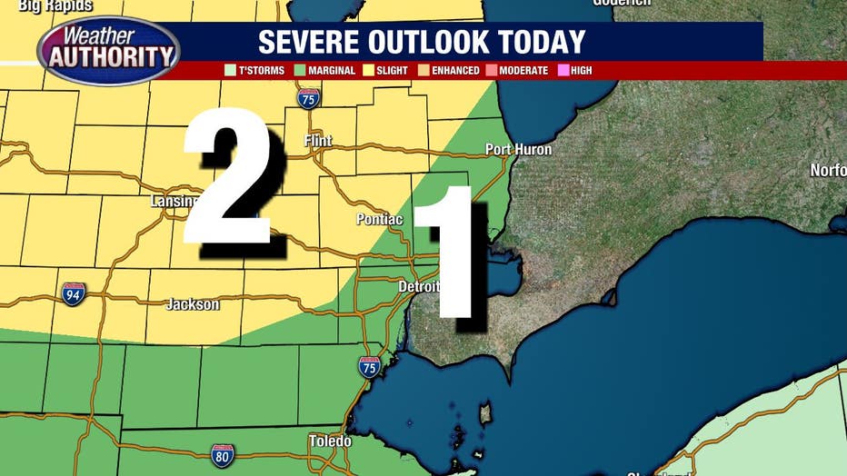
We're contending with a strong cap (warm air in the mid-levels) in the atmosphere which is a hugely limiting factor regarding storms. So I would say storms in the afternoon and evening are unlikely, but it's worth mentioning if we were to see a storm develop in that time, severe weather would be possible.
Check out the Storm Prediction Center outlook for today and notice Southeast Michigan lies in the slight and marginal risk for severe weather, IF a storm were to develop.
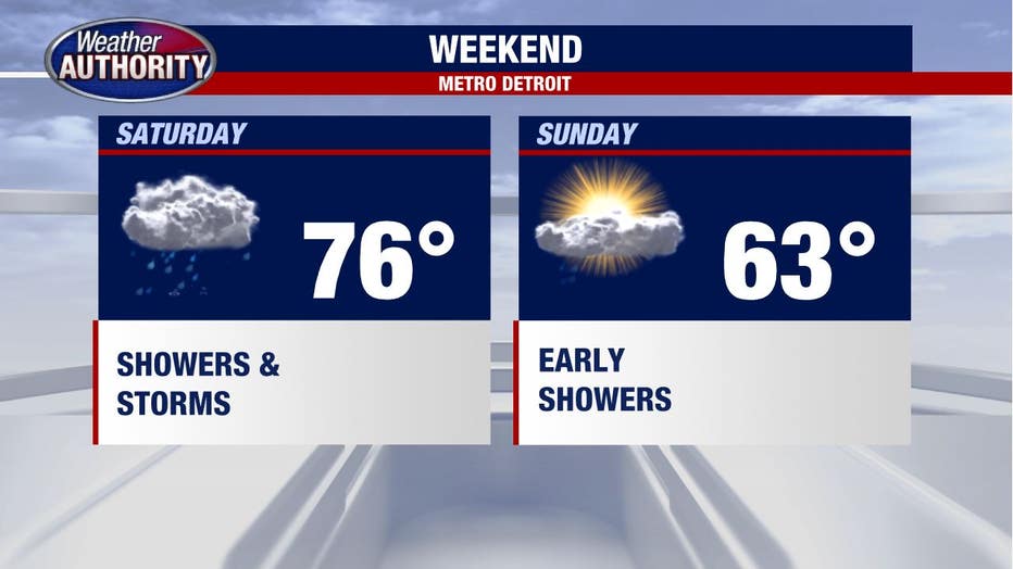
Wet weather is much more likely tonight and Saturday with rain showers lingering into Sunday morning as cooler air slips in.
Cooler temperatures win into early next week too!