

From thunderstorms to tornadoes, Southeast Michigan facing potential severe weather Wednesday
(FOX 2) - The short version: storms are likely today and severe weather is possible.
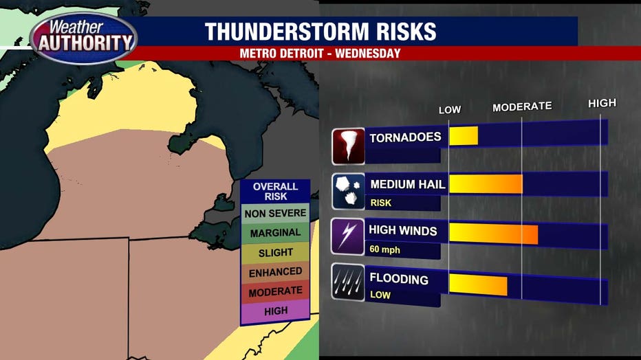
The window to watch is midday - about 11 a.m. to 3 p.m. Damaging wind, hail, and tornadoes are all possibilities. Don't freak out, just have a way to receive weather warnings and a plan in place should they be required later. The FOX2 Weather APP or a NOAA Weather Radio are two excellent options. FOX 2 will also be tracking the storms all Wednesday morning and afternoon.
More words: The wet weather this morning won't carry much of a severe concern, but that may change this afternoon. The Storm Prediction Center has Southeast Michigan in the Enhanced Category for any storms that pop this afternoon.

Scattered to numerous severe storms may be in the cards, with the main window falling this afternoon and possibly lingering into the evening. Strong wind, hail, and rotating storms capable of stronger tornadoes remain possible
The scenario comes with caveats.
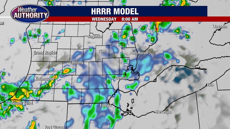
Any morning showers and storms will do their best and suck the energy out of the atmosphere, dampening the PM Severe threat. Here's one of our high resolution models depicting that exact scenario.
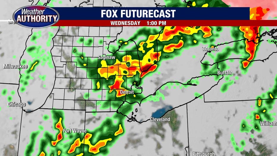
Around midday, a shortwave approaches and will bring with it the potential for another round of storms. These may have strong winds and hail within them, but the NE motion will relatively limit the potential for tornadoes.
The evening cold front swinging through may provide the best opportunity for tornadoes, however that's dependent on what materializes throughout the day, which very well may limit the energy left over to work with.
The exact picture is still a bit muddled, but there are some solid ingredients in play that are supportive of severe weather and potentially stronger tornadoes. Time will tell.
Wednesday's tornado risk
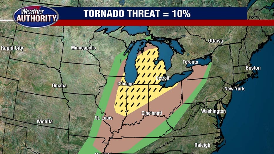
A warm front by definition has more spin in the atmosphere than a cold front, which means that tornadoes are possible. The main threats throughout the day include large hail up to 1 inch in diameter, isolated tornadoes, and winds gusting to over 55 mph. In addition to this, lots of thunder and lightning and heavy downpours are possible too.
The chance for this type of severe weather will linger until around 7:00 or 8:00 p.m. Wednesday before it tapers off as the atmosphere stables out Wednesday night into Thursday.
How to track Wednesday's storms
FOX 2 is keeping a close eye on Wednesday's incoming weather throughout the night Tuesday and also Wednesday morning. We'll be live all morning long and at 1 p.m., Derek Kevra will stream live updates as we track this storm and it's threat.
You can also download the FOX 2 Weather app for live radar updates wherever you are. You'll get alerts and updates throughout the day to keep you and your family safe.