

Temperatures to reach mid-80s ahead of evening showers Tuesday

Tuesday storms roll back into the forecast
But not until late in the day! We'll clear our smoke away tomorrow.
More sun, more smoke, and some storms return to the forecast!
We'll get out the door and through the morning dry with storms set to arrive late in the day ahead of an approaching cold front.
That front will change the trajectory of our upper winds and rid our skies of the smoky veil that's been covering the state the past two days.
Our cold front will also bring storms to SE Michigan late, dropping from north to south between 5 p.m. and 9 p.m.
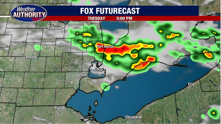
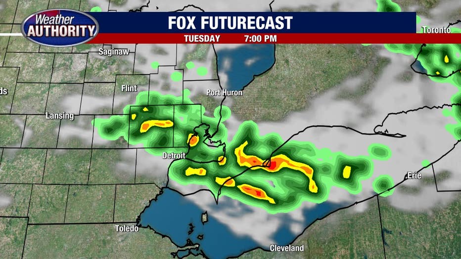
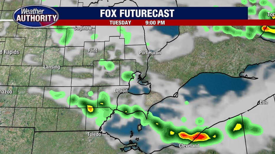
Here's a snapshot of the upcoming Tuesday forecast:
- At 5 p.m., storms will near the I-69 corridor
- At 7 p.m., they drop to the I-696 corridor
- Then at 9 p.m., what's left will push into northern Monroe and Lenawee counties
Take these model snapshots as a guide rather than gospel, but I think they have a good handle on the situation.
There is a marginal risk for an isolated strong wind gust in portions of Macomb, St. Clair, and Lapeer counties.
Temps turn cooler Wednesday behind the front.
That front will return north later in the week bringing back the opportunity for storms with it and possibly lingering into the weekend.
For now, the best opportunity appears to be Friday and Saturday.