

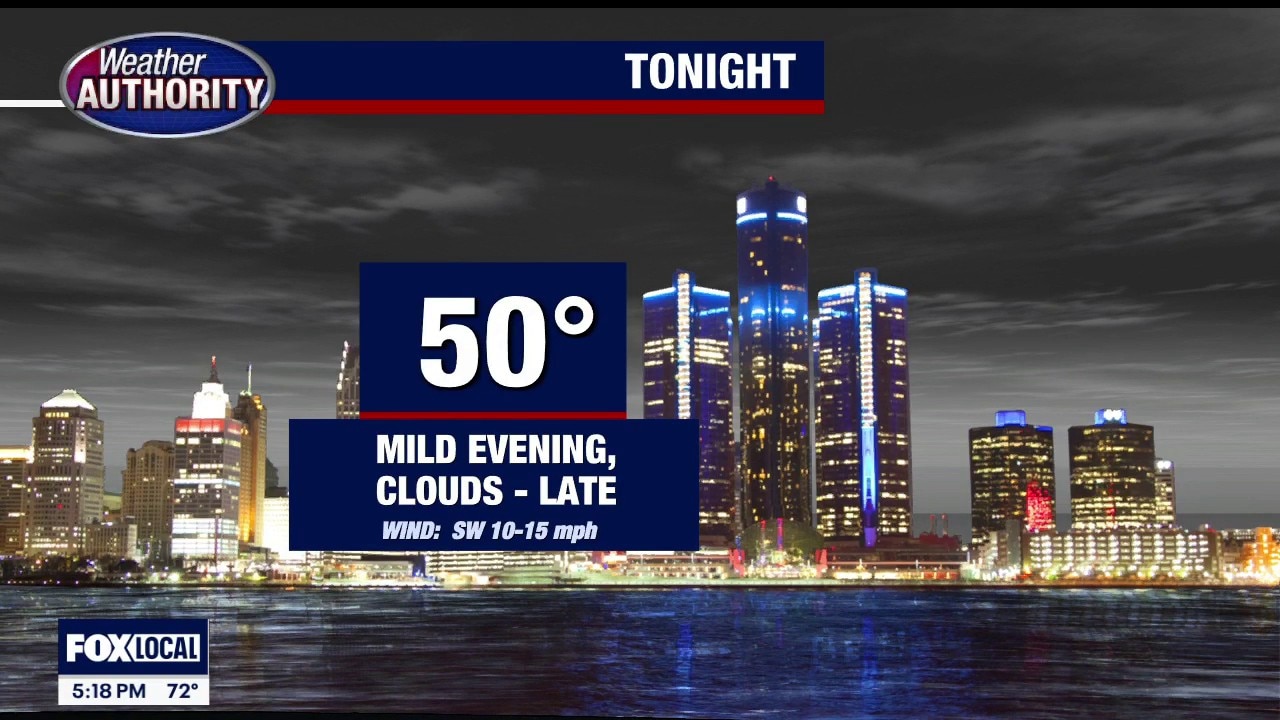
Mild With Storm Potential
Cooler today with highs in the 60s. Increasing clouds with heavy rain moving in overnight. Meteorologist Lori Pinson has your forecast.
Cooler today with highs in the 60s. Increasing clouds with heavy rain moving in overnight. Meteorologist Lori Pinson has your forecast.
Storms expected late Tuesday night
Rich Luterman has the forecast.
Rich Luterman has the forecast.
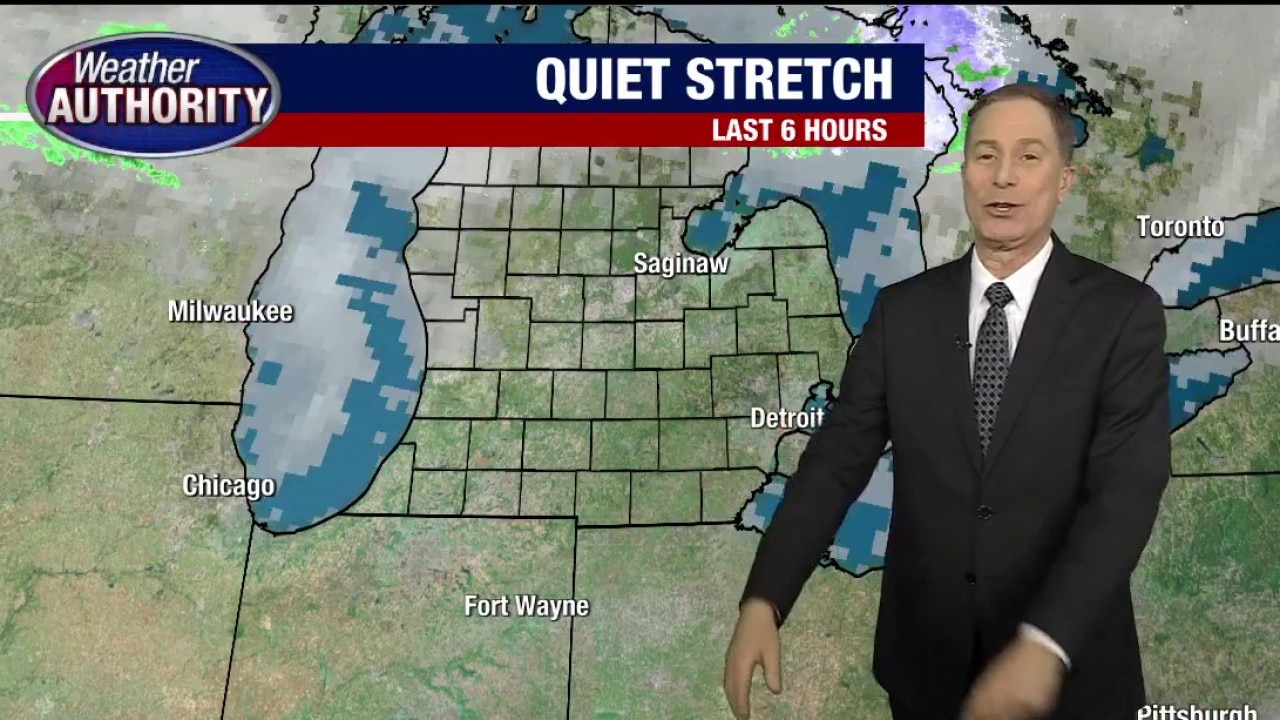
Weather remains steady until Tuesday, when rains return
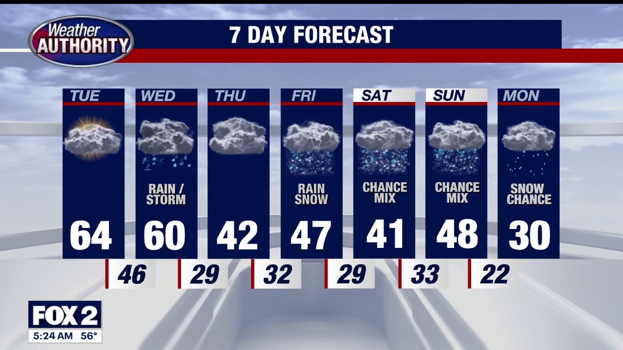
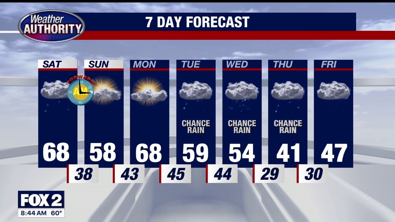
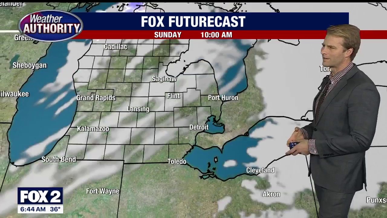
Quiet weather will persist Monday and Tuesday. More wet weather arrives Tuesday night and lasts into Wednesday. COOLER air arrives late-week… with more wet weather Friday and Sunday. PURE MICHIGAN! Rest of Sunday evening / night… Mostly clear… still breezy…. Low 43 Monday: Mostly sunny…. breezy and mild…. high 67 Tuesday: Increasing clouds…. still mild…. high 67 Wednesday: Cloudy… rainy…. High 59 Thursday: Partly cloudy…. COOLER…. high 41 Friday: Cloudy with light showers… high 48 Saturday: Mostly cloudy…. chilly…. High 42 Sunday: Cloudy with showers… high 46
Quiet weather will persist Monday and Tuesday. More wet weather arrives Tuesday night and lasts into Wednesday. COOLER air arrives late-week… with more wet weather Friday and Sunday. PURE MICHIGAN! Rest of Sunday evening / night… Mostly clear… still breezy…. Low 43 Monday: Mostly sunny…. breezy and mild…. high 67 Tuesday: Increasing clouds…. still mild…. high 67 Wednesday: Cloudy… rainy…. High 59 Thursday: Partly cloudy…. COOLER…. high 41 Friday: Cloudy with light showers… high 48 Saturday: Mostly cloudy…. chilly…. High 42 Sunday: Cloudy with showers… high 46
Cooler Sunday
Following the cold front passage, a cooler day is ahead. Milder Monday setting up with temperatures near 70 degrees. Meteorologist Lori Pinson has your forecast.
Following the cold front passage, a cooler day is ahead. Milder Monday setting up with temperatures near 70 degrees. Meteorologist Lori Pinson has your forecast.

Breezy but nice Sunday
Breezy end tothe weekend but comfortable with highs in the upper 50s! Highs will continue to climb through Monday with most spots in the upper 60s to near 70°! Rain chances return late Tuesday through the rest of the week.
Breezy end tothe weekend but comfortable with highs in the upper 50s! Highs will continue to climb through Monday with most spots in the upper 60s to near 70°! Rain chances return late Tuesday through the rest of the week.
Saturday Rain
Periods of rain this morning with some redevelopment by evening. Mild and breezy with highs in the 60s. Meteorologist Lori Pinson has your forecast.
Periods of rain this morning with some redevelopment by evening. Mild and breezy with highs in the 60s. Meteorologist Lori Pinson has your forecast.
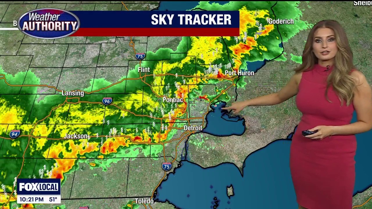
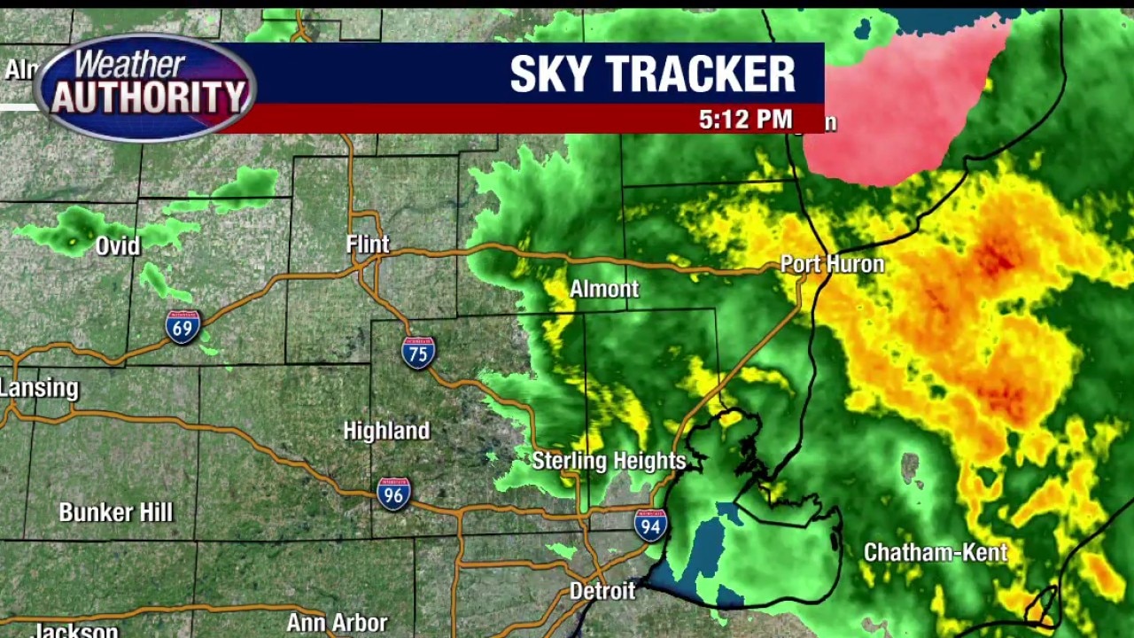
Deadly apparent tornado followed with storm system across Michigan
The large system is expected to enter Metro Detroit Friday night as it crosses the state going West to East. As of 7:55 p.m., no Southeast Michigan counties had been issued severe weather warnings. The National Weather Service (NWS) has issued a dense fog warning for the SE area until 1 a.m. Meanwhile, the NWS reported a severe thunderstorm warning for Shiawassee County at 7:50 p.m.
The large system is expected to enter Metro Detroit Friday night as it crosses the state going West to East. As of 7:55 p.m., no Southeast Michigan counties had been issued severe weather warnings. The National Weather Service (NWS) has issued a dense fog warning for the SE area until 1 a.m. Meanwhile, the NWS reported a severe thunderstorm warning for Shiawassee County at 7:50 p.m.

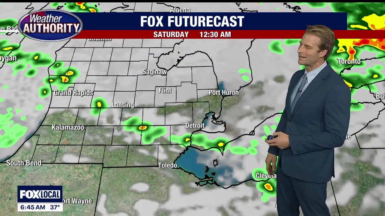
Warm weekend with storm chances
Warm start to the weekend with storms chances to kick it off! Saturday morning expect showers and storms to start your day with highs in the upper 60s. Scattered showers will continue through the day eventually moving out late Saturday night. Sunday looks beautiful with highs in the upper 50s to lower 60s with sun and clouds. Temperatures remain mild through mid week with rain chances returning Wednesday.
Warm start to the weekend with storms chances to kick it off! Saturday morning expect showers and storms to start your day with highs in the upper 60s. Scattered showers will continue through the day eventually moving out late Saturday night. Sunday looks beautiful with highs in the upper 50s to lower 60s with sun and clouds. Temperatures remain mild through mid week with rain chances returning Wednesday.
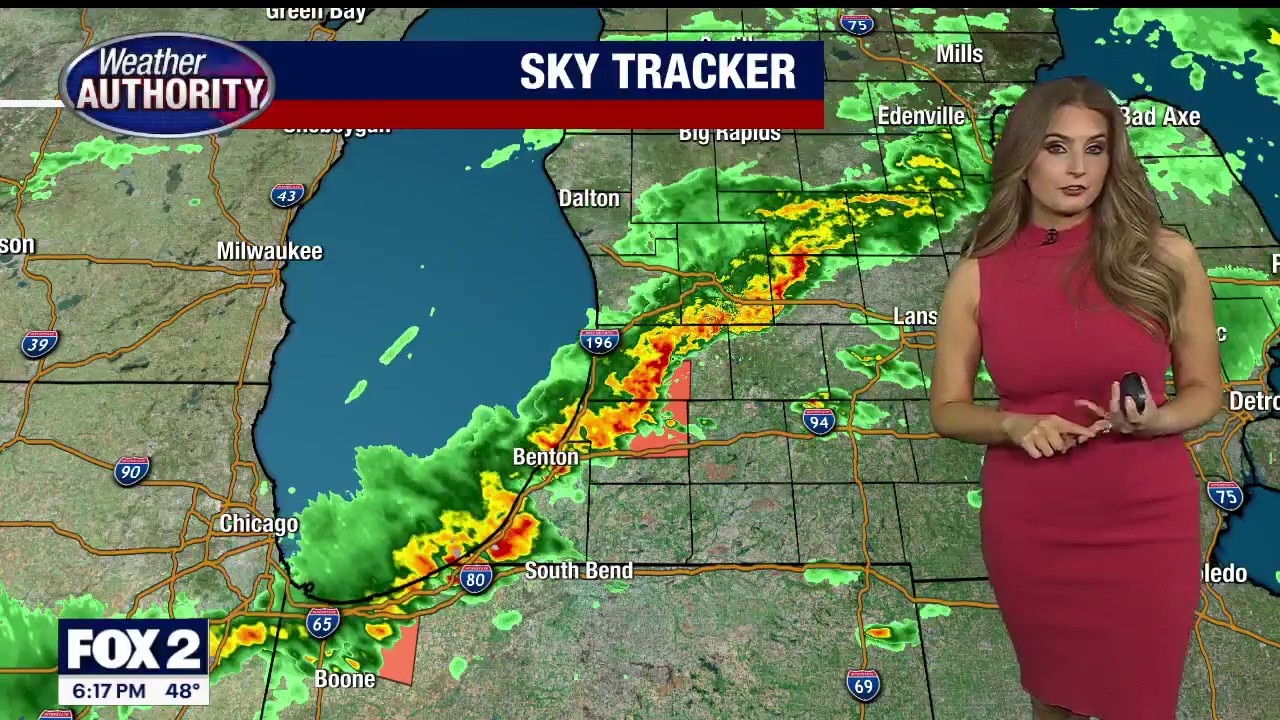
Severe weather rolls through southwest Michigan, storm chances tonight
Stephanie Mead has the latest on tonight's active weather outlook chances.
Stephanie Mead has the latest on tonight's active weather outlook chances.
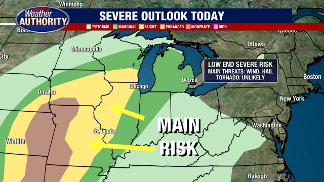
Some t'storms with gusty winds and hail possible tonight
An isolated tornado is a possibility but odds are low
An isolated tornado is a possibility but odds are low

Metro Detroit weather: Limited chance for severe weather as thunderstorms arrive to start the weekend
A marginal risk for severe thunderstorms is in place for Southeast Michigan, with hail, gusty winds, and some localized flooding as the main concerns.
A marginal risk for severe thunderstorms is in place for Southeast Michigan, with hail, gusty winds, and some localized flooding as the main concerns.
Chance for severe thunderstorms Friday in Metro Detroit
Severe thunderstorms are possibly in the forecast later Friday, with strong winds and hail being the greatest threats.
Severe thunderstorms are possibly in the forecast later Friday, with strong winds and hail being the greatest threats.
Rain moves out, rising temperatures move in over Metro Detroit
Higher temperatures are pushing in for Southeast Michigan's warmest spell of the year.
Higher temperatures are pushing in for Southeast Michigan's warmest spell of the year.


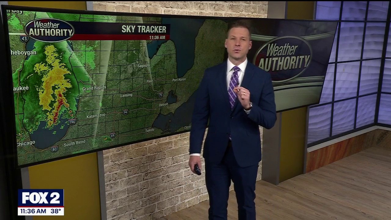
Metro Detroit weather: Dreary Thursday ahead of some warmer, drier days
Rainy and chilly -- today is a day for naps in Metro Detroit.
Rainy and chilly -- today is a day for naps in Metro Detroit.
Rainy Thursday in Metro Detroit
Early rain will fade, but it will pick up again later in the morning and into the afternoon.
Early rain will fade, but it will pick up again later in the morning and into the afternoon.
Rain returns overnight
Rain chances increase overnight and will be around throughout the day Thursday. Highs will warm to the mid 40s. Beautiful end to the week with highs in the upper 50s with storm chances very late Friday night. Rain will be around for Saturday with highs in the upper 60s.
Rain chances increase overnight and will be around throughout the day Thursday. Highs will warm to the mid 40s. Beautiful end to the week with highs in the upper 50s with storm chances very late Friday night. Rain will be around for Saturday with highs in the upper 60s.


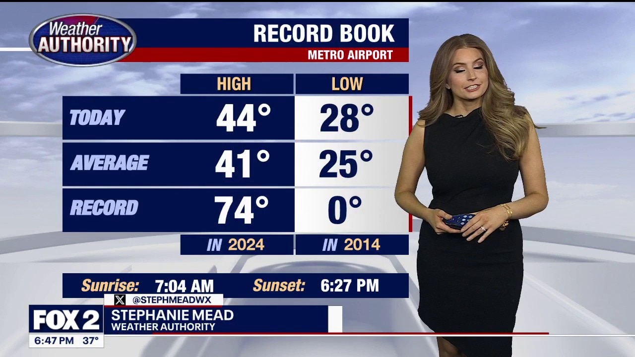
Metro Detroit weather: Dense fog blanketing Metro Detroit on Wednesday morning
Metro Detroit is waking up to dense fog that has prompted an advisory until 10 a.m.
Metro Detroit is waking up to dense fog that has prompted an advisory until 10 a.m.
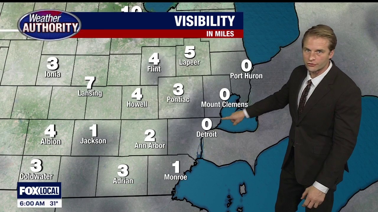
Dense Fog Advisory to start the day
A Dense Fog Advisory is in effect for parts of Metro Detroit until 10 a.m. due to low visibility.
A Dense Fog Advisory is in effect for parts of Metro Detroit until 10 a.m. due to low visibility.

Milder temperatures ahead
Becoming milder by the end of the week with more rain chances returning! We could be close to 70° by this weekend!
Becoming milder by the end of the week with more rain chances returning! We could be close to 70° by this weekend!


Metro Detroit weather: Temperatures start to head up after freezing drizzle to start the morning
A cold start to Tuesday is followed by the beginning of a warm-up that will hit its peak with highs in the upper 60s next weekend.
A cold start to Tuesday is followed by the beginning of a warm-up that will hit its peak with highs in the upper 60s next weekend.