


Snow showers for late Thursday into Friday
Rich Luterman has the forecast.
Rich Luterman has the forecast.


Finally some sunshine poking out today
Snow returns later Thursday and through Friday morning
Snow returns later Thursday and through Friday morning


Metro Detroit weather: Another cold start, but sun is in Wednesday's forecast
It’s another cold start to the day in Metro Detroit, but we’ll squeeze out a bit of sun to help counter the chill.
It’s another cold start to the day in Metro Detroit, but we’ll squeeze out a bit of sun to help counter the chill.


Some sun Wednesday
It's still cold out there, but Metro Detroit will get to see some sun today. Alan Longstreet explains what to expect ahead of next week's thaw.
It's still cold out there, but Metro Detroit will get to see some sun today. Alan Longstreet explains what to expect ahead of next week's thaw.

Sun and clouds for Wednesday
Rich Luterman has the forecast.
Rich Luterman has the forecast.

Some light snow showers continue
Another round of snow late in the work week
Another round of snow late in the work week


Metro Detroit weather: Light snow creating slick commute Tuesday
Temperatures are averaging around 25 degrees with a wind chill in the teens, a feel that isn't warm but also isn't nearly as bitter as it has been.
Temperatures are averaging around 25 degrees with a wind chill in the teens, a feel that isn't warm but also isn't nearly as bitter as it has been.


Light Snow Today
A milder start offset by areas of light snow today. More snow expected Friday. Colder temperatures for the weekend. Meteorologist Lori Pinson has your forecast.
A milder start offset by areas of light snow today. More snow expected Friday. Colder temperatures for the weekend. Meteorologist Lori Pinson has your forecast.


DTE gives tips on keeping your bills low during freezing temperatures
As freezing weather hit Metro Detroit communities, many have had to increase the setting on their thermostats, adding more pain to their wallets when the eventual bill comes in.
As freezing weather hit Metro Detroit communities, many have had to increase the setting on their thermostats, adding more pain to their wallets when the eventual bill comes in.


Mostly cloudy not as cold for Tuesday
Rich Luterman has the forecast.
Rich Luterman has the forecast.


Some light snow accumulation Monday; Less than 1"
Temperatures aren't as harsh though
Temperatures aren't as harsh though

Driving with snow on top of your car is illegal in several states across the US
Drivers who don't clear the top of their vehicles can face fines as high as $1,500 in several states.
Drivers who don't clear the top of their vehicles can face fines as high as $1,500 in several states.


Metro Detroit weather: Another round of snow to start another cold week
Two rounds of snow are in the Metro Detroit forecast this week as highs inch a bit closer to average.
Two rounds of snow are in the Metro Detroit forecast this week as highs inch a bit closer to average.


A couple opportunities for snow this week
It will be another below-average week with several snow chances in Metro Detroit.
It will be another below-average week with several snow chances in Metro Detroit.


Snow to start the work week
Snow arrives mid Monday morning brining less than an inch to spots througout the day. Highs will warm to the mid 20s! 30s return Tuesday wit more up and down temperatures through the week.
Snow arrives mid Monday morning brining less than an inch to spots througout the day. Highs will warm to the mid 20s! 30s return Tuesday wit more up and down temperatures through the week.


Cold Sunny Sunday
A colder start to your Sunday as compared to yesterday morning, but the bright sunshine should make up for it. Light snow moving in Monday. Meteorologist Lori Pinson has your forecast.
A colder start to your Sunday as compared to yesterday morning, but the bright sunshine should make up for it. Light snow moving in Monday. Meteorologist Lori Pinson has your forecast.


Cold continues, snow chances return
A cold end to the weeeknd with highs in the upper teens. Next chance fore scattered snow arrives Monday with highs breaking into the lower 20s!
A cold end to the weeeknd with highs in the upper teens. Next chance fore scattered snow arrives Monday with highs breaking into the lower 20s!


Cold Saturday
Only a few locations start the day with sub zero wind chills, but our temperatures remain below seasonal. Slightly milder air in the new week. Meteorologist Lori Pinson has your forecast.
Only a few locations start the day with sub zero wind chills, but our temperatures remain below seasonal. Slightly milder air in the new week. Meteorologist Lori Pinson has your forecast.


Cold Weekend
Cold weekend with highs in the teens and feel like temperatures overnight below zero. We do see improvements next week with highs in the 20s with sunshine for a good portion of the week!
Cold weekend with highs in the teens and feel like temperatures overnight below zero. We do see improvements next week with highs in the 20s with sunshine for a good portion of the week!


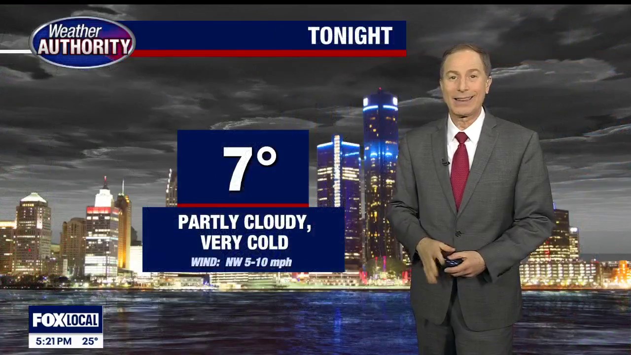
Still very frigid through the weekend
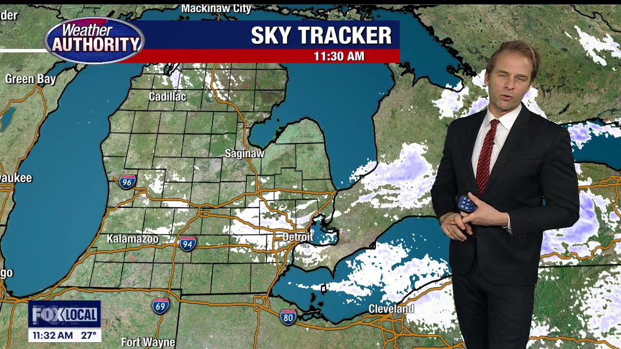
Snow returns to the forecast on Monday; Bigger event in a week
Snow returns to the forecast on Monday; Bigger event in a week