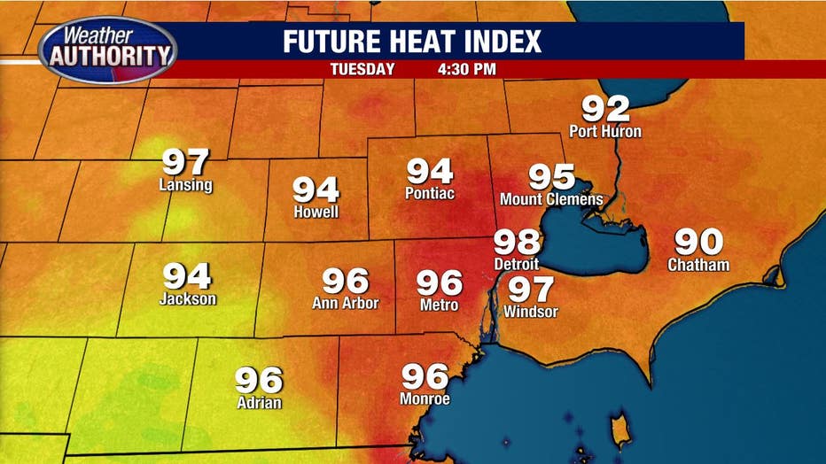
Tuesday's heat index will lead well into the 90s and persist through tomorrow

Tuesday temps turn up! Near 90 this afternoon with our humidity set to soar.
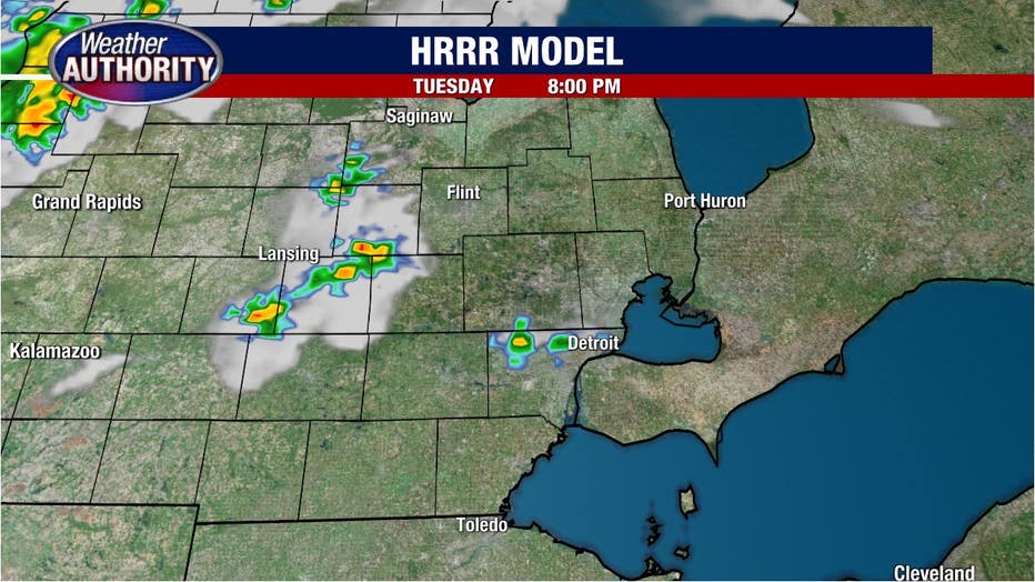
Storm chances look limited today, with a late storm possible.
We're turning the temperature back up a bit this afternoon with 90° making a comeback along with an increase in humidity leading to a heat index well into the 90s.
It'll leave us just shy of a heat advisory, but plenty sweaty.
Plan on a dry morning commute with nothing more than patchy fog in spots.
Storm chances look to remain limited this afternoon with a stray storm possibly late and most of us looking to remain on the dry side.
A cold front approaches overnight and Wednesday with the chance for storms continuing this week. But we still have two days of sweltering heat.
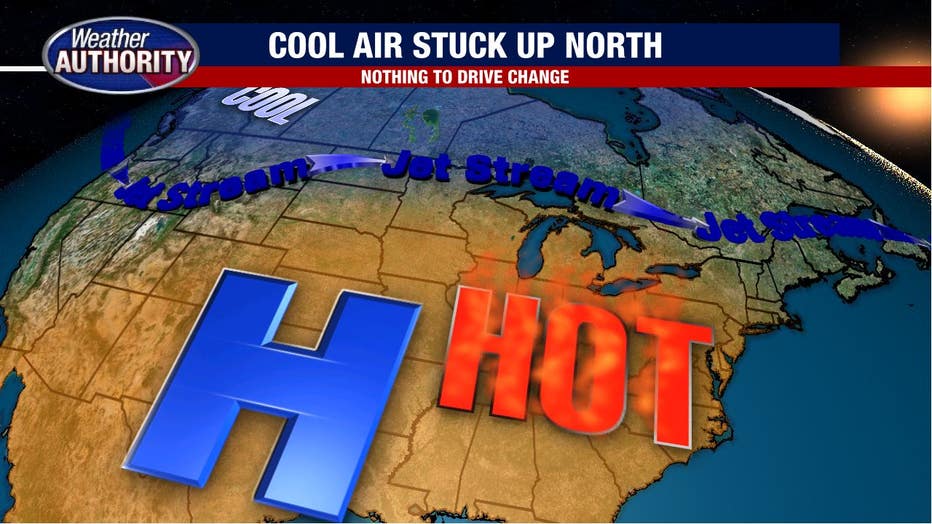
On the topic of heat and the relentless pattern we've been in, one huge factor is the location of the jet stream. It's not moving a whole lot.
Strong high pressure in the upper layers of the atmosphere is socked over the southern U.S. and is holding the jet stream well north of us in Michigan. The jet stream acts as a barrier for cool air and hot air and thanks to our position, it's hot air for us.
Download the FOX 2 Detroit app for iPhone and Android.
The issue is that nothing is expected to come in and "jostle" the stream south - which would give us cooler air. Instead, we're stuck in the heat.
Daily storm chances will stay in the forecast through the rest of the week with that front hanging around Southeast Michigan, but there will be plenty of dry time in between any storms. Our chances of severe weather remain quite low.