


Rain Moving In
Scattered showers moving in this afternoon and evening. Colder air for Monday. Meteorologist Lori Pinson has your forecast.
Scattered showers moving in this afternoon and evening. Colder air for Monday. Meteorologist Lori Pinson has your forecast.

Rain returns Sunday
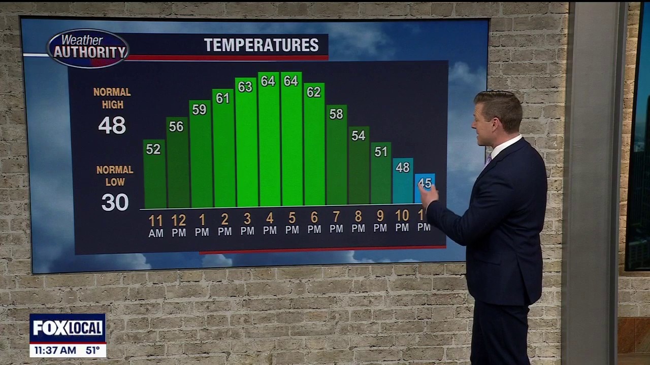
Mild start to the weekend with highsi n the 50s and 60s. Rain returns Sunday with steady showers by the afternoon. Next week looks cool to start then become milder by the end of the week with more 50s and 60s!
Mild start to the weekend with highsi n the 50s and 60s. Rain returns Sunday with steady showers by the afternoon. Next week looks cool to start then become milder by the end of the week with more 50s and 60s!
Rain moving out and temps climbing up
Should be a really nice end to the day as the sun pops out
Should be a really nice end to the day as the sun pops out


Metro Detroit weather: First day of spring arrives with highs in the 50s and 60s
Spring starts today, and it will feel like it in Metro Detroit.
Spring starts today, and it will feel like it in Metro Detroit.
Highs take aim at 60s for first day of spring
Spring starts Friday, and it will feel like it in Metro Detroit.
Spring starts Friday, and it will feel like it in Metro Detroit.
Great start to spring
A great start to spring with highs in the mid 60! A great weekend with highs in 50s and 60s! Next chance for rain arrives Sunday.
A great start to spring with highs in the mid 60! A great weekend with highs in 50s and 60s! Next chance for rain arrives Sunday.
Last full day of Winter is today!
Guys - we made it!
Guys - we made it!


Metro Detroit weather: Temperatures headed up, with 50s and 60s on the horizon this weekend
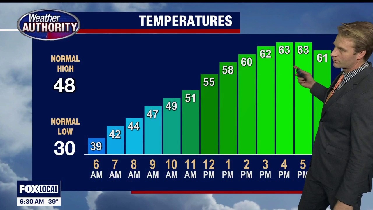
Warmer temps are on the way, with highs around 49 Thursday in Metro Detroit, and 50s and 60s in the weekend forecast.
Warmer temps are on the way, with highs around 49 Thursday in Metro Detroit, and 50s and 60s in the weekend forecast.
Warmer temps start to arrive
The first day of spring is Friday, as spring-like weather shows up in Metro Detroit.
The first day of spring is Friday, as spring-like weather shows up in Metro Detroit.

Wintry mix to start Thursday
Some freezing drizzle and snow to start Thursday morning. The morning drive will be fine for the most part with isolated icy spots. It'll all transition to rain quickly mid morning with hgihs warming to the upper 40s. We see mild temperatures by the end of the week!
Some freezing drizzle and snow to start Thursday morning. The morning drive will be fine for the most part with isolated icy spots. It'll all transition to rain quickly mid morning with hgihs warming to the upper 40s. We see mild temperatures by the end of the week!
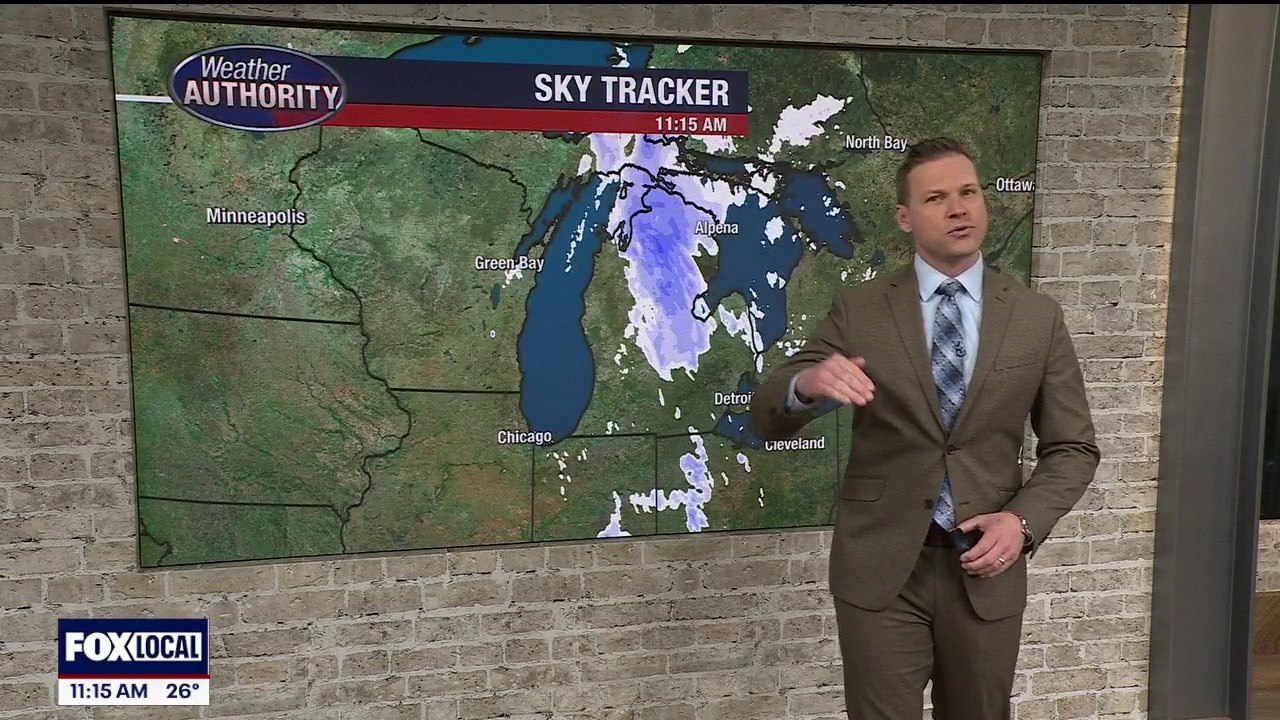
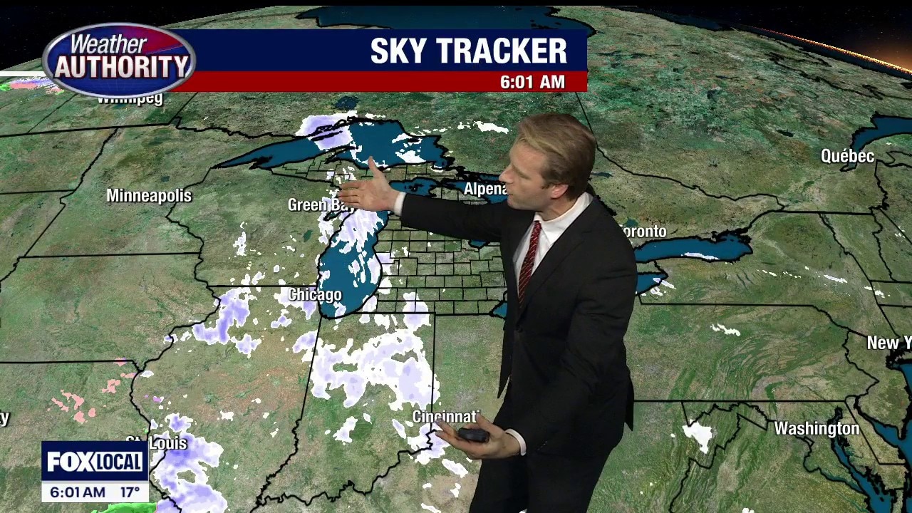
Some light snow, with temps remaining chilly
We do get gradually warmer from here on out
We do get gradually warmer from here on out


Metro Detroit weather: Cold eases some Wednesday, but wind chills stay well below average
It won't be as cold as it was to start the week, but Wednesday still has the chill, with Metro Detroit wind chills forecasted to be well below average for this time of year.
It won't be as cold as it was to start the week, but Wednesday still has the chill, with Metro Detroit wind chills forecasted to be well below average for this time of year.
A little less cold - but still chilly
Temperatures are headed in the right direction, but you really won't feel it Wednesday.
Temperatures are headed in the right direction, but you really won't feel it Wednesday.


Metro Detroit weather: Another breezy day with single-digit wind chills to start the morning
Winds may not be gusting near advisory levels of 45 mph, but this morning winds are gusting up to 30 mph, making it feel like single-digit wind chills in Metro Detroit.
Winds may not be gusting near advisory levels of 45 mph, but this morning winds are gusting up to 30 mph, making it feel like single-digit wind chills in Metro Detroit.

Colder Tuesday
Breezy and cold for St. Patrick's Day with lake effect snow showers throughout the day. Milder temperatures on the way by Thursday. Meteorologist Lori Pinson has your forecast.
Breezy and cold for St. Patrick's Day with lake effect snow showers throughout the day. Milder temperatures on the way by Thursday. Meteorologist Lori Pinson has your forecast.
Cloudy, breezy and cold for St. Patrick's Day
Rich Luterman has the forecast.
Rich Luterman has the forecast.


Metro Detroit weather: Wind Advisory remains in effect, but threat for severe weather has passed
A Wind Advisory remains in effect for Metro Detroit due to gusts up to 43 mph, but the threat for severe weather is over.
A Wind Advisory remains in effect for Metro Detroit due to gusts up to 43 mph, but the threat for severe weather is over.
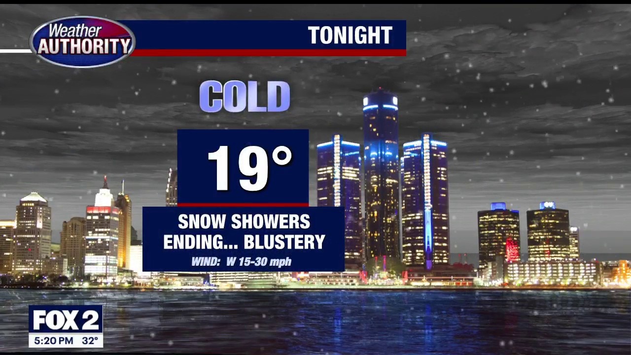
Another Windy Day
Mild to start with falling temperatures throughout the day resulting in light snow. Wind Advisory remains in place. Meteorologist Lori Pinson has your forecast.
Mild to start with falling temperatures throughout the day resulting in light snow. Wind Advisory remains in place. Meteorologist Lori Pinson has your forecast.
Heavy winds expected through Monday evening
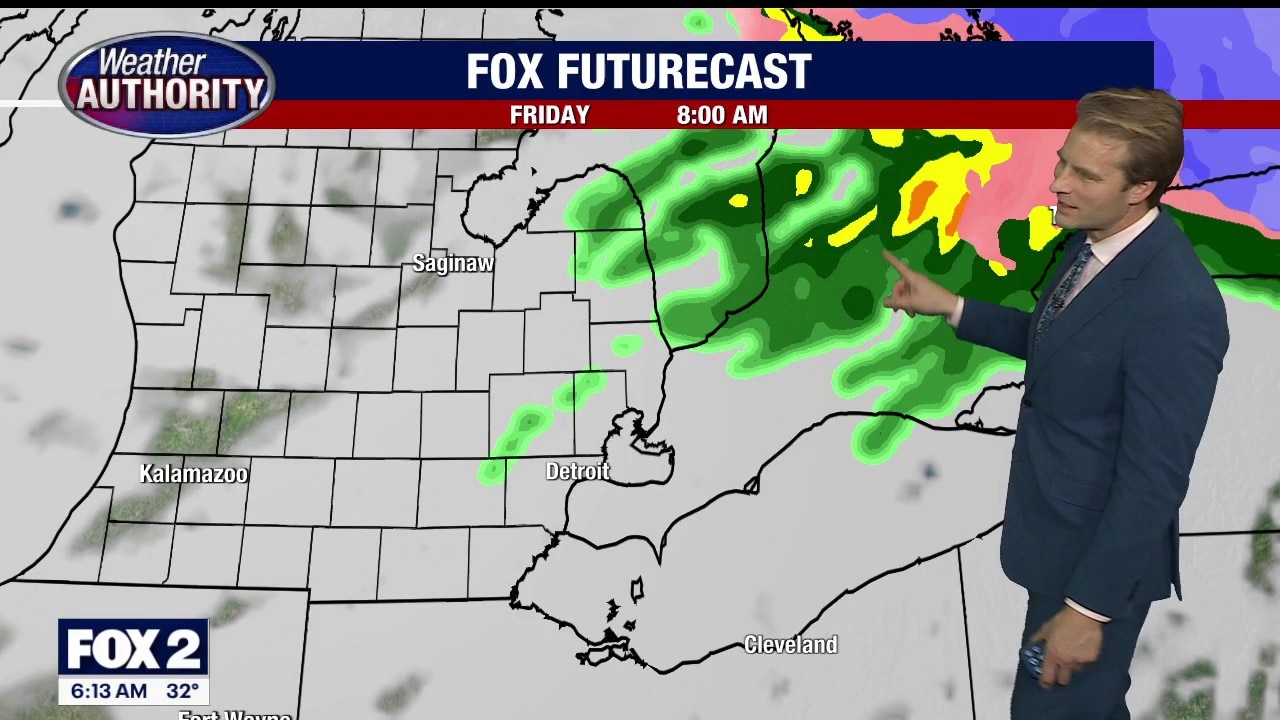
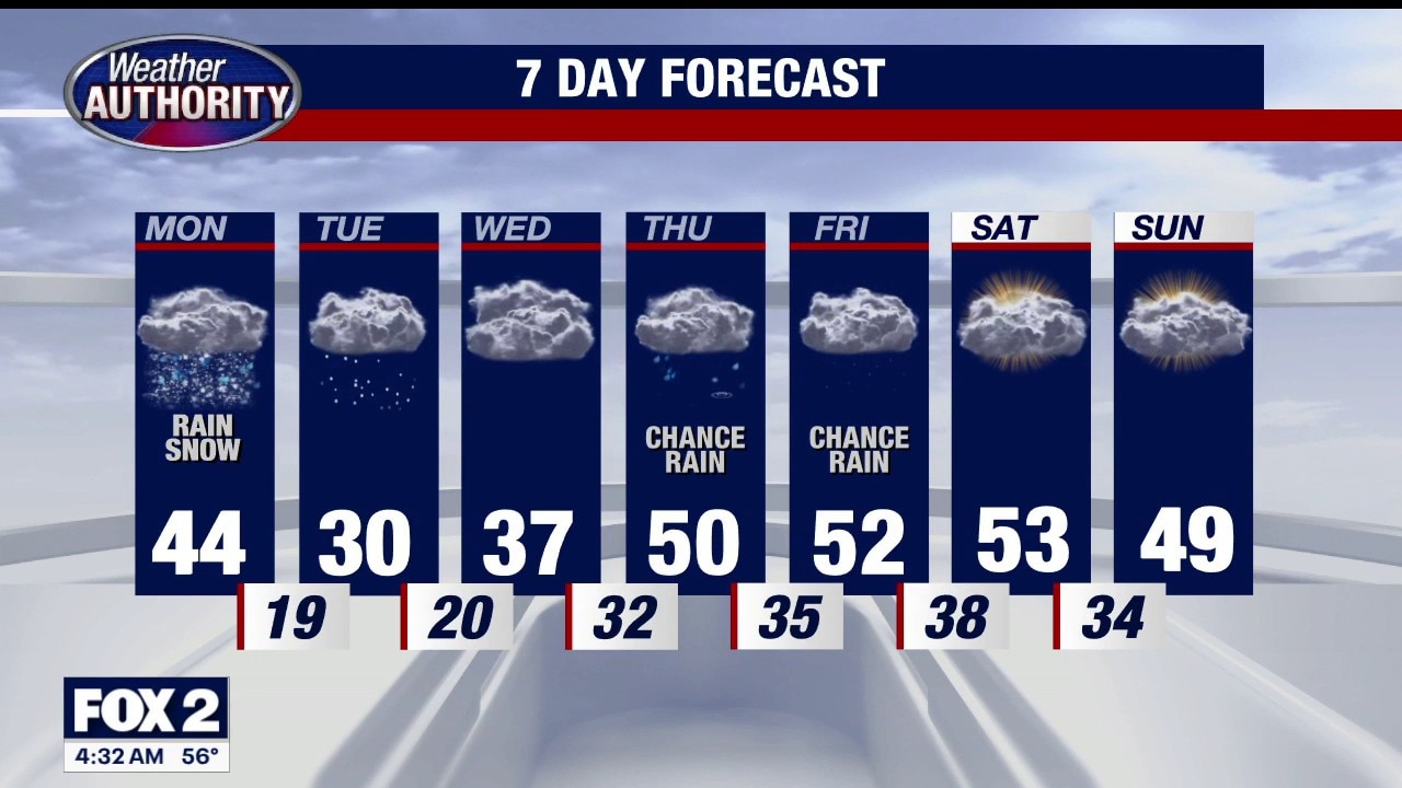
There is a wind advisory through Monday evening for all of Southeastern Michigan, including gusts up to 50 miles per hour. There is a chance for some strong thunderstorms late Sunday night. Gusty winds the main threat. Much colder air will arrive Monday evening and last through Wednesday morning. Temps will moderate later this week. Rest of Sunday evening / night… Blustery and mild… some overnight showers and storms… some could be strong. Low 43 Monday: Cloudy…. WINDY… falling temps… perhaps some flurries… high 44 Tuesday (St Patty’s Day): Mostly cloudy… BRISK and COLD… high near 30 Wednesday: Cloudy and chilly… some flurries…. High 39 Thursday: Mostly cloudy…. shower chance….high near 50 Friday: Mostly cloudy… high 54 Saturday: Mostly cloudy…. high 53
There is a wind advisory through Monday evening for all of Southeastern Michigan, including gusts up to 50 miles per hour. There is a chance for some strong thunderstorms late Sunday night. Gusty winds the main threat. Much colder air will arrive Monday evening and last through Wednesday morning. Temps will moderate later this week. Rest of Sunday evening / night… Blustery and mild… some overnight showers and storms… some could be strong. Low 43 Monday: Cloudy…. WINDY… falling temps… perhaps some flurries… high 44 Tuesday (St Patty’s Day): Mostly cloudy… BRISK and COLD… high near 30 Wednesday: Cloudy and chilly… some flurries…. High 39 Thursday: Mostly cloudy…. shower chance….high near 50 Friday: Mostly cloudy… high 54 Saturday: Mostly cloudy…. high 53

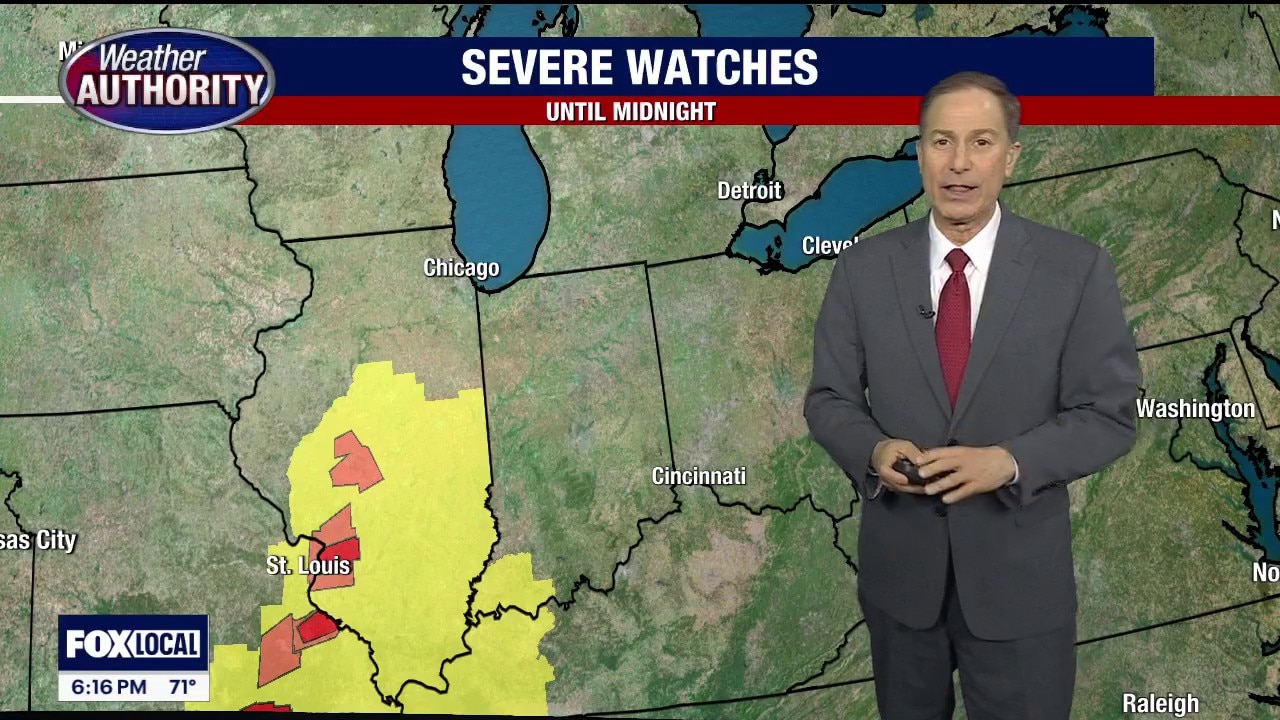
Severe Weather Possible Overnight
Milder and windy today with a Wind Advisory in effect starting at 11a. Winds could gust up to 45mph. Severe weather possible after midnight. Meteorologist Lori Pinson has your forecast.
Milder and windy today with a Wind Advisory in effect starting at 11a. Winds could gust up to 45mph. Severe weather possible after midnight. Meteorologist Lori Pinson has your forecast.