


Detroit Grand Prix Forecast
Perfect weather for the Grand Prix, but will it last? Meteorologist Lori Pinson has your forecast
Perfect weather for the Grand Prix, but will it last? Meteorologist Lori Pinson has your forecast
Perfect Weekend
Nice stretch continues into the weekend with highs in the 70s and sunshine!
Nice stretch continues into the weekend with highs in the 70s and sunshine!
Gorgeous weather continues today
And all weekend long!
And all weekend long!


Metro Detroit weather: Sunny and rain-free weekend ahead
Metro Detroit is headed into a nice weekend as the stretch of dry weather continues for the next week.
Metro Detroit is headed into a nice weekend as the stretch of dry weather continues for the next week.
Rain-free stretch continues headed into the weekend
We're headed into the weekend rain-free, and it stays that way for a while!
We're headed into the weekend rain-free, and it stays that way for a while!


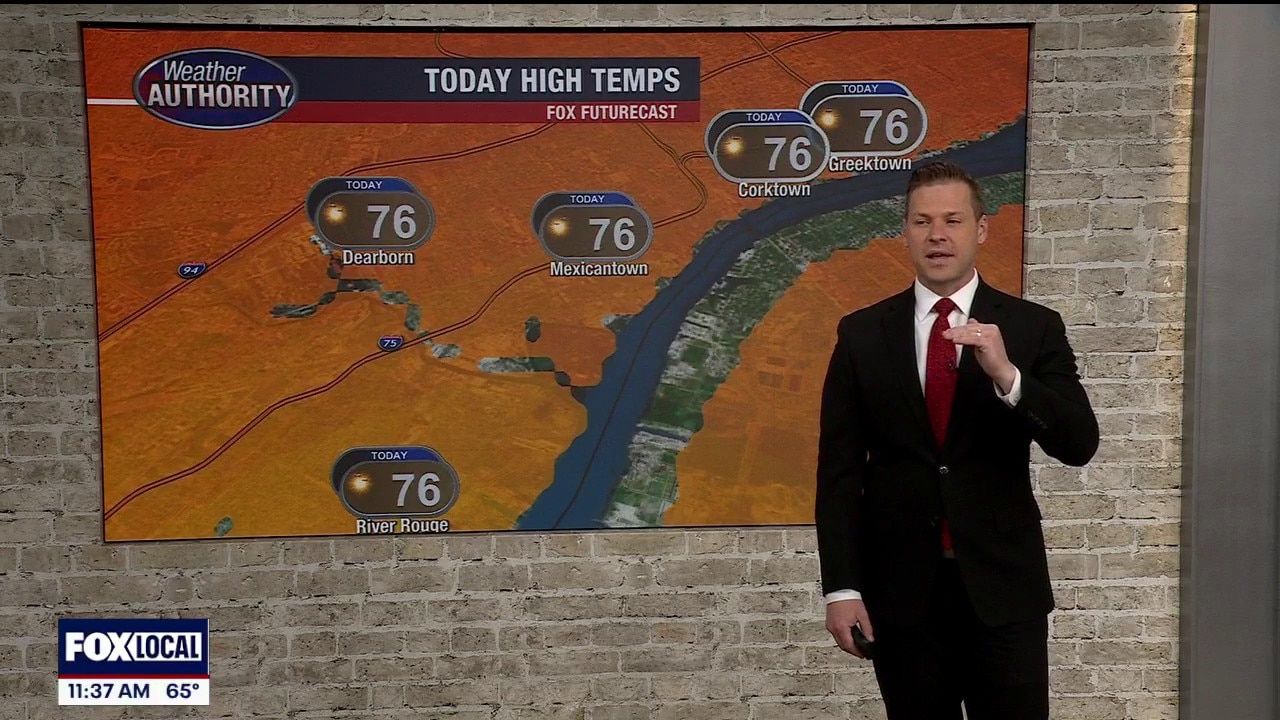
Metro Detroit weather: Temps take a small step back today, but the sun remains
We'll cool things down and keep the sun today in Metro Detroit.
We'll cool things down and keep the sun today in Metro Detroit.

A bit cooler but the sun remains
The temperature falls a bit today, but the sun sticks around in Metro Detroit.
The temperature falls a bit today, but the sun sticks around in Metro Detroit.
Another great warm day in store!
Small chance for an isolated shower this evening
Small chance for an isolated shower this evening


Metro Detroit weather: Another day in the 80s as nice, dry stretch continues
Metro Detroit's sweet stretch of weather keeps rolling with very few chances for rain over the next several days.
Metro Detroit's sweet stretch of weather keeps rolling with very few chances for rain over the next several days.
Rain chances remain low for next few days
A nice stretch of weather continues in Metro Detroit with rain chances staying low this week.
A nice stretch of weather continues in Metro Detroit with rain chances staying low this week.
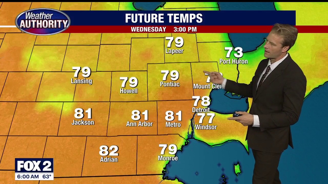
A warmer but not uncomfortable stretch ahead
Very low rain chances this week too
Very low rain chances this week too


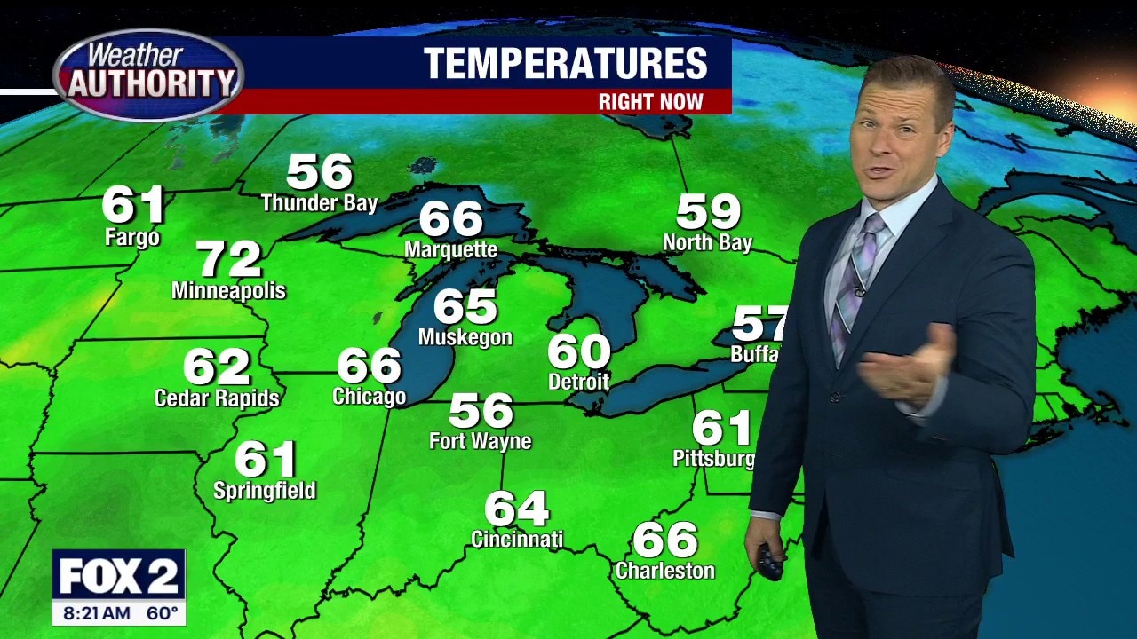
Metro Detroit weather: Warm but comfortable day ahead as humidity levels stay in check
Temperatures are climbing back into the 80s across Metro Detroit today, but thankfully the humidity won’t be nearly as intense as some of the sticky stretches we’ve dealt with recently.
Temperatures are climbing back into the 80s across Metro Detroit today, but thankfully the humidity won’t be nearly as intense as some of the sticky stretches we’ve dealt with recently.
A warmer day ahead
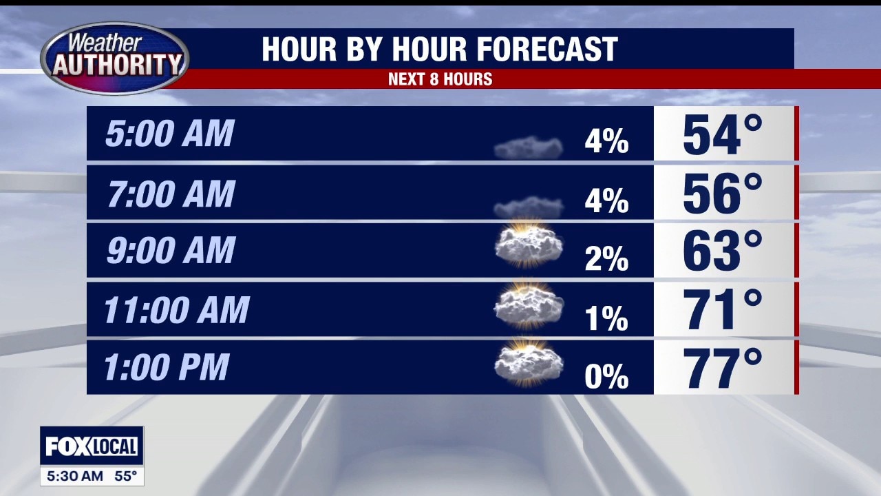
Rain chances remain low until late Wednesday
Rain chances remain low until late Wednesday
A very nice Memorial Day forecast
High temps, low rain chances and sunshine
High temps, low rain chances and sunshine
Warmer Memorial Day
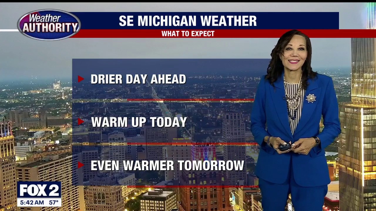
Drier day with decreasing clouds and warmer temperatures. Mainly dry week ahead. Meteorologist Lori Pinson has your forecast.
Drier day with decreasing clouds and warmer temperatures. Mainly dry week ahead. Meteorologist Lori Pinson has your forecast.
Rain is finally over and now a good end to the holiday
Temperatures start to climb finally too
Temperatures start to climb finally too
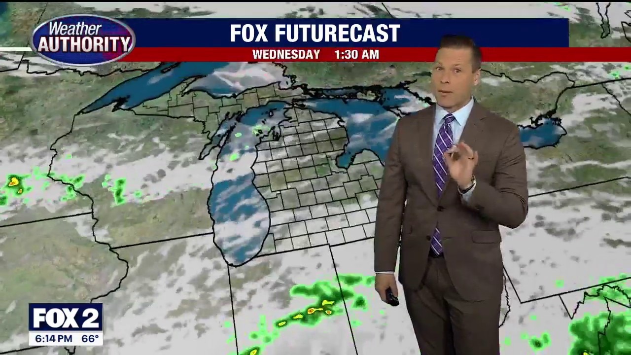
Pesky rain lingers for Sunday evening
Eventually it will move out and we'll have a better Monday
Eventually it will move out and we'll have a better Monday
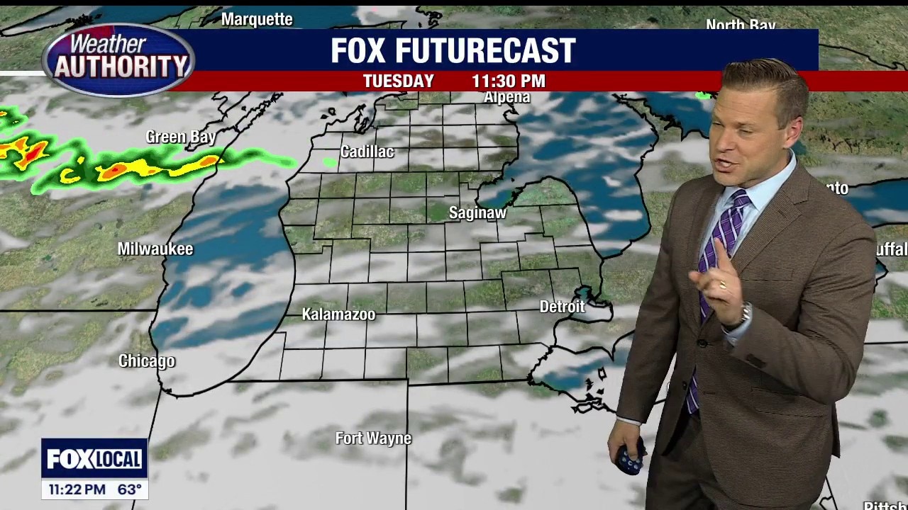
Storms Possible Today
Your Sunday starts out dry with the threat of storms by afternoon. Meteorologist Lori Pinson has your forecast.
Your Sunday starts out dry with the threat of storms by afternoon. Meteorologist Lori Pinson has your forecast.
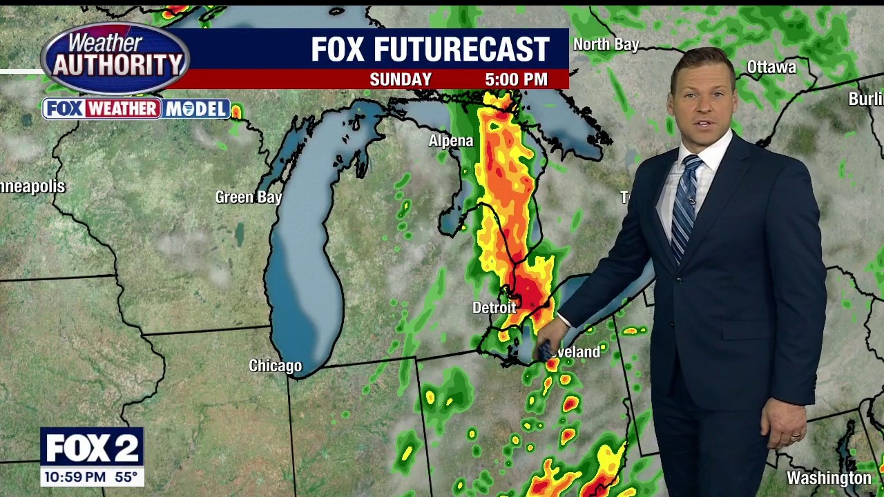
Sunday afternoon showers or storms likely
Temperatures begin to rise as well
Temperatures begin to rise as well
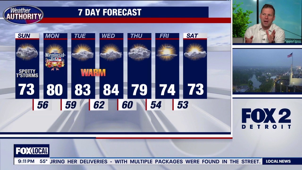
Warmup coming for Memorial Day, later in the week
Thunderstorms Sunday, but warm weather the rest of the week in the 7 day forecast.
Thunderstorms Sunday, but warm weather the rest of the week in the 7 day forecast.