

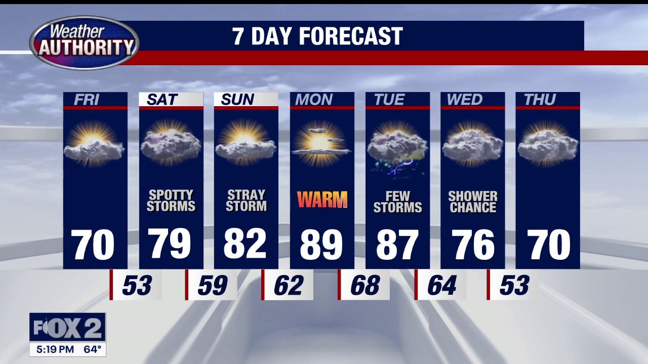
Warm and muggy weekend
A warm weekend with humidity. Storm chances will be around through the afternoon Saturday and Sunday.
A warm weekend with humidity. Storm chances will be around through the afternoon Saturday and Sunday.


Metro Detroit weather: Nice Friday ahead of a big weekend warm-up
A comfortable Friday leads into a warmer weekend, which sets the stage for a hot start to next week in Metro Detroit.
A comfortable Friday leads into a warmer weekend, which sets the stage for a hot start to next week in Metro Detroit.
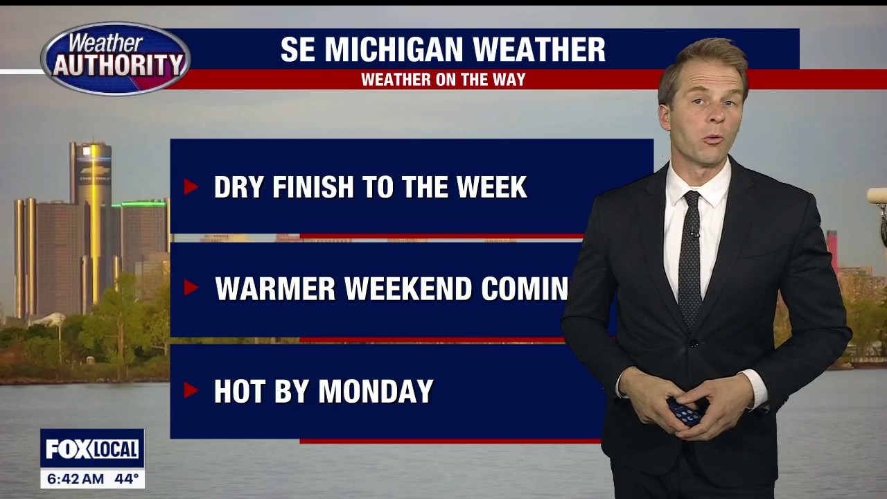
Comfortable, dry finish to the end of the week
A comfortable Friday leads into a warmer weekend, which sets the stage for a hot start to next week. Alan Longstreet breaks down the Metro Detroit weather forecast.
A comfortable Friday leads into a warmer weekend, which sets the stage for a hot start to next week. Alan Longstreet breaks down the Metro Detroit weather forecast.
Warm-up trend starts Friday with 80-degree temps for weekend
Rich Luterman has the forecast.
Rich Luterman has the forecast.


Metro Detroit weather: The warm-up is beginning
It will shape up to be a nice day in Metro Detroit, with even warmer weather ahead.
It will shape up to be a nice day in Metro Detroit, with even warmer weather ahead.
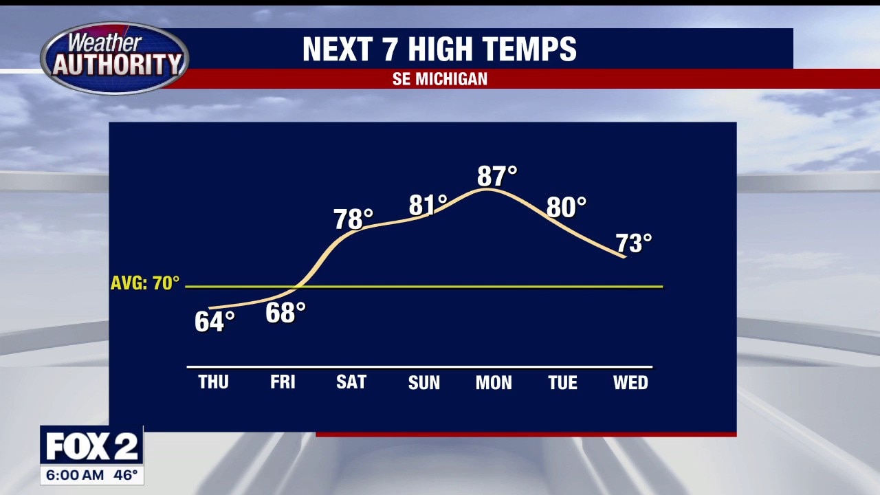
Warmer days ahead
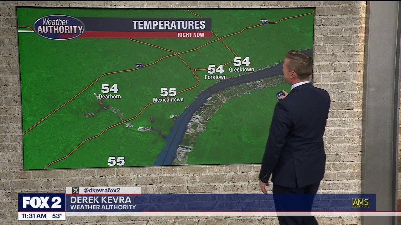
Temperatures are ticking up in Metro Detroit.
Temperatures are ticking up in Metro Detroit.
Warmer temps for Thursday
Rich Luterman has the forecast.
Rich Luterman has the forecast.
A cooler day ahead, with cloudy skies
Next chance for rain arrives this weekend
Next chance for rain arrives this weekend


Metro Detroit weather: Temperatures drop, but not for long
Temperatures drop today, the wind ramps up, and a fall feel takes over in Metro Detroit for a minute ahead of a big warmup.
Temperatures drop today, the wind ramps up, and a fall feel takes over in Metro Detroit for a minute ahead of a big warmup.
Temps fall Wednesday
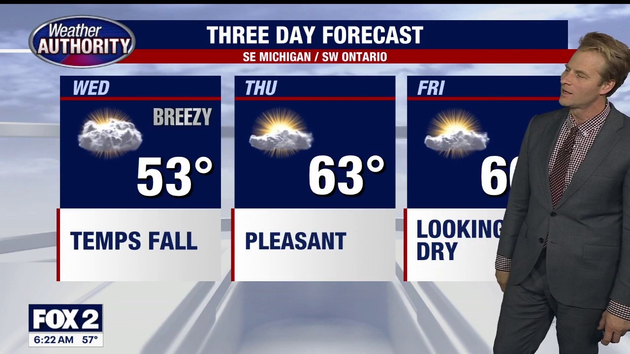
Temperatures drop today, but they head back up to wind down the week. Alan Longstreet has the full forecast, which includes some days in the 80s.
Temperatures drop today, but they head back up to wind down the week. Alan Longstreet has the full forecast, which includes some days in the 80s.
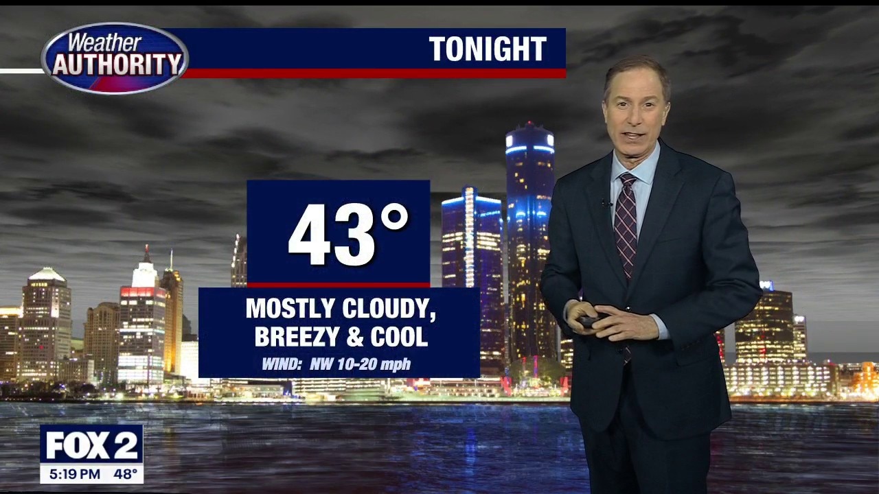
Cloudy breezy and cool for Wednesday
Rich Luterman has the forecast.
Rich Luterman has the forecast.
Rain chance today
Rain returns this afternoon! Highs will hit the upper 50s to lower 60s. Cooler and breezy Wednesday with highs in the upper 50s. Much warmer this weekend with highs in the 70s and 80s!
Rain returns this afternoon! Highs will hit the upper 50s to lower 60s. Cooler and breezy Wednesday with highs in the upper 50s. Much warmer this weekend with highs in the 70s and 80s!


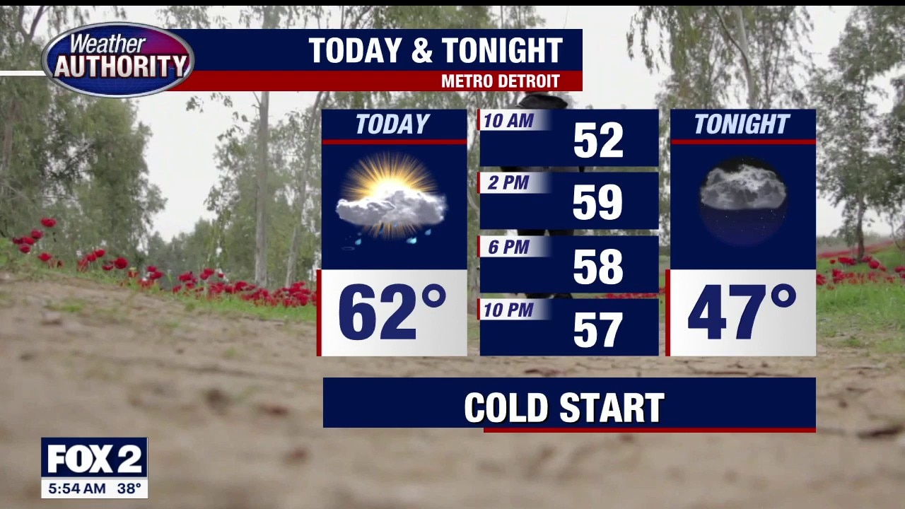
Metro Detroit weather: Cold and dry start before rain arrives later
The day starts dry and cold in Southeast Michigan before rain arrives later.
The day starts dry and cold in Southeast Michigan before rain arrives later.
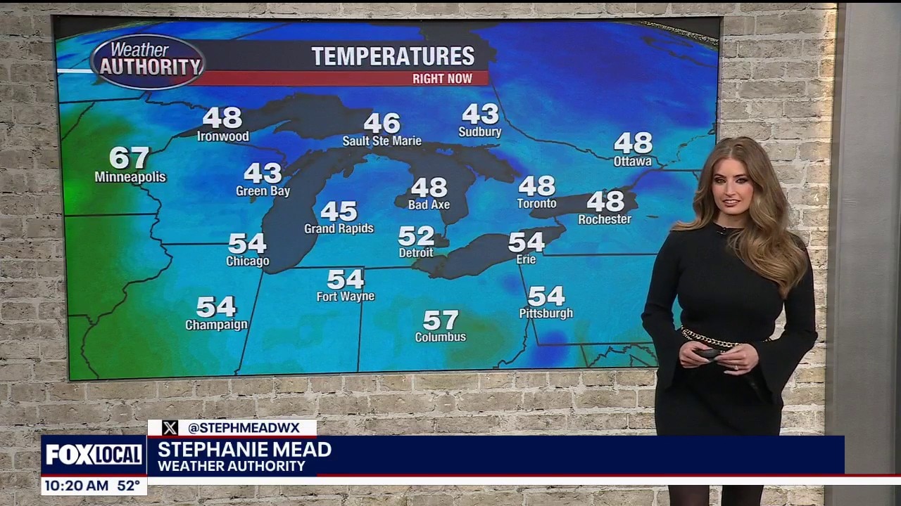
Cold Tuesday Start
Freeze Warning to our north includes Lapeer, Port Huron and Bad Axe, Frost Advisory for everyone else in southeast Michigan. Both expire at 8am. Rain moving in later today with a warming trend by the weekend. Meteorologist Lori Pinson has your forecast.
Freeze Warning to our north includes Lapeer, Port Huron and Bad Axe, Frost Advisory for everyone else in southeast Michigan. Both expire at 8am. Rain moving in later today with a warming trend by the weekend. Meteorologist Lori Pinson has your forecast.


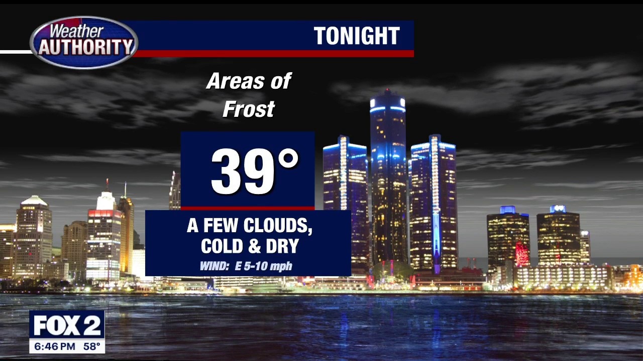
Frost advisory overnight into Tuesday, freeze warning for some SE Michigan counties
For the rest of Monday evening/overnight, a few clouds and cold and dry. Some areas of frost are expected with a low of 39.
For the rest of Monday evening/overnight, a few clouds and cold and dry. Some areas of frost are expected with a low of 39.
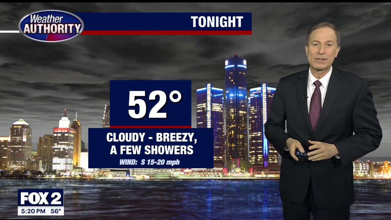
Mostly cloudy and late-day showers for Tuesday
Rich Luterman has the forecast.
Rich Luterman has the forecast.


Metro Detroit weather: Chilly start to the day ahead of a warmer week
It's a cool start to the week in Metro Detroit, but by the weekend we will be in the 70s.
It's a cool start to the week in Metro Detroit, but by the weekend we will be in the 70s.
Cold Monday Start
Frost Advisory to start your Monday with readings in the 30s. Cool, dry day ahead with milder temperatures and rain this week. Meteorologist Lori Pinson has your forecast.
Frost Advisory to start your Monday with readings in the 30s. Cool, dry day ahead with milder temperatures and rain this week. Meteorologist Lori Pinson has your forecast.
Frost advisory tonight, with near 80 degrees coming later in the week
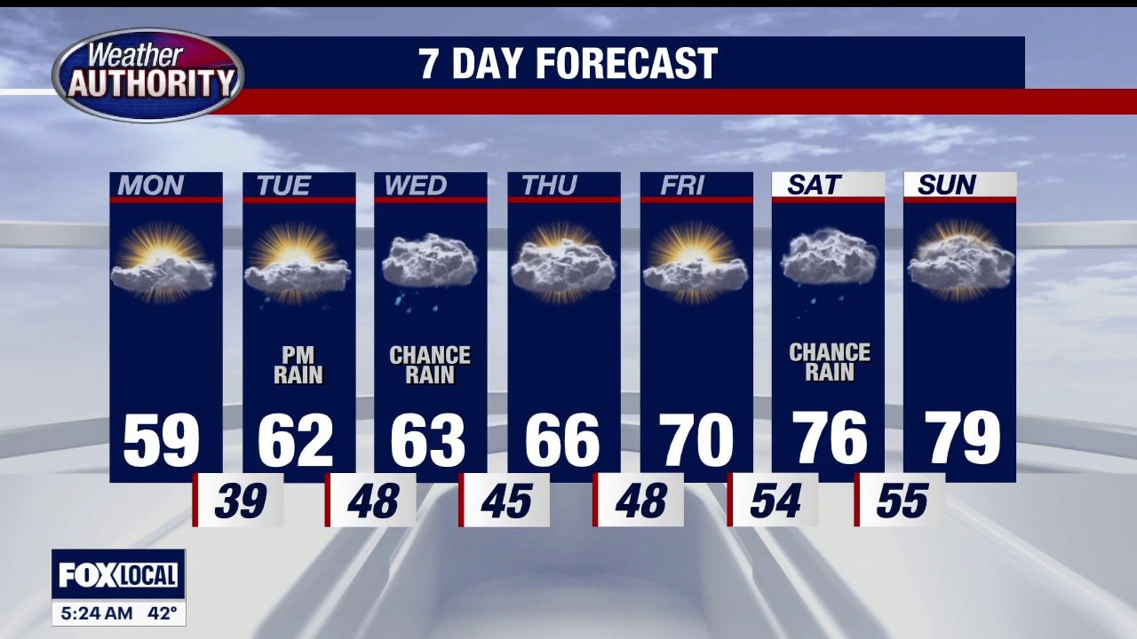
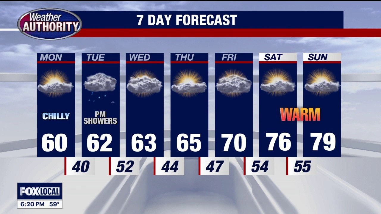
FROST ADVISORY IS IN EFFECT FOR THE OVERNIGHT across parts of SE Michigan…. Some spots may see lows dip into the lower 30’s. This COOLER pattern sticks around through Wednesday. Tuesday features some afternoon and evening rain showers with our next cold front. A NICE WARM-UP starts Friday and lasts into next week. Rest of Sunday evening / night…. Decreasing clouds… CHILLY…. Some areas of frost possible….. low 40 (colder away from the cities) Monday: Partly sunny… pleasant… high near 60 Tuesday: Mostly cloudy some PM rain showers… high 62 Wednesday: Mostly cloudy…. still cool… high 63 Thursday: Sun and clouds… high 65 Friday: Increasing clouds… MILDER…. High near 70 Saturday: Partly sunny… VERY NICE… high 76 Sunday: Partly sunny…. WARMER…. high 79
FROST ADVISORY IS IN EFFECT FOR THE OVERNIGHT across parts of SE Michigan…. Some spots may see lows dip into the lower 30’s. This COOLER pattern sticks around through Wednesday. Tuesday features some afternoon and evening rain showers with our next cold front. A NICE WARM-UP starts Friday and lasts into next week. Rest of Sunday evening / night…. Decreasing clouds… CHILLY…. Some areas of frost possible….. low 40 (colder away from the cities) Monday: Partly sunny… pleasant… high near 60 Tuesday: Mostly cloudy some PM rain showers… high 62 Wednesday: Mostly cloudy…. still cool… high 63 Thursday: Sun and clouds… high 65 Friday: Increasing clouds… MILDER…. High near 70 Saturday: Partly sunny… VERY NICE… high 76 Sunday: Partly sunny…. WARMER…. high 79

Mother's Day Forecast
Cooler with plenty of sunshine for Mom's Day. Rain by midweek. Meteorologist Lori Pinson has your forecast.
Cooler with plenty of sunshine for Mom's Day. Rain by midweek. Meteorologist Lori Pinson has your forecast.