


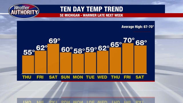
Cool end to the weekend
Mother's Day looks cool but dry! Cool start to the week with warmer temperatures by the end of the week.
Mother's Day looks cool but dry! Cool start to the week with warmer temperatures by the end of the week.
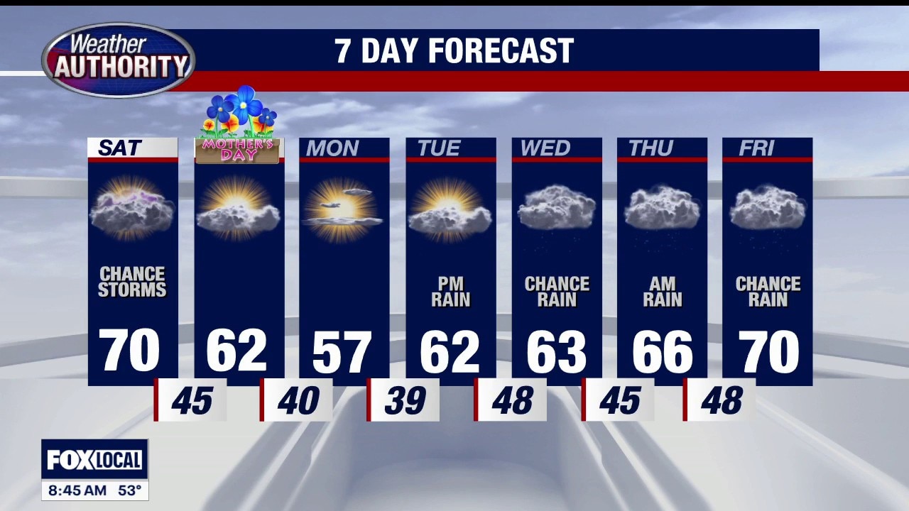
Storms Possible
Afternoon storms are possible producing gusty winds, small hail and isolated downpours. Dry and cooler Mother's Day. Meteorologist Lori Pinson has your forecast.
Afternoon storms are possible producing gusty winds, small hail and isolated downpours. Dry and cooler Mother's Day. Meteorologist Lori Pinson has your forecast.

Warmer Mother's Day weekend
A warm start to the weekend with an isolated storm chance Saturday afternoon. Highs will come close to 70°. Cooler but dry Mother's Day!
A warm start to the weekend with an isolated storm chance Saturday afternoon. Highs will come close to 70°. Cooler but dry Mother's Day!
Weekend weather showing improvement every day
Mother's Day looking cool but dry!
Mother's Day looking cool but dry!

Metro Detroit weather: A cool start but a nice stretch of weather is arriving
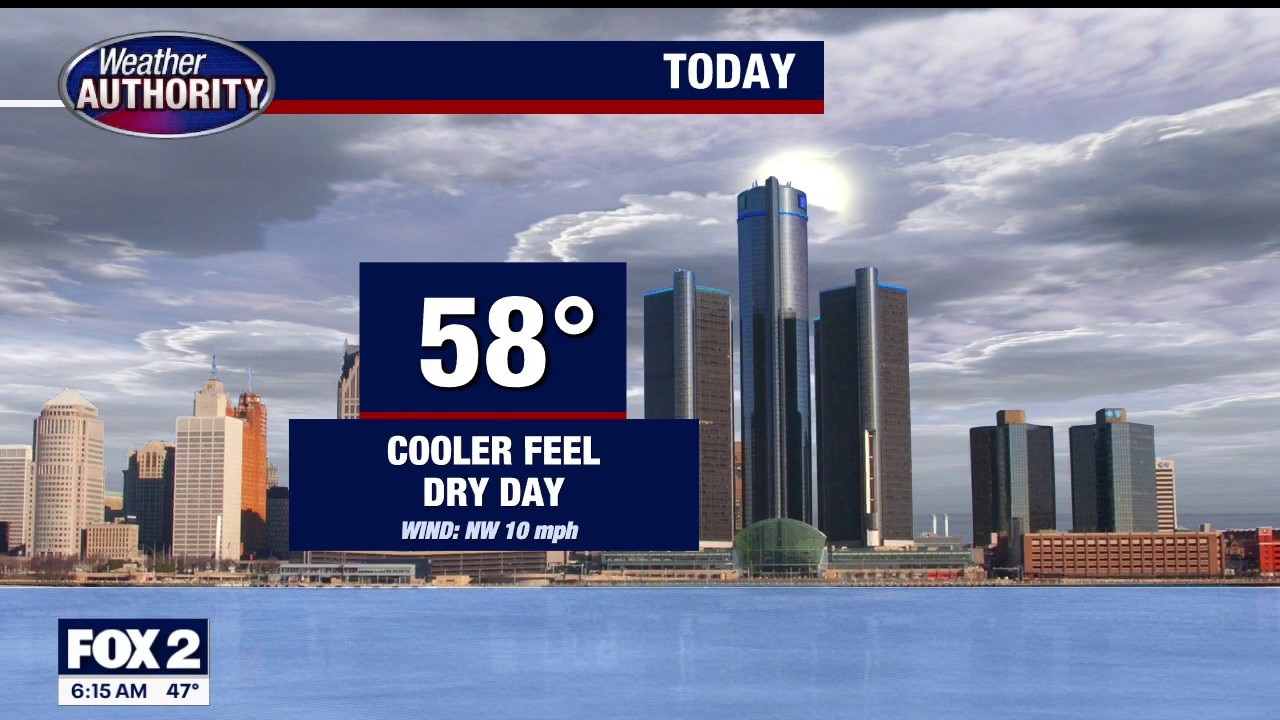
It’s cold and sunny to start the day, but Metro Detroit will climb into the 60s this afternoon under partly sunny skies. It'll feel better than what we’ve had lately.
It’s cold and sunny to start the day, but Metro Detroit will climb into the 60s this afternoon under partly sunny skies. It'll feel better than what we’ve had lately.
Another cool start to the day
It's another cold start to the day, but we will warm up some later.
It's another cold start to the day, but we will warm up some later.
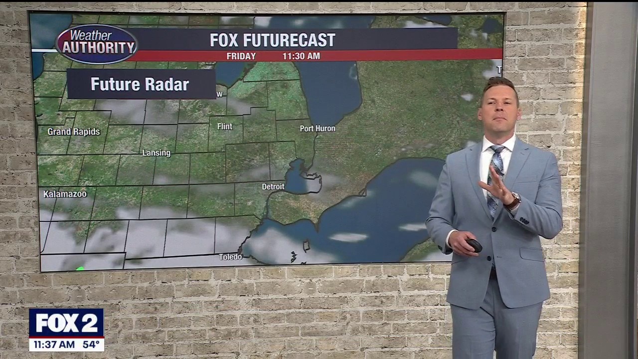
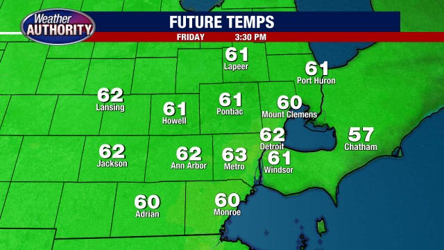
Partly sunny and pleasant for Friday
Rich Luterman has the forecast.
Rich Luterman has the forecast.
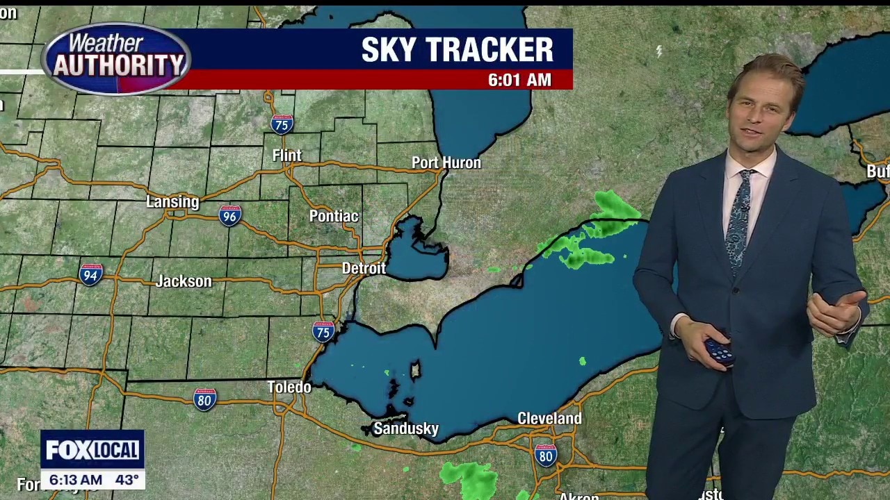
Another cooler, cloudy day ahead
Some spotty light showers are not impossible either
Some spotty light showers are not impossible either

Metro Detroit weather: Another cool day, but warmer temps are ahead
The cool keeps coming, but a warmup is on the way in Metro Detroit.
The cool keeps coming, but a warmup is on the way in Metro Detroit.
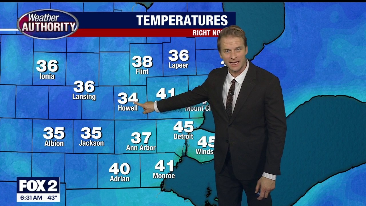
Cooler start to the day
It's a chilly start to Thursday in Metro Detroit.
It's a chilly start to Thursday in Metro Detroit.
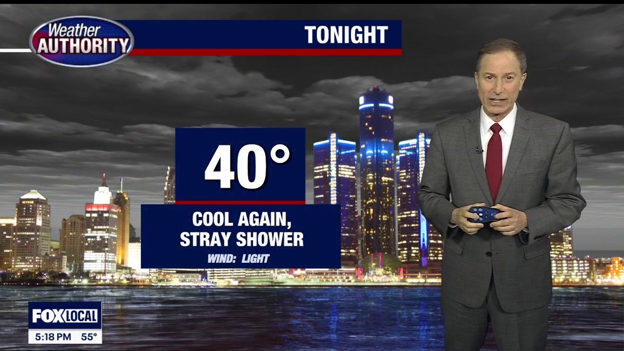
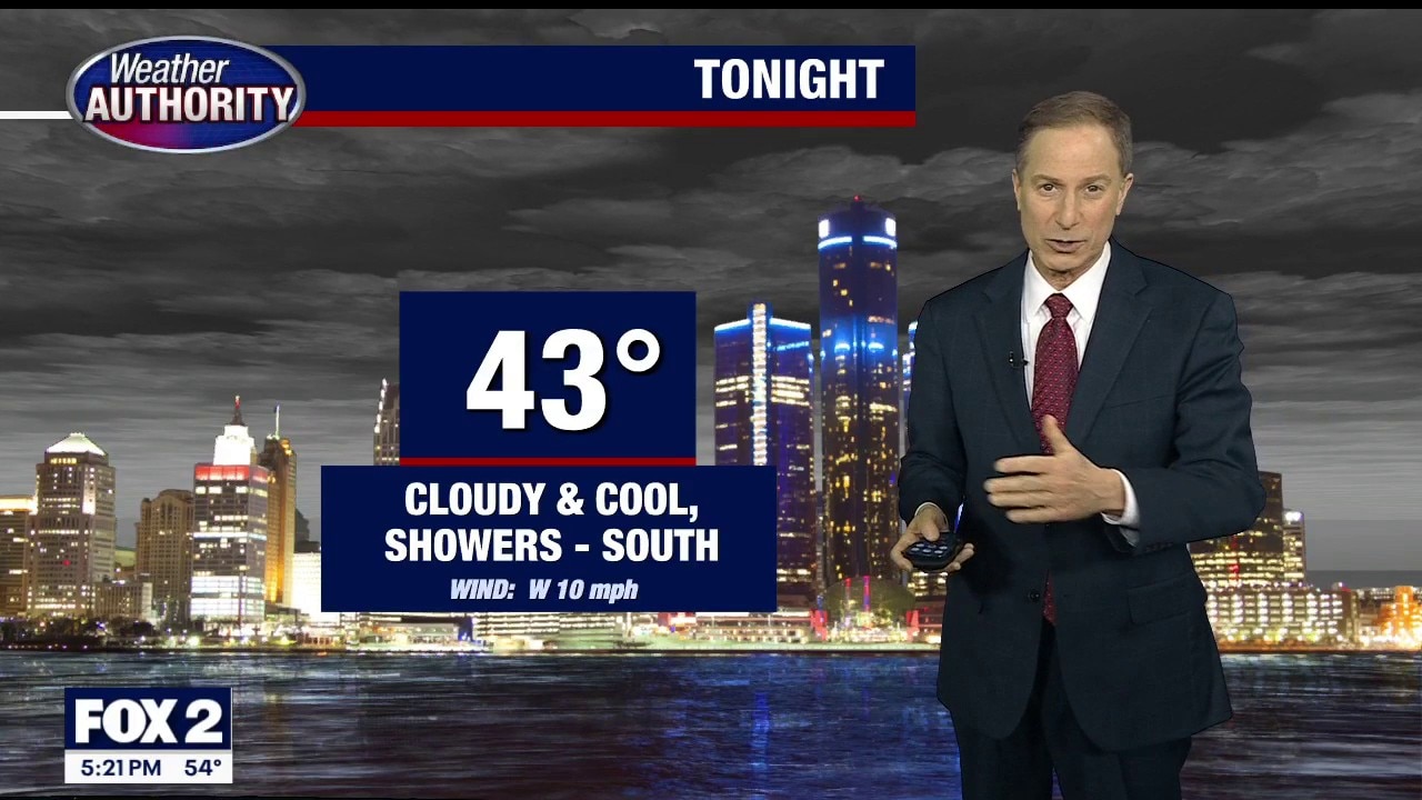
Cool stretch continues
A cool day today with highs in the upper 50s. Chilly tonight with lows in the upper 30s! Cool with a spotty afternoon shower chance Thursday!
A cool day today with highs in the upper 50s. Chilly tonight with lows in the upper 30s! Cool with a spotty afternoon shower chance Thursday!
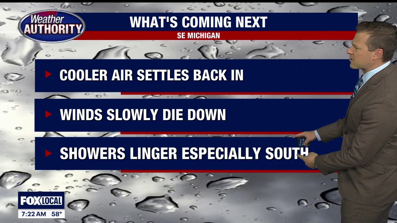
Rain finally subsides, cooler temps continue
Alan Longstreet has the forecast.
Alan Longstreet has the forecast.


Metro Detroit Weather: Cool temperatures linger, but rain ends Wednesday
Highs stay stuck in the 50s this afternoon under mostly cloudy skies after a little early sunshine.
Highs stay stuck in the 50s this afternoon under mostly cloudy skies after a little early sunshine.
Cloudy and chilly for Wednesday
Rich Luterman has the forecast.
Rich Luterman has the forecast.
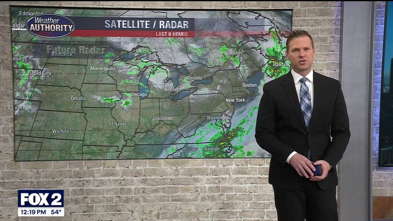
Some showers are still possible today
But not strong or severe storms like Monday
But not strong or severe storms like Monday


Metro Detroit weather: Mild and rainy before temps drop below seasonal for the rest of the week
Rain moves out in the morning but is expected to return to Metro Detroit later in the day.
Rain moves out in the morning but is expected to return to Metro Detroit later in the day.
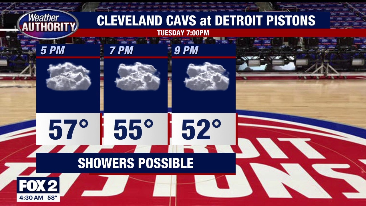
Tuesday Showers
Scattered showers this morning with redevelopment expected this afternoon. Cooler and breezy. Meteorologist Lori Pinson has your forecast.
Scattered showers this morning with redevelopment expected this afternoon. Cooler and breezy. Meteorologist Lori Pinson has your forecast.
Cloudy and cooler with rain showers Tuesday
Rich Luterman has the forecast.
Rich Luterman has the forecast.


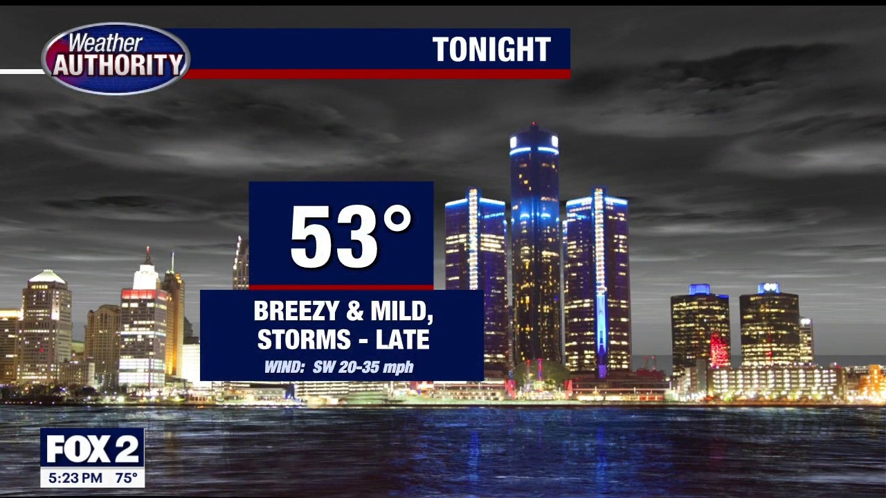
Thunderstorms take aim at Southeast Michigan Monday night
The risk of thunderstorms in Metro Detroit will be greatest around 9 p.m.
The risk of thunderstorms in Metro Detroit will be greatest around 9 p.m.


Metro Detroit weather: Highs in the 70s Monday before a cold front arrives
Monday will be warm with rain later in the day in Metro Detroit.
Monday will be warm with rain later in the day in Metro Detroit.