

Rainy Saturday, but looking nice for Memorial Day, after
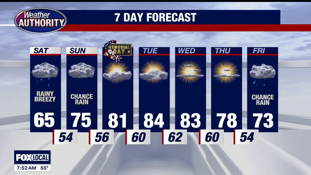
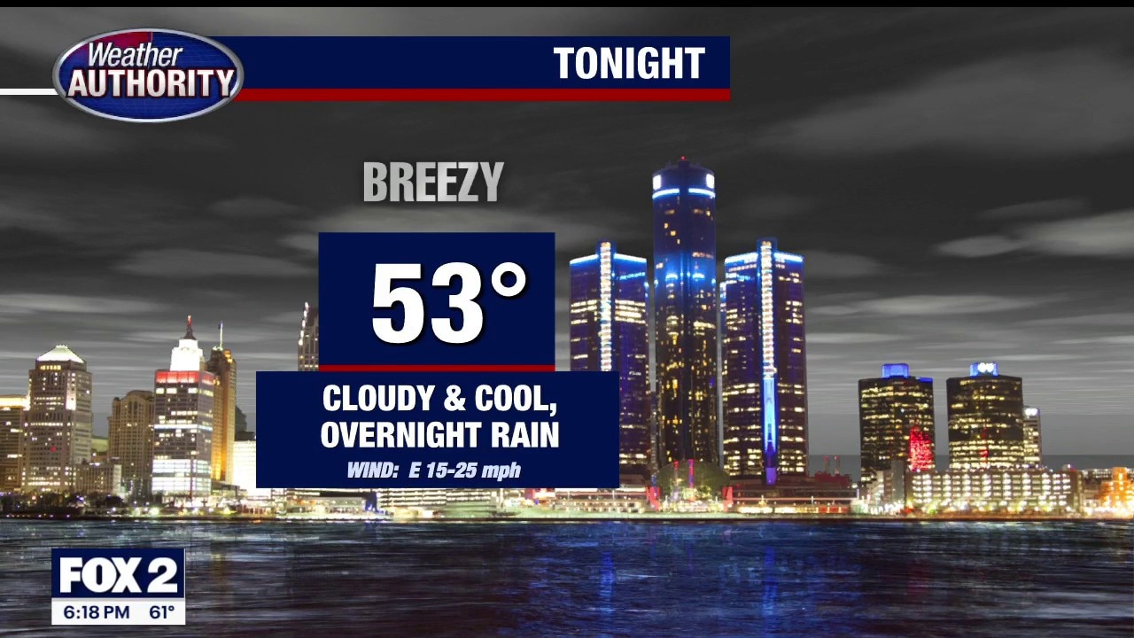
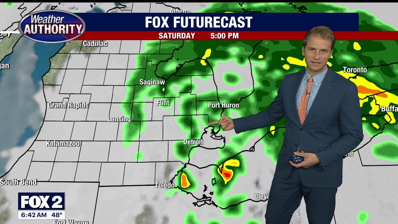
HERE'S ANOTHER LIVE LOOK OUTSIDE ON THIS RAINY SATURDAY EVENING. A QUARTER TO A HALF-INCH OF RAIN TODAY. TONIGHT... COOL AND CLOUDY WITH SOME LINGERING SPRINKLES. LOW TONIGHT IN THE LOW 50'S. TOMORROW... IT'S GOING TO BE CLOUDY... BUT WARMER... AND WITH LESS RAIN. THERE IS A CHANCE FOR SOME AFTERNOON SHOWERS. HIGH IN THE MIDDLE 70'S. BUT JUST WAIT FOR MONDAY. THE UNOFFICIAL START OF SUMMER WILL FEEL LIKE IT. TEMPERATURES... NEAR 80 DEGREES FOR MEMORIAL DAY. A MIX OF SUN AND CLOUDS. MONDAY THROUGH FRIDAY LOOKS LIKE A VERY NICE STRETCH OF WEATHER... WITH HIGHS IN THE 80'S. HEAD TO 'FOX-TWO DETROIT DOT-COM' FOR MUCH MORE ON THE FORECAST FOR TONIGHT... AND THE DAYS AHEAD.
HERE'S ANOTHER LIVE LOOK OUTSIDE ON THIS RAINY SATURDAY EVENING. A QUARTER TO A HALF-INCH OF RAIN TODAY. TONIGHT... COOL AND CLOUDY WITH SOME LINGERING SPRINKLES. LOW TONIGHT IN THE LOW 50'S. TOMORROW... IT'S GOING TO BE CLOUDY... BUT WARMER... AND WITH LESS RAIN. THERE IS A CHANCE FOR SOME AFTERNOON SHOWERS. HIGH IN THE MIDDLE 70'S. BUT JUST WAIT FOR MONDAY. THE UNOFFICIAL START OF SUMMER WILL FEEL LIKE IT. TEMPERATURES... NEAR 80 DEGREES FOR MEMORIAL DAY. A MIX OF SUN AND CLOUDS. MONDAY THROUGH FRIDAY LOOKS LIKE A VERY NICE STRETCH OF WEATHER... WITH HIGHS IN THE 80'S. HEAD TO 'FOX-TWO DETROIT DOT-COM' FOR MUCH MORE ON THE FORECAST FOR TONIGHT... AND THE DAYS AHEAD.
Rainy Saturday Start
Scattered showers to start your Saturday. Remaining overcast with a chance for storms late Sunday. Dry for the holiday. Meteorologist Lori Pinson has your forecast
Scattered showers to start your Saturday. Remaining overcast with a chance for storms late Sunday. Dry for the holiday. Meteorologist Lori Pinson has your forecast
Shower chance over Memorial Day weekend
Rich Luterman has the forecast.
Rich Luterman has the forecast.


Memorial Day weather: Rainy, cool start to the holiday weekend before temps head up
It will be a wet, rainy, and cool start to Memorial Day weekend in Metro Detroit.
It will be a wet, rainy, and cool start to Memorial Day weekend in Metro Detroit.
Rain moves in tonight to start the holiday weekend
Rain later Friday will continue into Saturday, but it won't be a total washout this Memorial Day weekend.
Rain later Friday will continue into Saturday, but it won't be a total washout this Memorial Day weekend.
Mostly cloudy with evening shower on Friday
Rich Luterman has the forecast.
Rich Luterman has the forecast.


Metro Detroit weather forecast: Another chilly day, but warmer temps are ahead for Memorial Day weekend
It's another chilly day, but by the end of the weekend in Metro Detroit, temps are back to the 70s just in time for Memorial Day.
It's another chilly day, but by the end of the weekend in Metro Detroit, temps are back to the 70s just in time for Memorial Day.
Another chilly day in Metro Detroit
It's going to be chilly out there again, but the warmup is just around the corner.
It's going to be chilly out there again, but the warmup is just around the corner.
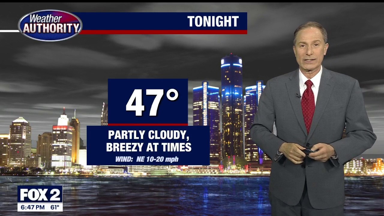
Chilly night
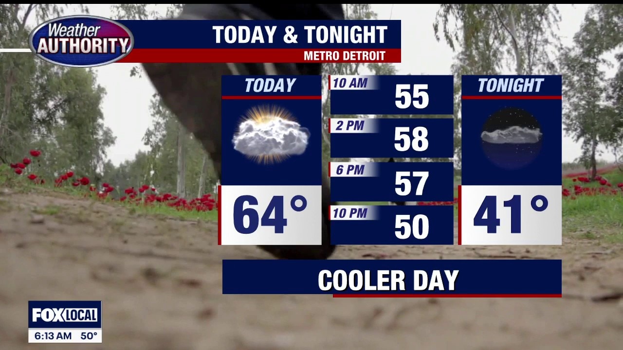
Chilly night with lows in the upper 30s to lower 40s. Mild day with highs in the mid 60s. Showers and 70s return this weekend.
Chilly night with lows in the upper 30s to lower 40s. Mild day with highs in the mid 60s. Showers and 70s return this weekend.
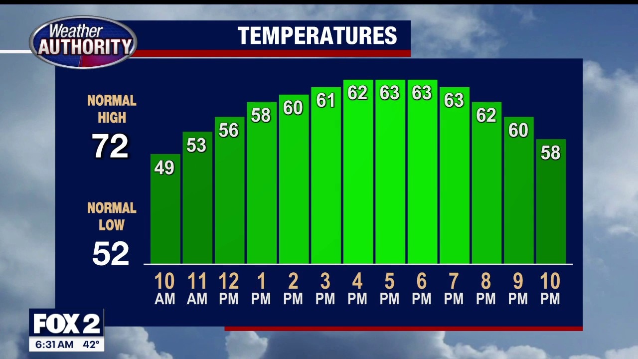
A much cooler stretch of weather
Rain chances remain low until the weekend
Rain chances remain low until the weekend


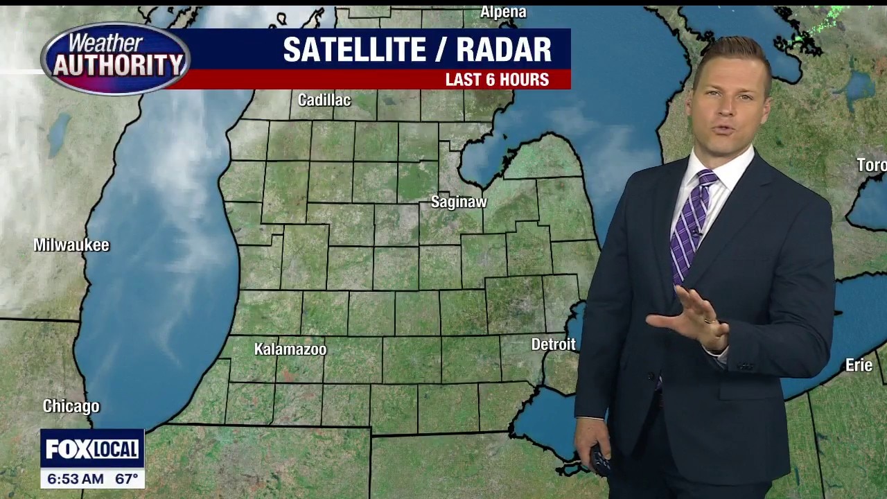
Metro Detroit weather: Cool, quiet, and dry Wednesday
After severe weather to start the week, a much quieter day is ahead in Southeast Michigan.
After severe weather to start the week, a much quieter day is ahead in Southeast Michigan.
Cooler Dry Wednesday
Storms have moved east leaving cooler and drier air in its wake. Next chance for rain is Friday evening. Meteorologist Lori Pinson has your forecast.
Storms have moved east leaving cooler and drier air in its wake. Next chance for rain is Friday evening. Meteorologist Lori Pinson has your forecast.
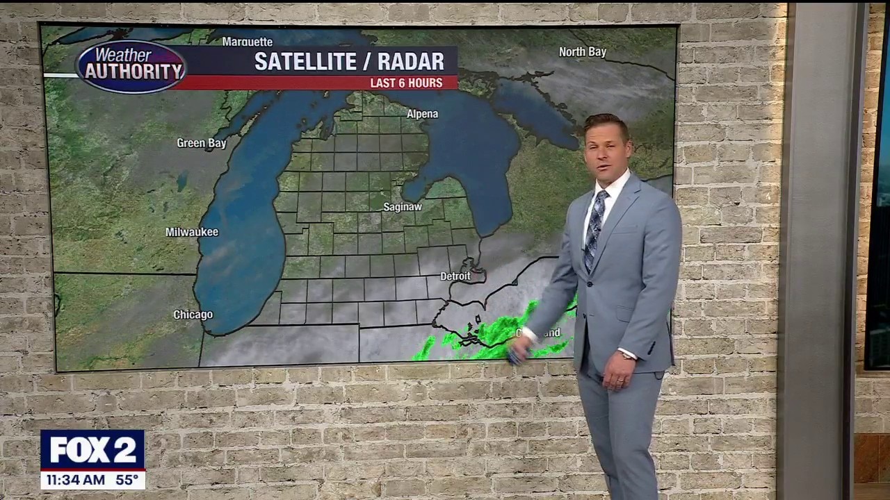
Afternoon storm risk
Storm chances this afternoon between 2-7pm. Winds, hail and an isolated tornado are the main threats. Highs will hit the mid to upper 80s! Cooler mid to late week with highs in the 60s through Friday!
Storm chances this afternoon between 2-7pm. Winds, hail and an isolated tornado are the main threats. Highs will hit the mid to upper 80s! Cooler mid to late week with highs in the 60s through Friday!
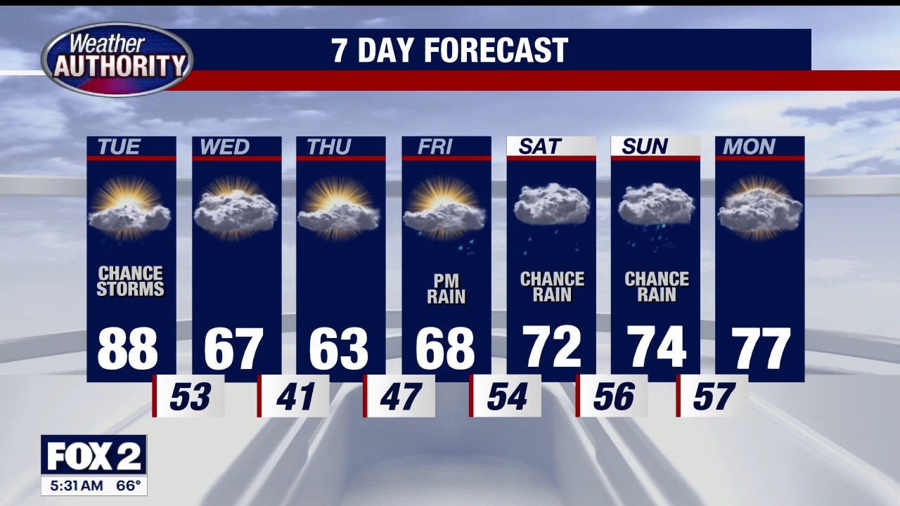
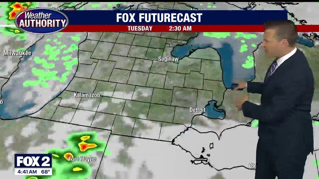
Storms Possible Today
Afternoon storms possible, then cooler air tomorrow. Meteorologist Lori Pinson has your forecast.
Afternoon storms possible, then cooler air tomorrow. Meteorologist Lori Pinson has your forecast.
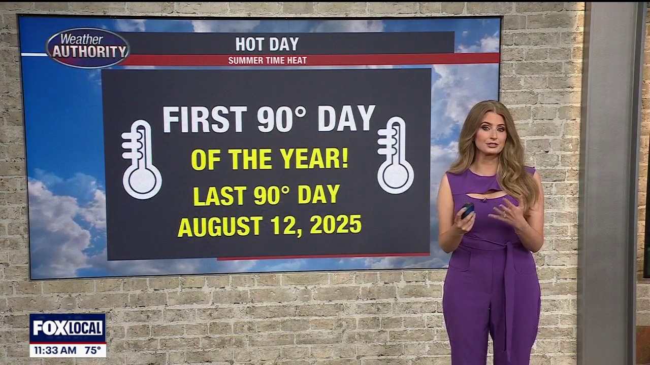
A very summer like day in Metro Detroit, humid start to the week
The warmth and humidity will also help fuel the chance for thunderstorms later today. A few spotty storms could begin developing after approximately 3 PM as we enter our primary severe weather window, which will continue through about 9 PM. Not everyone will see severe weather, but any storm that becomes stronger could quickly produce large hail, gusty winds, torrential downpours, frequent lightning, and loud thunder. An isolated tornado also cannot be ruled out today, especially during the late afternoon and early evening hours.
The warmth and humidity will also help fuel the chance for thunderstorms later today. A few spotty storms could begin developing after approximately 3 PM as we enter our primary severe weather window, which will continue through about 9 PM. Not everyone will see severe weather, but any storm that becomes stronger could quickly produce large hail, gusty winds, torrential downpours, frequent lightning, and loud thunder. An isolated tornado also cannot be ruled out today, especially during the late afternoon and early evening hours.
Severe Weather Possible Monday
Gusty winds, large hail and an isolated tornado is possible
Gusty winds, large hail and an isolated tornado is possible
Warm with isolated storm chances
A warm end to the weekend with highs in the lower 80s! Isolated strong to severe storms are possible during the afternoon. Better chance for storms Monday afternoon with highs nearing 90°!
A warm end to the weekend with highs in the lower 80s! Isolated strong to severe storms are possible during the afternoon. Better chance for storms Monday afternoon with highs nearing 90°!

Stormy Saturday Start
Heavy rain to start your Saturday with afternoon high temperatures expected to rise near 80 degrees. Meteorologist Lori Pinson has your forecast.
Heavy rain to start your Saturday with afternoon high temperatures expected to rise near 80 degrees. Meteorologist Lori Pinson has your forecast.
Warm and muggy weekend
A warm weekend with humidity. Storm chances will be around through the afternoon Saturday and Sunday.
A warm weekend with humidity. Storm chances will be around through the afternoon Saturday and Sunday.


Metro Detroit weather: Nice Friday ahead of a big weekend warm-up
A comfortable Friday leads into a warmer weekend, which sets the stage for a hot start to next week in Metro Detroit.
A comfortable Friday leads into a warmer weekend, which sets the stage for a hot start to next week in Metro Detroit.