



Metro Detroit weather forecast: Another chilly day, but warmer temps are ahead for Memorial Day weekend
It's another chilly day, but by the end of the weekend in Metro Detroit, temps are back to the 70s just in time for Memorial Day.
It's another chilly day, but by the end of the weekend in Metro Detroit, temps are back to the 70s just in time for Memorial Day.
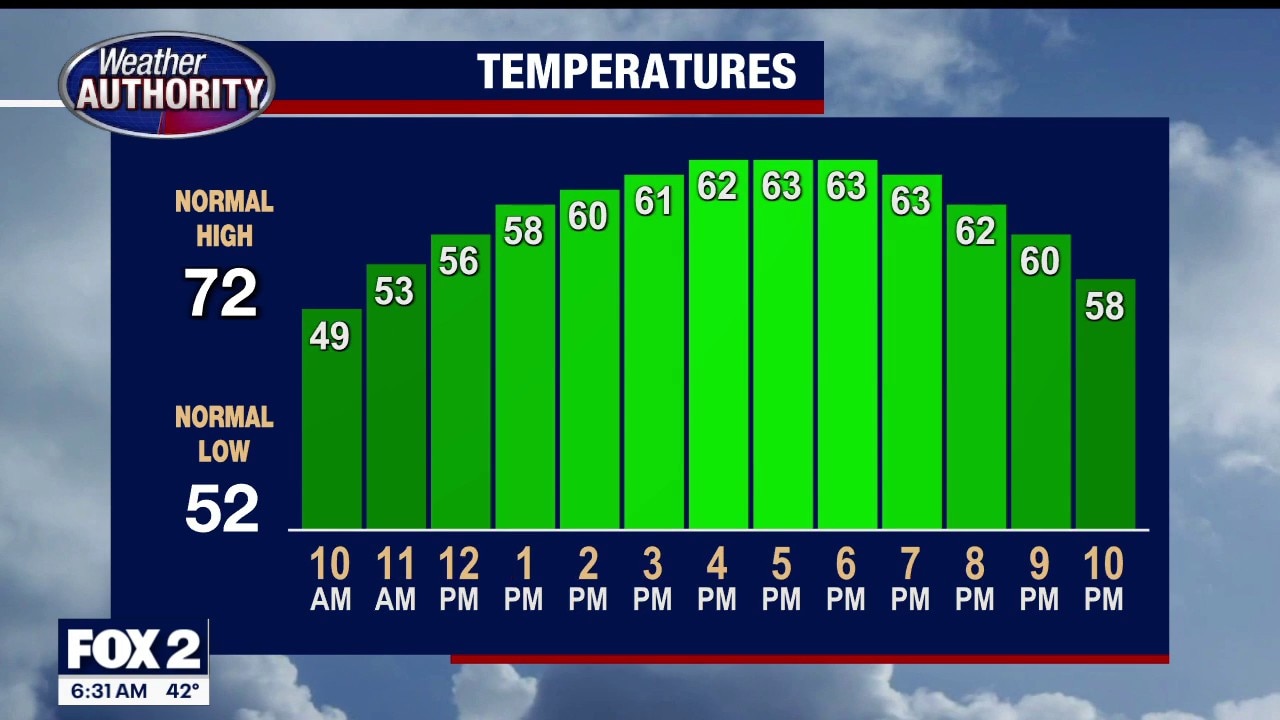
Another chilly day in Metro Detroit
It's going to be chilly out there again, but the warmup is just around the corner.
It's going to be chilly out there again, but the warmup is just around the corner.

Chilly night
Chilly night with lows in the upper 30s to lower 40s. Mild day with highs in the mid 60s. Showers and 70s return this weekend.
Chilly night with lows in the upper 30s to lower 40s. Mild day with highs in the mid 60s. Showers and 70s return this weekend.
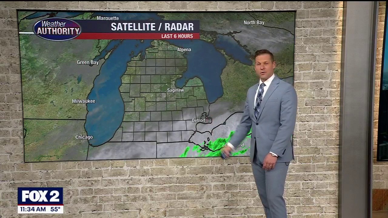
A much cooler stretch of weather
Rain chances remain low until the weekend
Rain chances remain low until the weekend


Metro Detroit weather: Cool, quiet, and dry Wednesday
After severe weather to start the week, a much quieter day is ahead in Southeast Michigan.
After severe weather to start the week, a much quieter day is ahead in Southeast Michigan.

Cooler Dry Wednesday
Storms have moved east leaving cooler and drier air in its wake. Next chance for rain is Friday evening. Meteorologist Lori Pinson has your forecast.
Storms have moved east leaving cooler and drier air in its wake. Next chance for rain is Friday evening. Meteorologist Lori Pinson has your forecast.


Worst Hawaii flooding in decades disrupts farms and produce markets
Hawaii's farming industry is struggling to recover after March storms produced the worst flooding the state has seen in 20 years. The natural disaster has dealt a serious blow to local food supply chains, with state officials urging farmers not to give up.
Hawaii's farming industry is struggling to recover after March storms produced the worst flooding the state has seen in 20 years. The natural disaster has dealt a serious blow to local food supply chains, with state officials urging farmers not to give up.
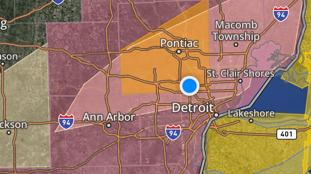

Southeast Michigan storms: Tracking severe thunderstorms on Tuesday, May 19
Another severe weather threat is landing on Southeast Michigan as thunderstorms are possible throughout the afternoon.
Another severe weather threat is landing on Southeast Michigan as thunderstorms are possible throughout the afternoon.
Afternoon storm risk
Storm chances this afternoon between 2-7pm. Winds, hail and an isolated tornado are the main threats. Highs will hit the mid to upper 80s! Cooler mid to late week with highs in the 60s through Friday!
Storm chances this afternoon between 2-7pm. Winds, hail and an isolated tornado are the main threats. Highs will hit the mid to upper 80s! Cooler mid to late week with highs in the 60s through Friday!


More possible storms coming to Southeast Michigan after Monday's severe weather
We’re watching the advance of a cold front that is expected to move off to the east as it moves throughout the state Tuesday. It’s sweeping through and trying to switch that southwesterly flow to more of a west-northwest flow, which will bring in some cooler, drier air.
We’re watching the advance of a cold front that is expected to move off to the east as it moves throughout the state Tuesday. It’s sweeping through and trying to switch that southwesterly flow to more of a west-northwest flow, which will bring in some cooler, drier air.

Storms Possible Today
Afternoon storms possible, then cooler air tomorrow. Meteorologist Lori Pinson has your forecast.
Afternoon storms possible, then cooler air tomorrow. Meteorologist Lori Pinson has your forecast.


DTE Outages in Southeast Michigan: Thousands lose power after severe weather
Power outages are popping up after one round of storms struck Southeast Michigan on Monday. With more bad weather on the way this week in Michigan, severe weather could cause more homes to lose electricity.
Power outages are popping up after one round of storms struck Southeast Michigan on Monday. With more bad weather on the way this week in Michigan, severe weather could cause more homes to lose electricity.

Metro Detroit storm watch: Severe Thunderstorms on Monday, May 18
A severe thunderstorm watch is in place for most of southern Michigan on Monday, May 18, with warnings expected to follow.
A severe thunderstorm watch is in place for most of southern Michigan on Monday, May 18, with warnings expected to follow.

Humid start to the week in Southeast Michigan with possible severe afternoon storms
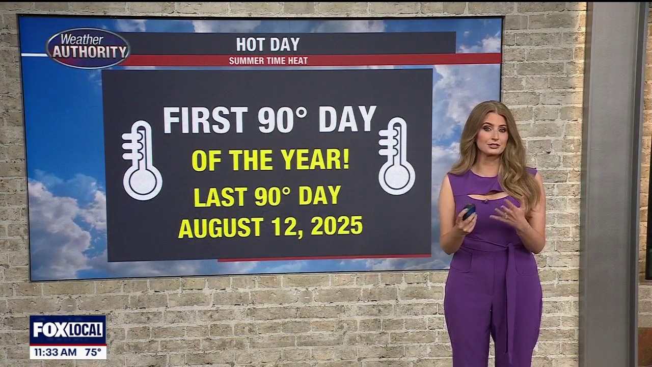
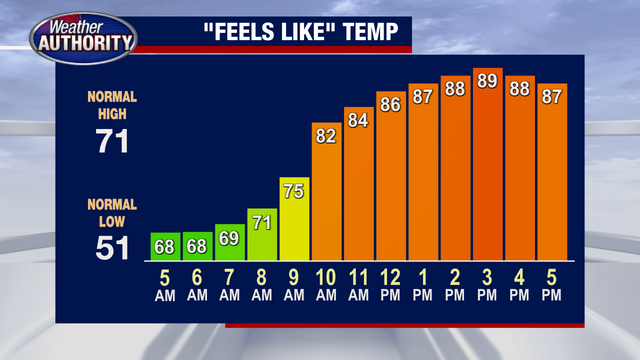
If it feels more like July than May today, you’re not imagining it. Southeast Michigan is in for a very warm and humid stretch to start the week, with temperatures making a run toward 90 degrees this afternoon and heat index values climbing into the lower 90s. It will easily be one of the hottest and most humid days we’ve seen so far this year.
If it feels more like July than May today, you’re not imagining it. Southeast Michigan is in for a very warm and humid stretch to start the week, with temperatures making a run toward 90 degrees this afternoon and heat index values climbing into the lower 90s. It will easily be one of the hottest and most humid days we’ve seen so far this year.
A very summer like day in Metro Detroit, humid start to the week
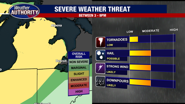
The warmth and humidity will also help fuel the chance for thunderstorms later today. A few spotty storms could begin developing after approximately 3 PM as we enter our primary severe weather window, which will continue through about 9 PM. Not everyone will see severe weather, but any storm that becomes stronger could quickly produce large hail, gusty winds, torrential downpours, frequent lightning, and loud thunder. An isolated tornado also cannot be ruled out today, especially during the late afternoon and early evening hours.
The warmth and humidity will also help fuel the chance for thunderstorms later today. A few spotty storms could begin developing after approximately 3 PM as we enter our primary severe weather window, which will continue through about 9 PM. Not everyone will see severe weather, but any storm that becomes stronger could quickly produce large hail, gusty winds, torrential downpours, frequent lightning, and loud thunder. An isolated tornado also cannot be ruled out today, especially during the late afternoon and early evening hours.
Severe Weather Possible Monday
Gusty winds, large hail and an isolated tornado is possible
Gusty winds, large hail and an isolated tornado is possible

Tornado Warning issued in northern Michigan
A Tornado Warning, set to expire at 7:30 p.m. has been issued for Sanilac County, per the National Weather Service.
A Tornado Warning, set to expire at 7:30 p.m. has been issued for Sanilac County, per the National Weather Service.
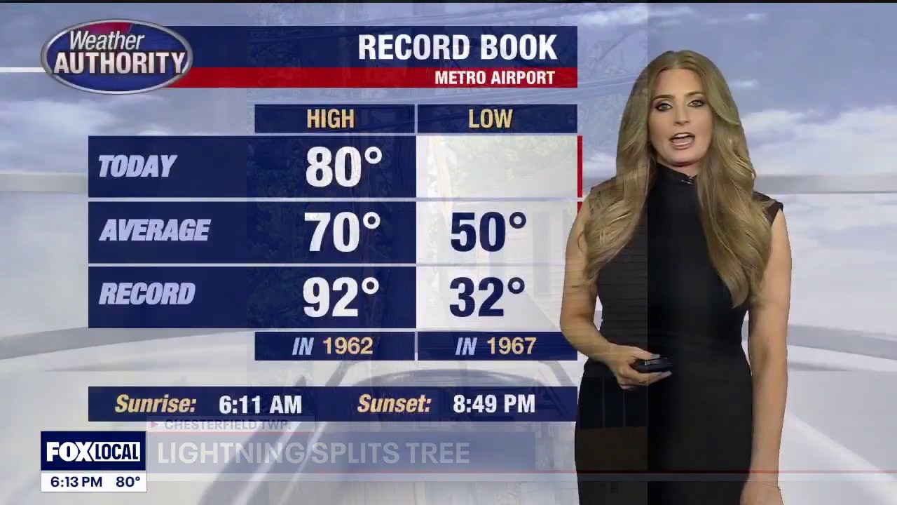
Warm with isolated storm chances
A warm end to the weekend with highs in the lower 80s! Isolated strong to severe storms are possible during the afternoon. Better chance for storms Monday afternoon with highs nearing 90°!
A warm end to the weekend with highs in the lower 80s! Isolated strong to severe storms are possible during the afternoon. Better chance for storms Monday afternoon with highs nearing 90°!

Stormy Saturday Start
Heavy rain to start your Saturday with afternoon high temperatures expected to rise near 80 degrees. Meteorologist Lori Pinson has your forecast.
Heavy rain to start your Saturday with afternoon high temperatures expected to rise near 80 degrees. Meteorologist Lori Pinson has your forecast.

Warm and muggy weekend
A warm weekend with humidity. Storm chances will be around through the afternoon Saturday and Sunday.
A warm weekend with humidity. Storm chances will be around through the afternoon Saturday and Sunday.