

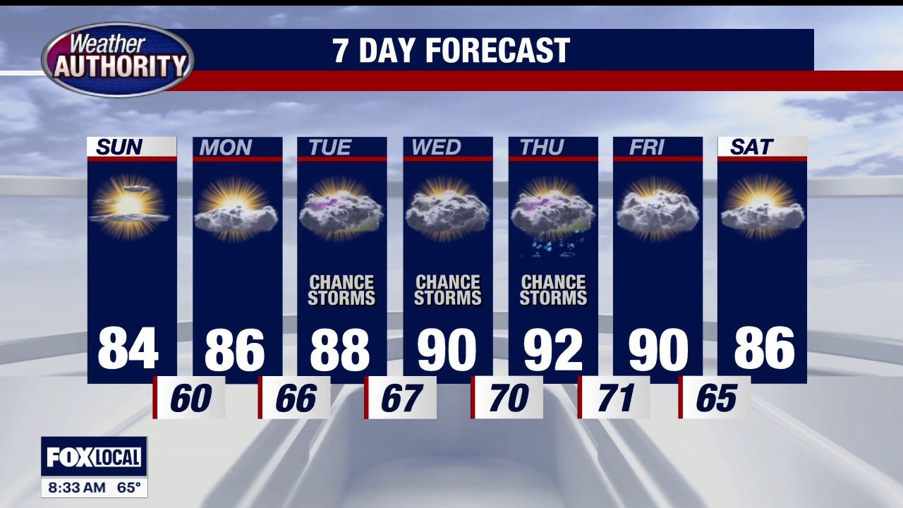
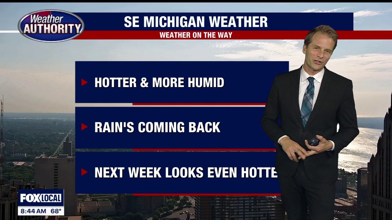
Warm week ahead, rain and storm chances after Monday
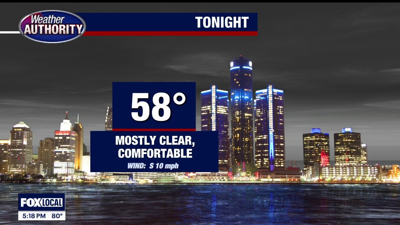
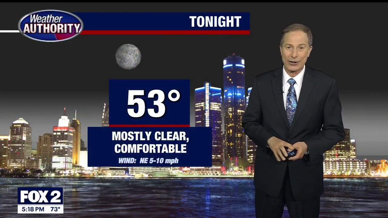
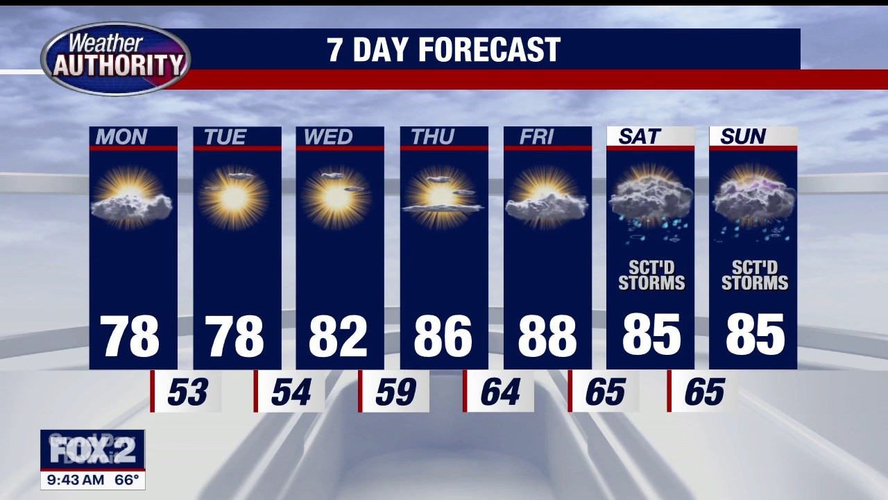
Warm week ahead with more humidity arriving Tuesday… along with much-needed rain showers. The best chance for some stronger storms is down the road – Friday. Rest of Sunday evening / night…. Mostly clear and comfortable…. Low 59 Monday: Partly sunny…. nice and warm…. high 86 Tuesday: Cloudy, warm and humid…. occasional rain showers and perhaps a rumble of thunder…. High 86 Wednesday: Partly sunny…. WARM and HUMID…. stray t-shower possible…. High near 90 Thursday: Partly sunny…. WARM and HUMID…. stray t-shower possible…. High near 90 Friday: WARM and HUMID…. spotty t-storms…. high 87 Saturday: Sun and clouds…. Still VERY WARM….. high 87 Sunday: Partly cloudy…. WARM…. high 85
Warm week ahead with more humidity arriving Tuesday… along with much-needed rain showers. The best chance for some stronger storms is down the road – Friday. Rest of Sunday evening / night…. Mostly clear and comfortable…. Low 59 Monday: Partly sunny…. nice and warm…. high 86 Tuesday: Cloudy, warm and humid…. occasional rain showers and perhaps a rumble of thunder…. High 86 Wednesday: Partly sunny…. WARM and HUMID…. stray t-shower possible…. High near 90 Thursday: Partly sunny…. WARM and HUMID…. stray t-shower possible…. High near 90 Friday: WARM and HUMID…. spotty t-storms…. high 87 Saturday: Sun and clouds…. Still VERY WARM….. high 87 Sunday: Partly cloudy…. WARM…. high 85
Hotter Temps On The Way
Comfortable today. Mild temps with low humidity. Hotter, humid with storms by mid-week. Meteorologist Lori Pinson has your forecast.
Comfortable today. Mild temps with low humidity. Hotter, humid with storms by mid-week. Meteorologist Lori Pinson has your forecast.
Afternoon Storms Possible
Afternoon storms are possible today. Clearing and comfortable Sunday. Heat and humidity returns next week. Meteorologist Lori Pinson has your forecast.
Afternoon storms are possible today. Clearing and comfortable Sunday. Heat and humidity returns next week. Meteorologist Lori Pinson has your forecast.
Rain returns
Rain chances tonight and through early Saturday morning. The rest of the weekend looks great with highs in the mid 80s.
Rain chances tonight and through early Saturday morning. The rest of the weekend looks great with highs in the mid 80s.
Heating up for next week
Alan Longstreet has the forecast.
Alan Longstreet has the forecast.
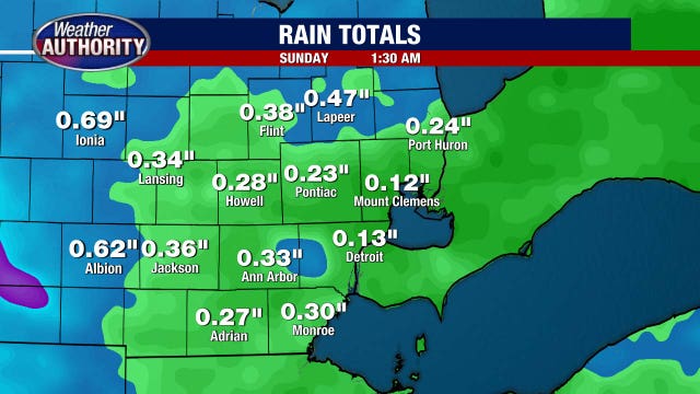
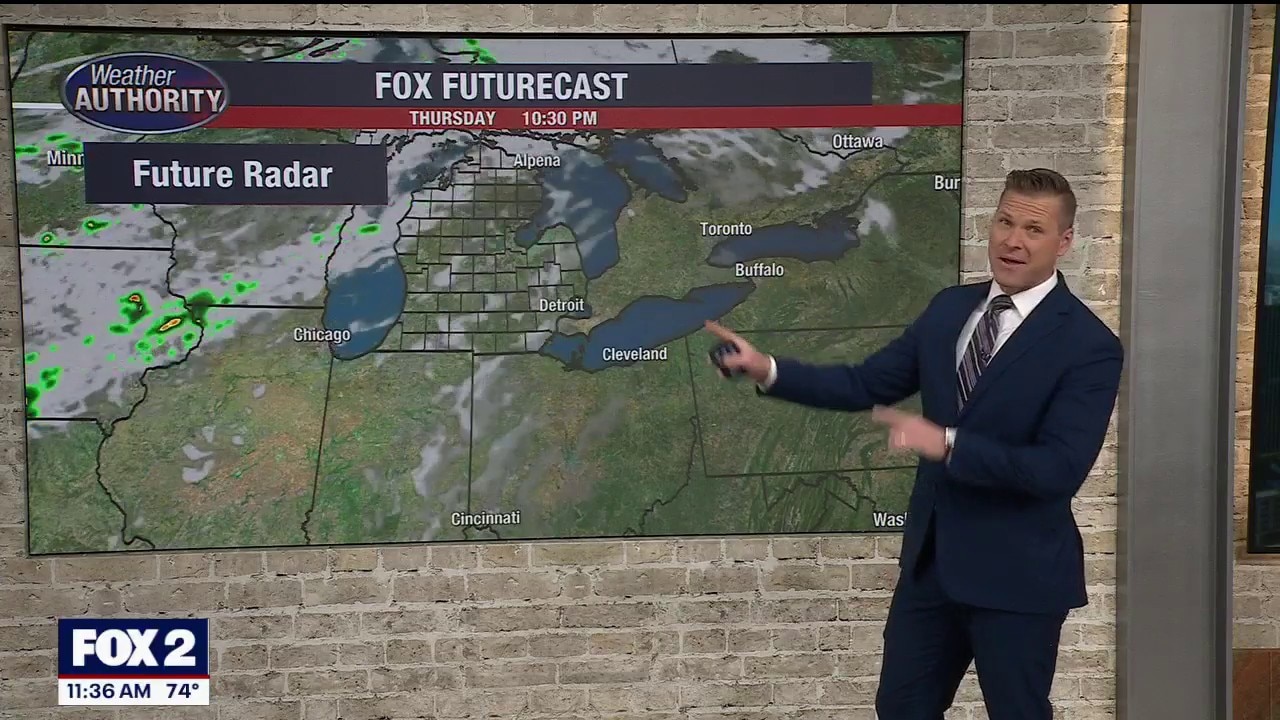
Rain arrives this evening after a long dry spell
Some rumbles of thunder are possible too
Some rumbles of thunder are possible too

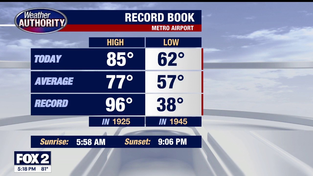
Metro Detroit weather: Final day of dry stretch before some rain this weekend
It’s the final totally completely absolutely dry day in what has been an incredible stretch of weather in Metro Detroit.
It’s the final totally completely absolutely dry day in what has been an incredible stretch of weather in Metro Detroit.
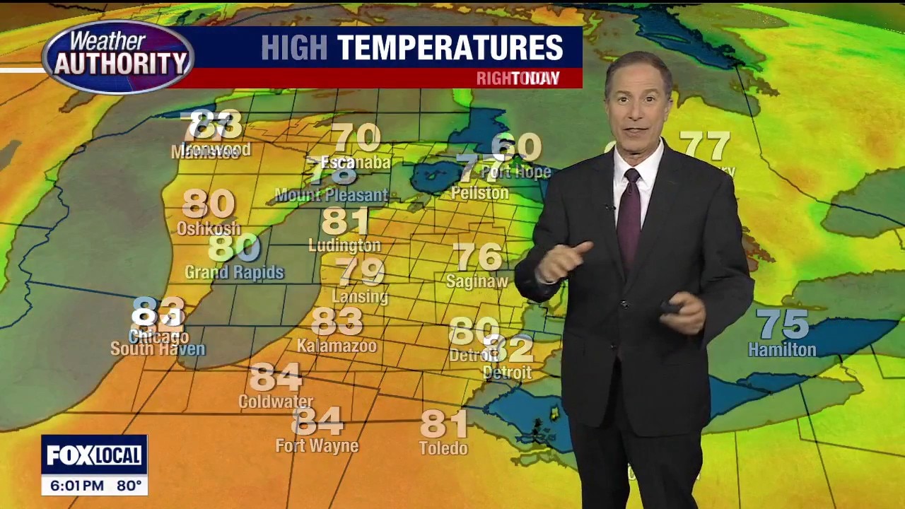
Summer feel is here
The temperatures are headed up and will stay warm in Metro Detroit.
The temperatures are headed up and will stay warm in Metro Detroit.
Sunny warm and dry for Thursday
Rich Luterman has the forecast.
Rich Luterman has the forecast.
More perfect weather on the way!
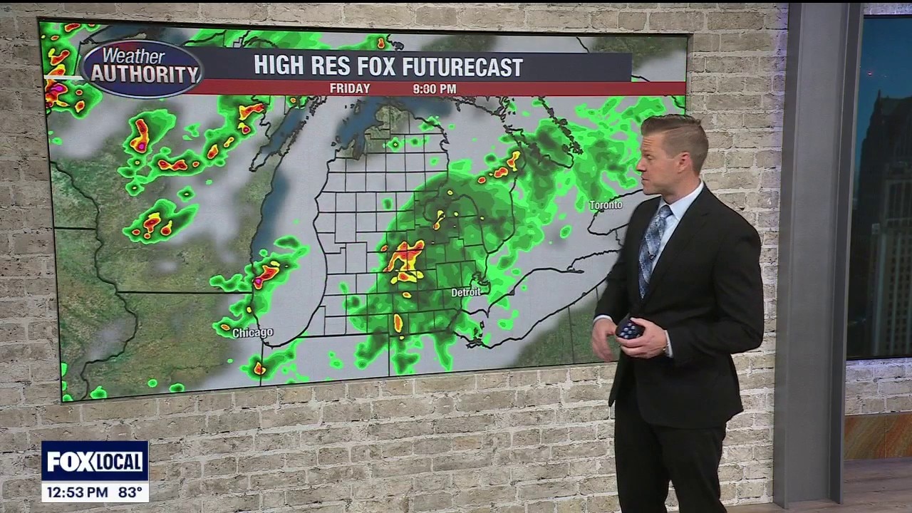
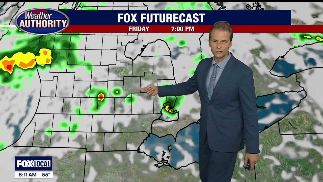
T'storms return starting late Friday
T'storms return starting late Friday


Metro Detroit weather: The beautiful stretch continues, but rain does return to the area soon
Today marks 10 straight days of great weather in Metro Detroit.
Today marks 10 straight days of great weather in Metro Detroit.
Day 10 of perfect weather in Metro Detroit
Another day of low humidity levels, warm temps, and dry weather in Metro Detroit.
Another day of low humidity levels, warm temps, and dry weather in Metro Detroit.
Mostly sunny, warm and dry for Wednesday
Rich Luterman has the forecast.
Rich Luterman has the forecast.


Metro Detroit weather: Another mild, sunny, and dry day
Get ready for another day of beautiful weather in Metro Detroit.
Get ready for another day of beautiful weather in Metro Detroit.

Sunny Tuesday
Another mild & sunny day. More of the same tomorrow with rain by the weekend. Meteorologist Lori Pinson has your forecast.
Another mild & sunny day. More of the same tomorrow with rain by the weekend. Meteorologist Lori Pinson has your forecast.
Sunny, warm and dry for Tuesday
Rich Luterman has the forecast.
Rich Luterman has the forecast.
Mild & Dry Week
Warmer temperatures this week with a chance for storms by the weekend. Meteorologist Lori Pinson has your forecast
Warmer temperatures this week with a chance for storms by the weekend. Meteorologist Lori Pinson has your forecast


Metro Detroit forecast: Streak of fantastic weather continues
Metro Detroit's dry, sunny stretch continues on, with rain out of sight this week.
Metro Detroit's dry, sunny stretch continues on, with rain out of sight this week.
Another beautiful day in store
But storms return as we head into the weekend
But storms return as we head into the weekend
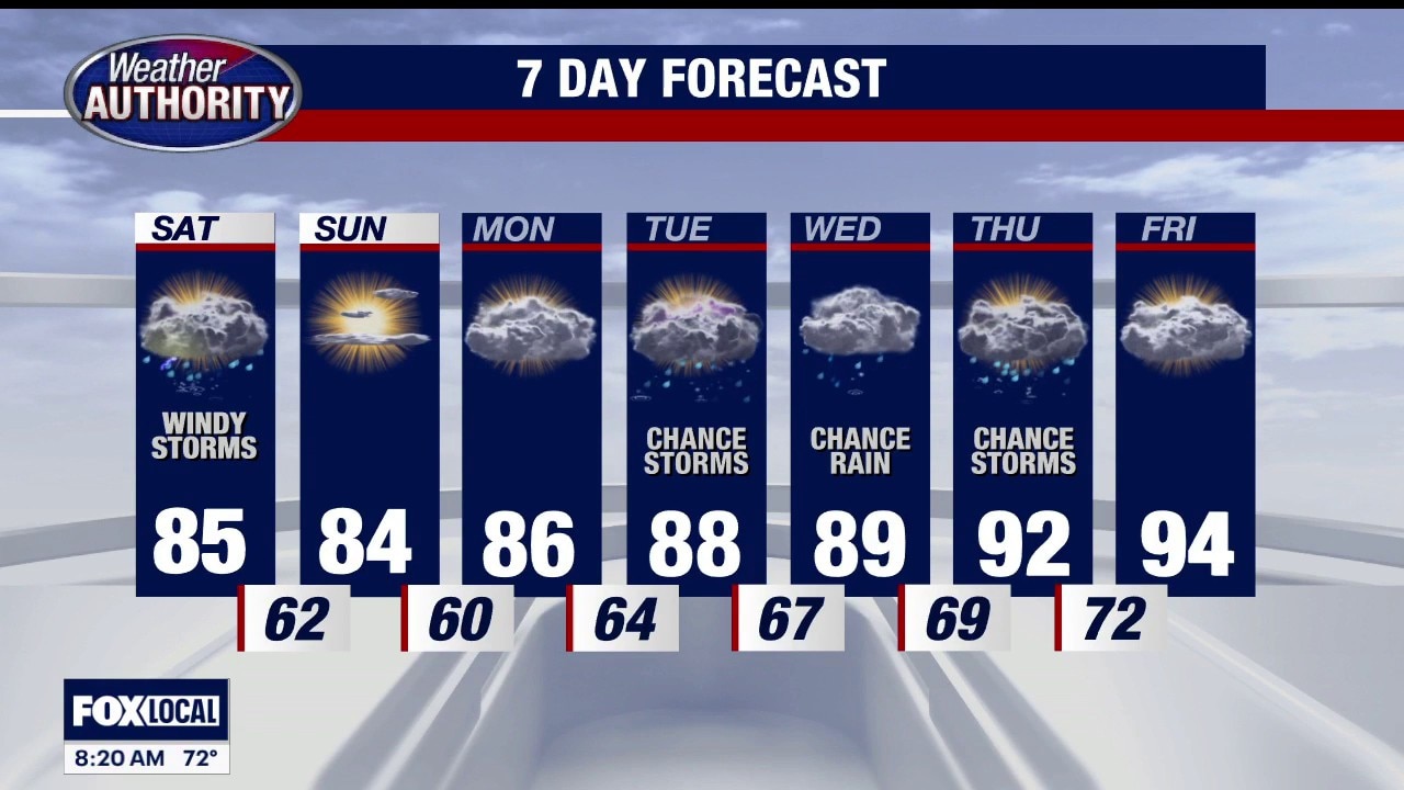
Warm, dry weather continues most of the week, showers possible next weekend
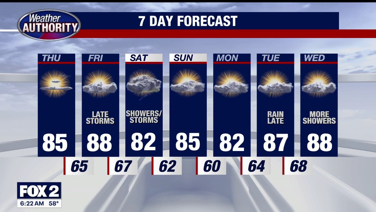
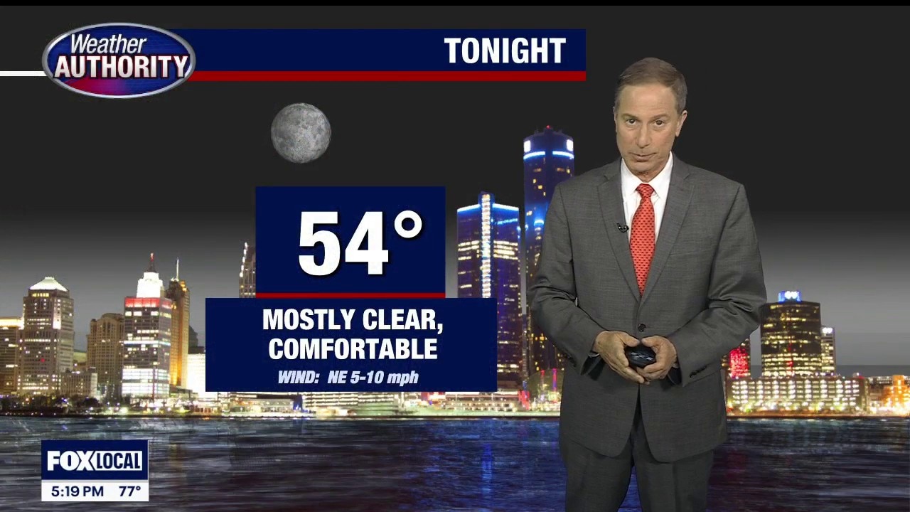
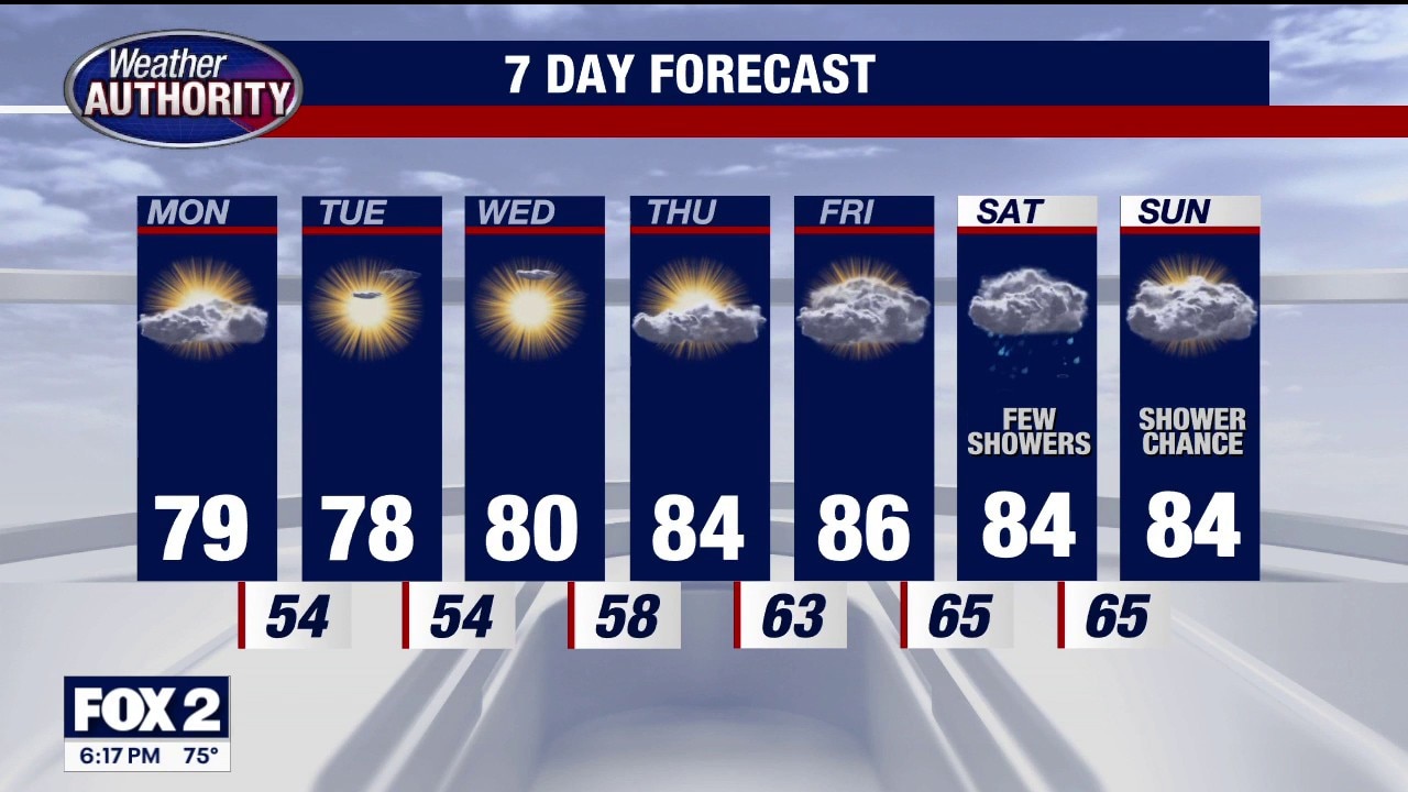
Our great stretch continues through Friday morning. Rain chances increase Friday night into Saturday! Rest of Sunday evening / night…. Mostly clear and comfortable…. Low 55 Monday: Partly sunny…. VERY NICE…… high 79 Tuesday: Lots of sunshine…. High 78 Wednesday: Bright and beautiful…… high near 80 Thursday: Partly sunny…. warmer…. high 84 Friday Increasing clouds…… WARM…. high 86 Saturday: Cloudy…. Occasional showers and perhaps a few storms… high 84 Sunday: Mostly cloudy… shower chance…….. high 84
Our great stretch continues through Friday morning. Rain chances increase Friday night into Saturday! Rest of Sunday evening / night…. Mostly clear and comfortable…. Low 55 Monday: Partly sunny…. VERY NICE…… high 79 Tuesday: Lots of sunshine…. High 78 Wednesday: Bright and beautiful…… high near 80 Thursday: Partly sunny…. warmer…. high 84 Friday Increasing clouds…… WARM…. high 86 Saturday: Cloudy…. Occasional showers and perhaps a few storms… high 84 Sunday: Mostly cloudy… shower chance…….. high 84